---0---
---0---. Plate on page 242 of The First Hundred Years of Avon Park, Florida (1976).
 The Historical Society of Avon ParkAVON PARK, FL · EST. 1886
The Archive
The Society's visual record: 342 historic photographs, postcards, maps, and architectural drawings documenting over a century of Avon Park history. Every image carries full provenance, rights statements, and credit attribution.
---0---. Plate on page 242 of The First Hundred Years of Avon Park, Florida (1976).
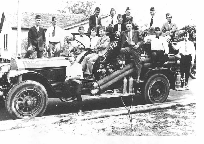
1927 Volunteer Firemen was the American Legion Post No. 69. Plate on page 202 of The First Hundred Years of Avon Park, Florida (1976).
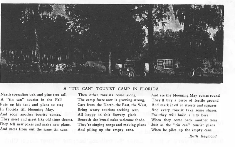
A "tin Can" Tourist Camp in Florida. Plate on page 237 of The First Hundred Years of Avon Park, Florida (1976).
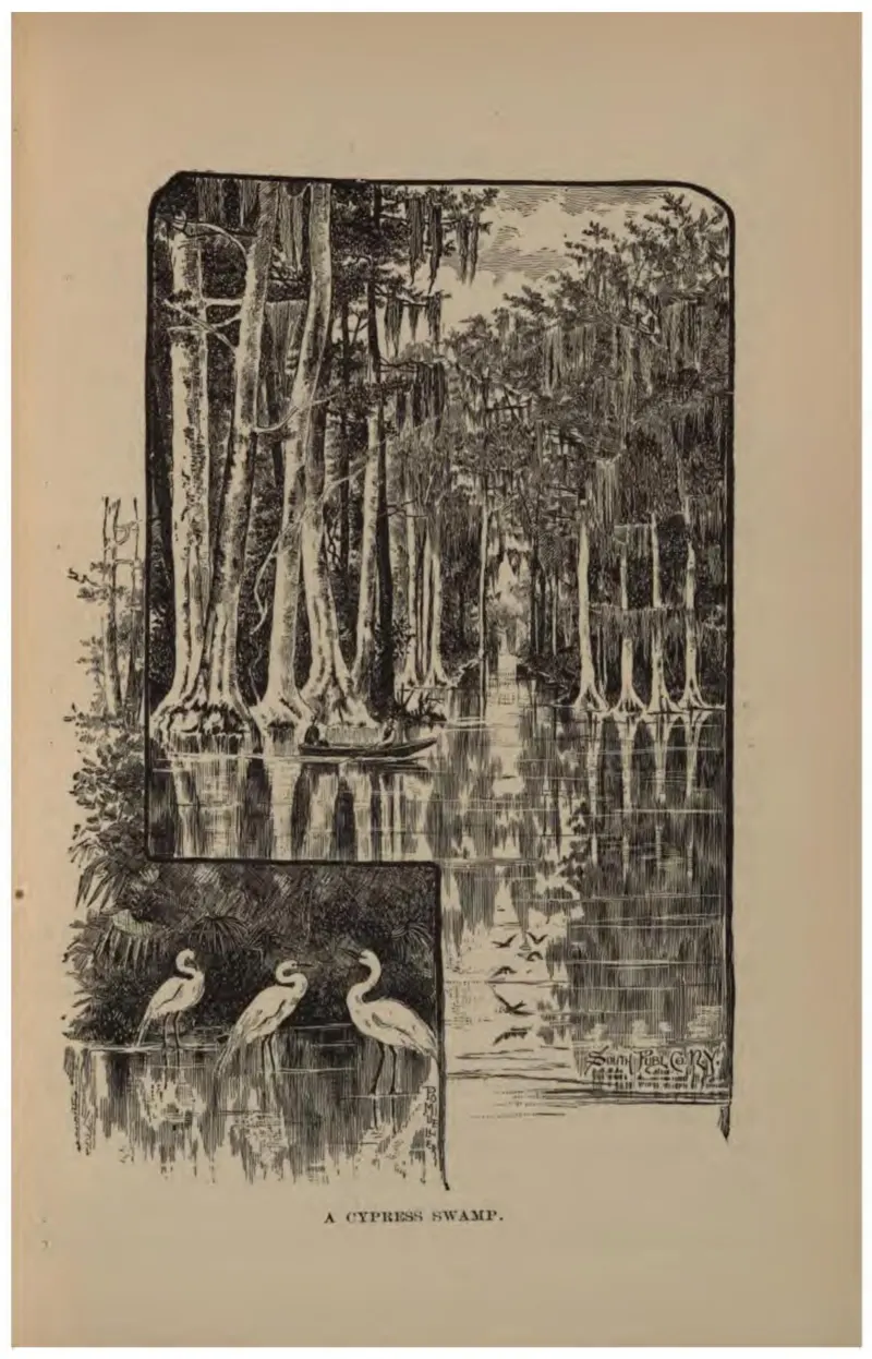
Buttressed cypress in standing water with three wading birds in the foreground.
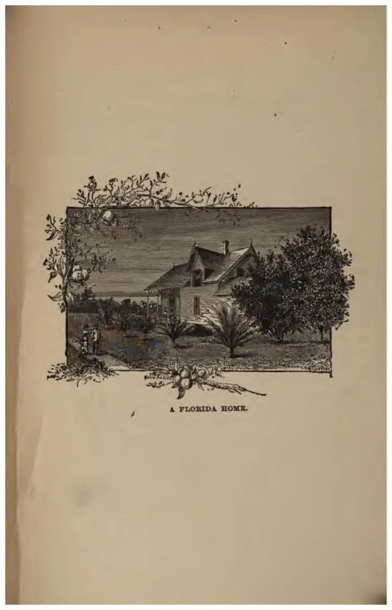
A frame house among orange trees, framed by a spray of blossom and fruit.
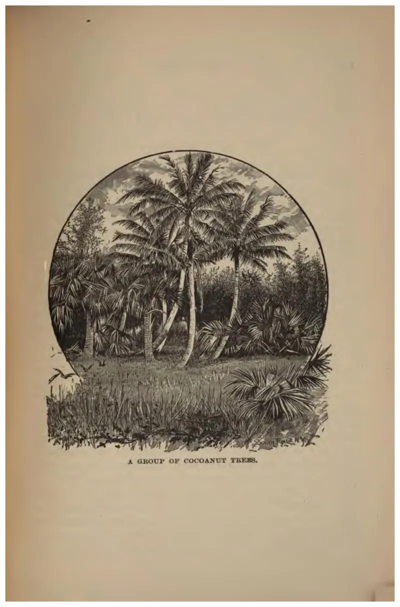
Coconut palms in an oval vignette, used to argue Florida's tropical character.
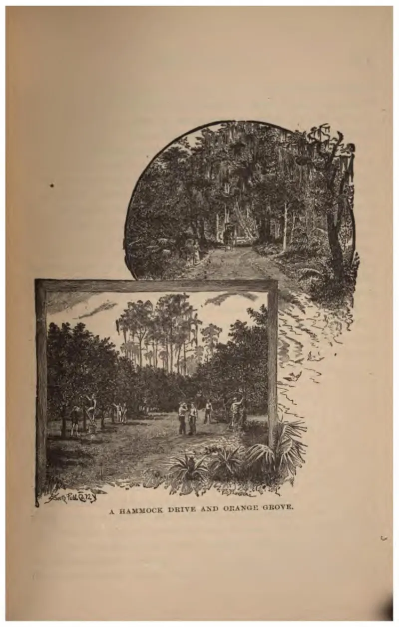
A drive through hammock and a grove with figures on the road, in two vignettes.
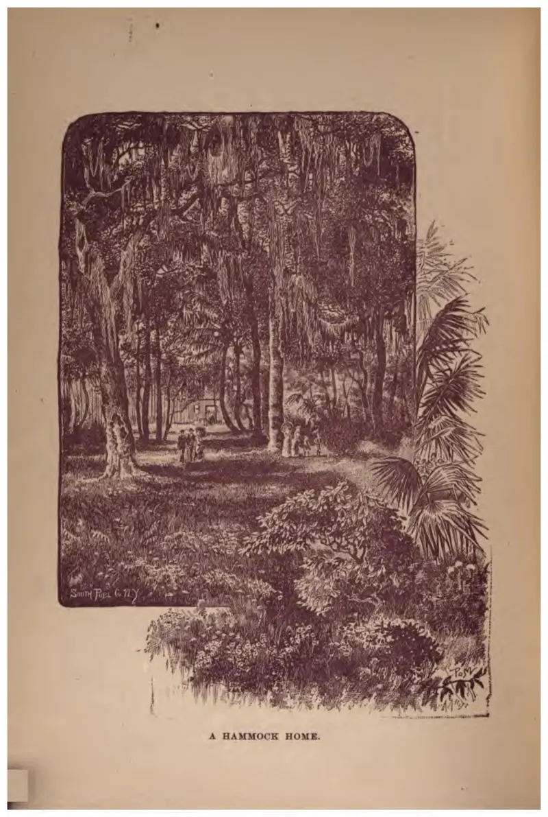
A house set deep in hardwood hammock, reached by a sand track.
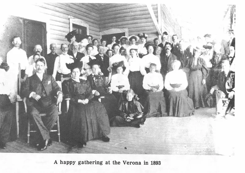
A happy gathering at the Verona in 1893. Plate on page 42 of The First Hundred Years of Avon Park, Florida (1976).
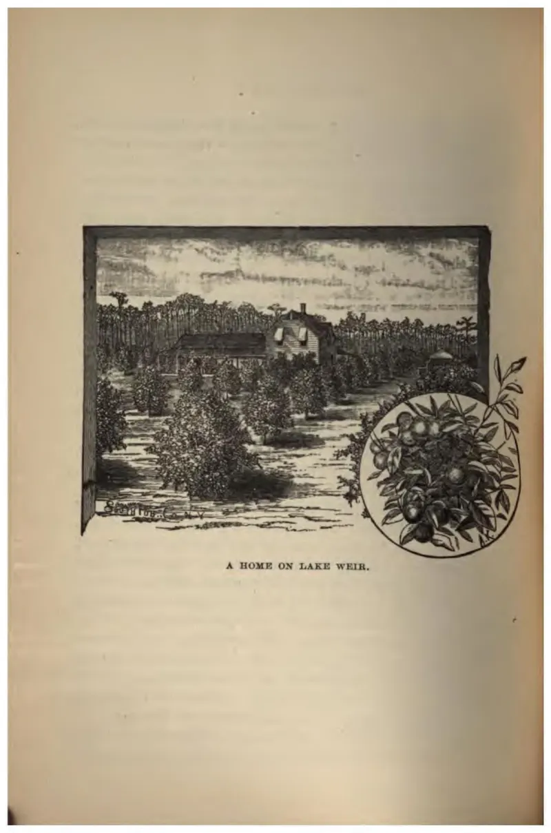
A frame house among orange trees on Lake Weir, with a spray of fruit in a roundel.
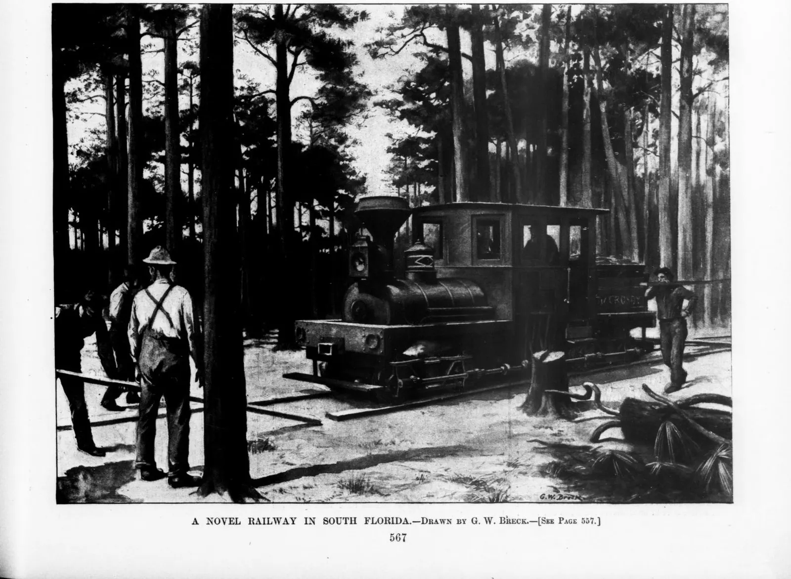
G. W. Breck's drawing of the Avon Park wooden-railed tramway and its Shay locomotive, from Harper's Weekly, 15 June 1895.
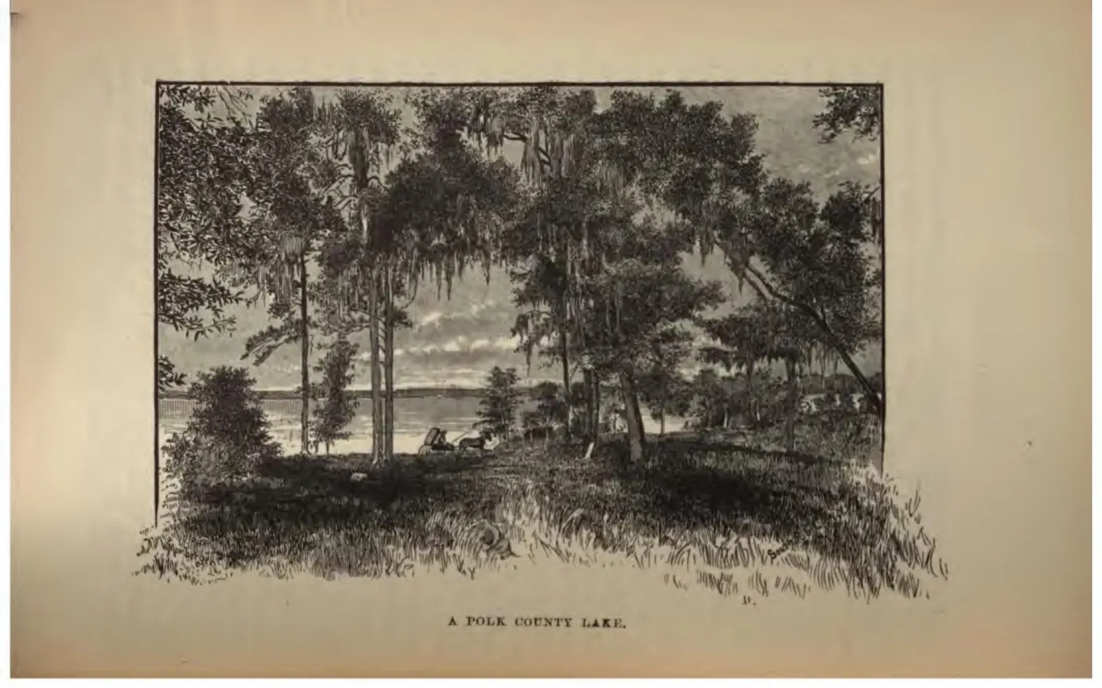
A Polk County lake seen through mossy oaks from a low bluff.
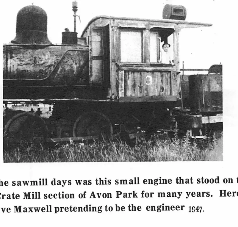
A Relic of the sawmill days was this small engine that stood on the spur line in the Crate Mill section of Avon Park for many years. Here is three year old Steve Maxwell pretending to be the engineer 1947. Plate on page 75 of The First Hundred Years of Avon Park, Florida (1976).
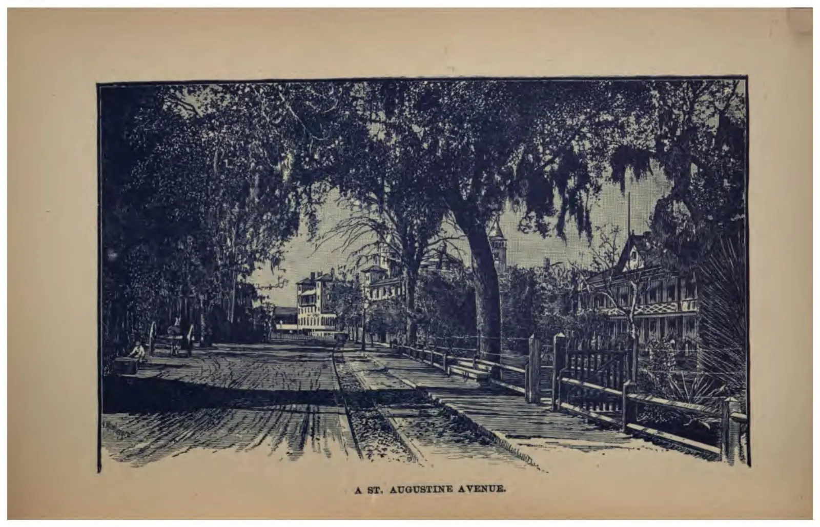
A sand street in St. Augustine shaded by arching live oaks.
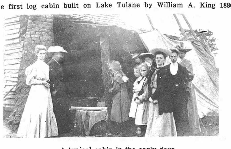
A typical cabin in the early days. Plate on page 31 of The First Hundred Years of Avon Park, Florida (1976).
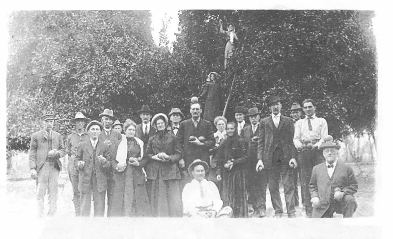
A typical group of prospectors who came and stayed at the Verona Hotel. Plate on page 98 of The First Hundred Years of Avon Park, Florida (1976).
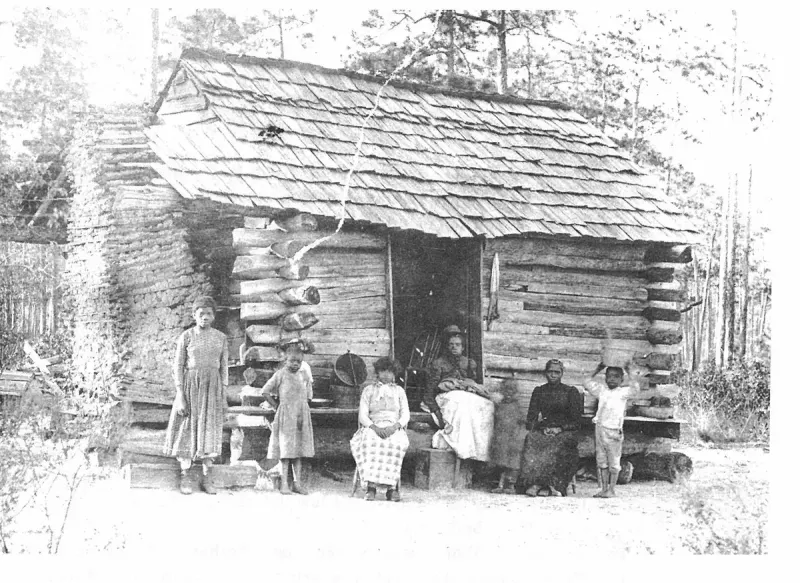
A typical log cabin, shack built for a colored family living at Hagan's turpentine still which was located South of Avon Park in early days, about 1900. Plate on page 112 of The First Hundred Years of Avon Park, Florida (1976).
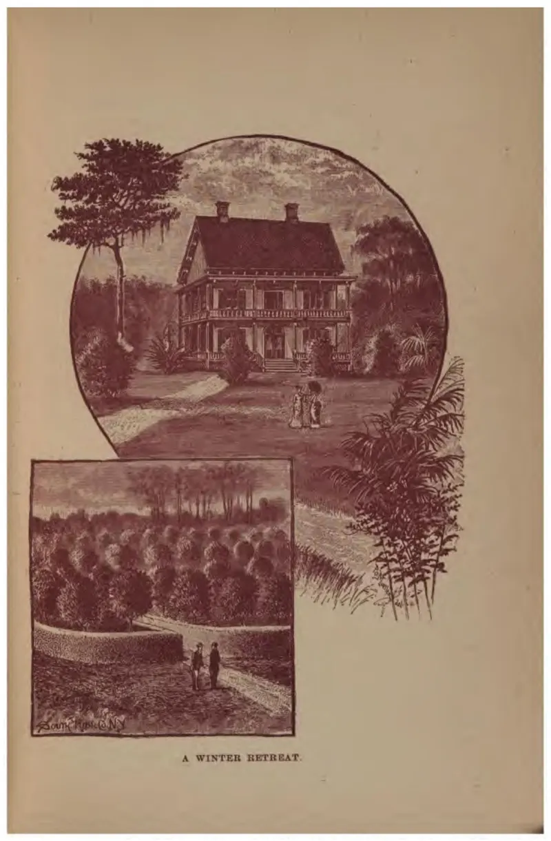
A northern-style frame house in an oval vignette above a young orange grove.
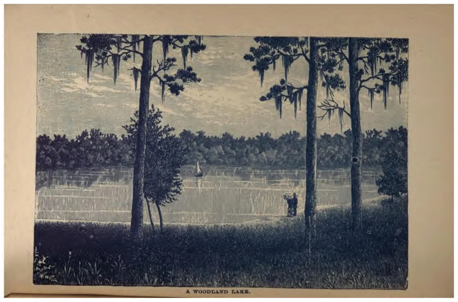
A lake seen through pines hung with Spanish moss, two figures on the near shore.
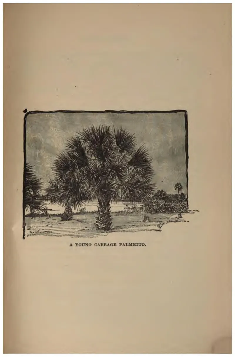
A single young cabbage palmetto standing in open country.
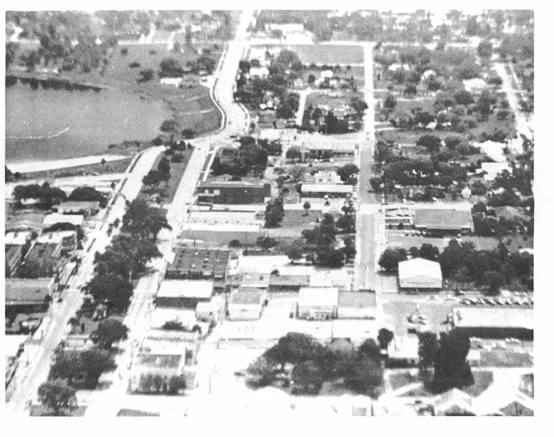
Aerial view of Avon Park downtown today, showing Lake Verona in the background. Plate on page 219 of The First Hundred Years of Avon Park, Florida (1976).
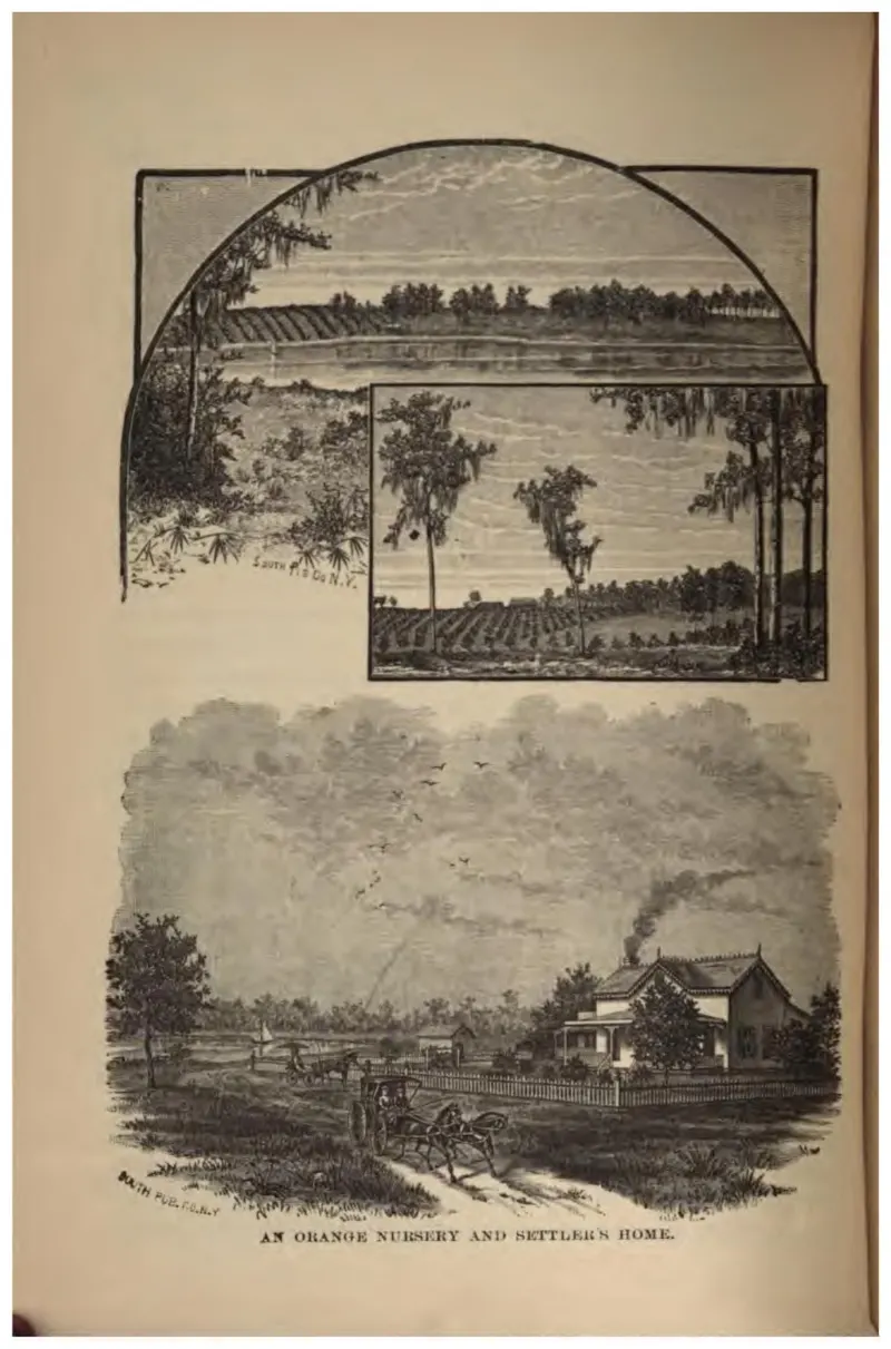
Three vignettes: nursery rows, a cleared grove, and a settler's house with a wagon on the road.
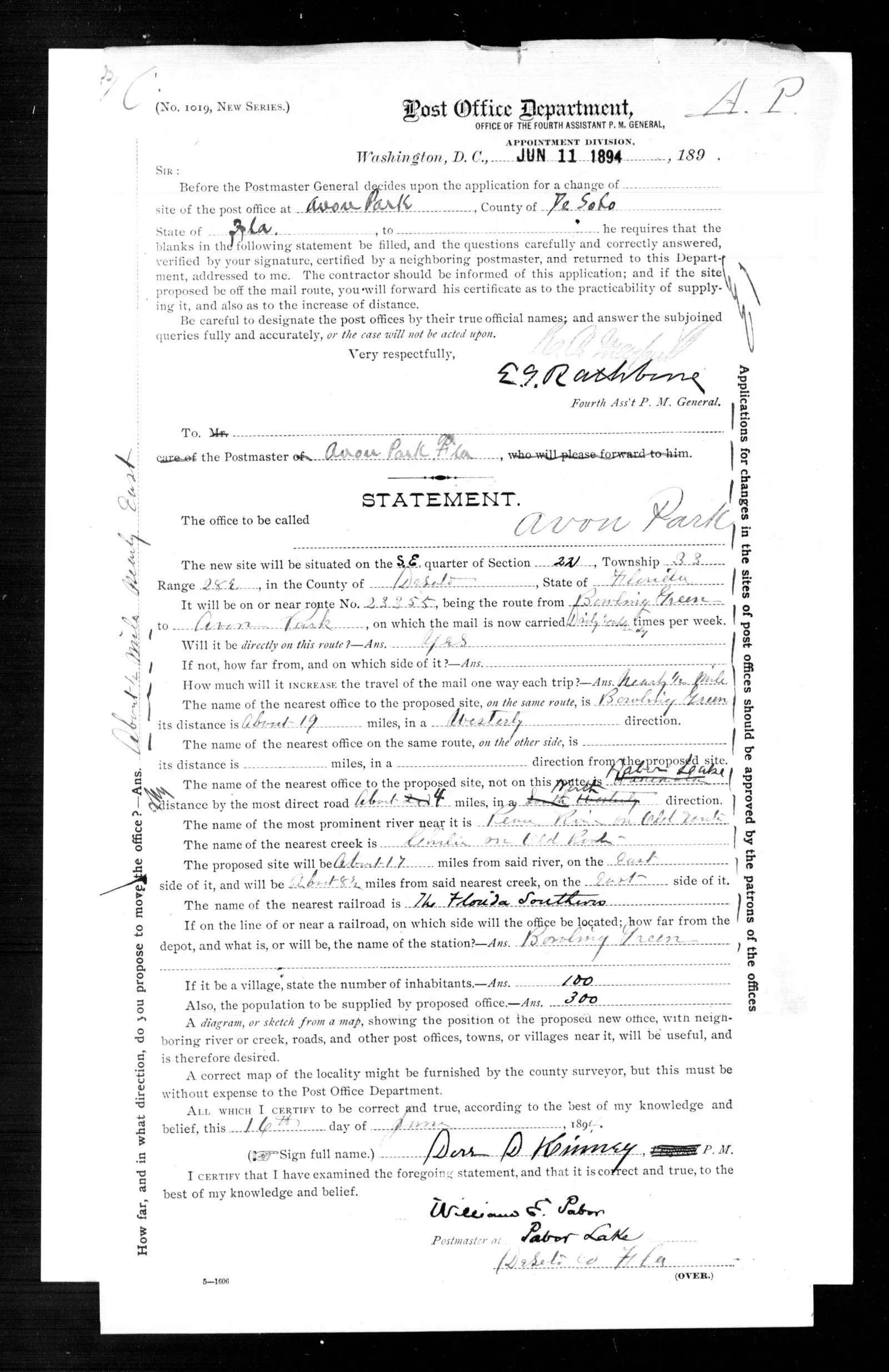
Post Office Department statement for a change of site of the Avon Park post office to the southeast quarter of section 22, Township 33 South, Range 28 East, signed by postmaster Dorr D. Kinney on 16 June 1894 and certified by William E. Pabor, postmaster at Pabor Lake.
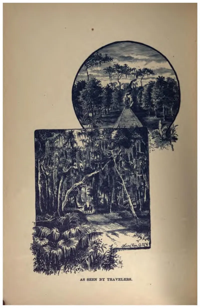
Two vignettes of dense palmetto and hammock, the Florida a passing traveler sees.
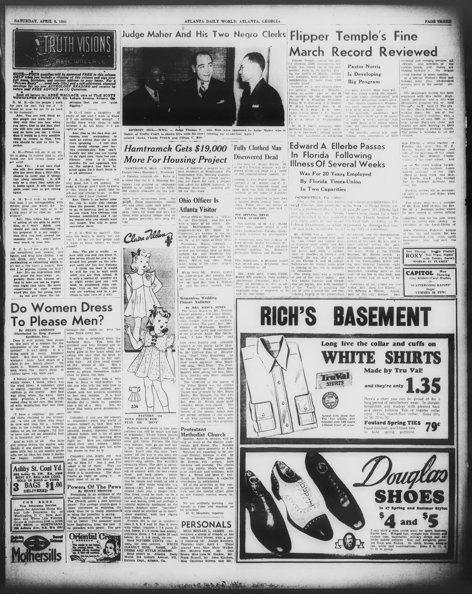
Image 3 of Atlanta daily world (Atlanta, Georgia), April 5, 1941, City Edition, featuring the obituary of Edward A. Ellerbe and mentioning his brother James Ellerbe as principal of the high school at Avon Park.
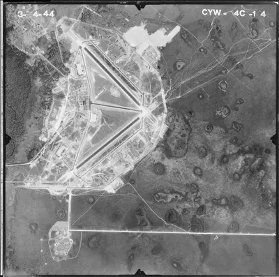
A United States government aerial survey frame, stamped 3-4-44 and CYW-4C-14, showing the wartime airfield: three runways set in a triangle, the taxiways and hardstands around them, the cantonment of barracks and hangars to the west, a bombing target circle to the south-west, and the range to the east pocked with hundreds of bomb craters.
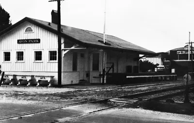
The Atlantic Coast Line Railroad depot in Avon Park, Florida, built around 1912.
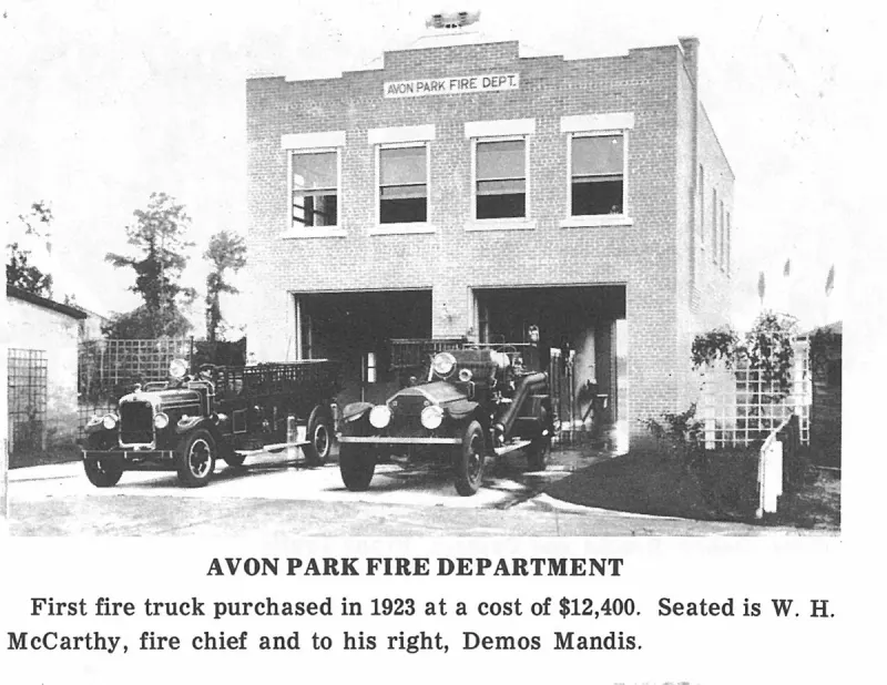
Avon Park Fire Department. Plate on page 201 of The First Hundred Years of Avon Park, Florida (1976).
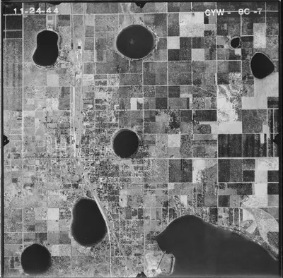
A United States Department of Agriculture aerial survey frame, stamped 11-24-44 and CYW-8C-7, showing Avon Park's street grid strung along the north-south rail and highway line, five of its round lakes, a larger lake at the south-east, and the ruled blocks of citrus grove that surround the town on every side.
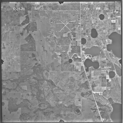
A United States Department of Agriculture aerial survey frame, stamped 12-27-70 and CYW-1MM-191, taken two years after Hopewell School closed: the town's lakes and grid at the upper right, the highway and railroad running south-east toward Sebring as a diagonal across the frame, the crossing runways at the top, and, on the left, the scrub and grove country west of the town; the frame's eastern edge falls some five hundred meters short of the Black neighborhood.
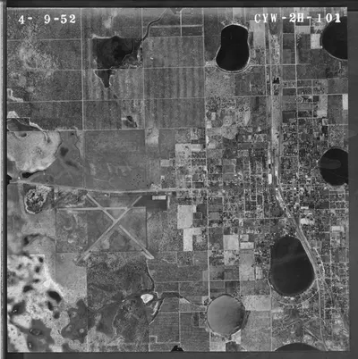
A United States Department of Agriculture aerial survey frame, stamped 4-9-52 and CYW-2H-101, showing the town built along the Atlantic Coast Line, Lake Verona at its south-east, the X-shaped crossing runways of the municipal airport to the west, and the ruled blocks of citrus grove around it all; the frame's eastern edge stops about a hundred and fifty meters short of the Black neighborhood east of the tracks.
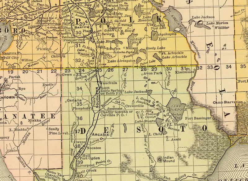
Detail of Rand, McNally & Co.'s New Business Atlas Map of Florida, copyright 1892, showing Avon Park in DeSoto County just south of the Polk County line.
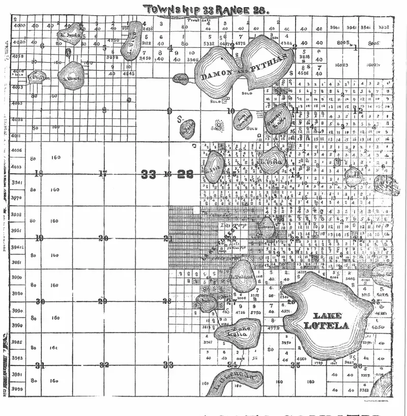
Avon Park, De Soto County. Plate on page 3 of The First Hundred Years of Avon Park, Florida (1976).
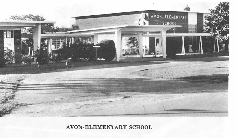
Avon·elementary School. Plate on page 226 of The First Hundred Years of Avon Park, Florida (1976).
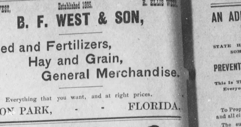
Display advertisement for B. F. West & Son of Avon Park, Florida, 'Established 1895', naming B. F. West and R. Ellis West, offering feed and fertilizers, hay and grain, and general merchandise, printed on the Avon Park page of The De Soto County News (Arcadia) on 18 August 1905.
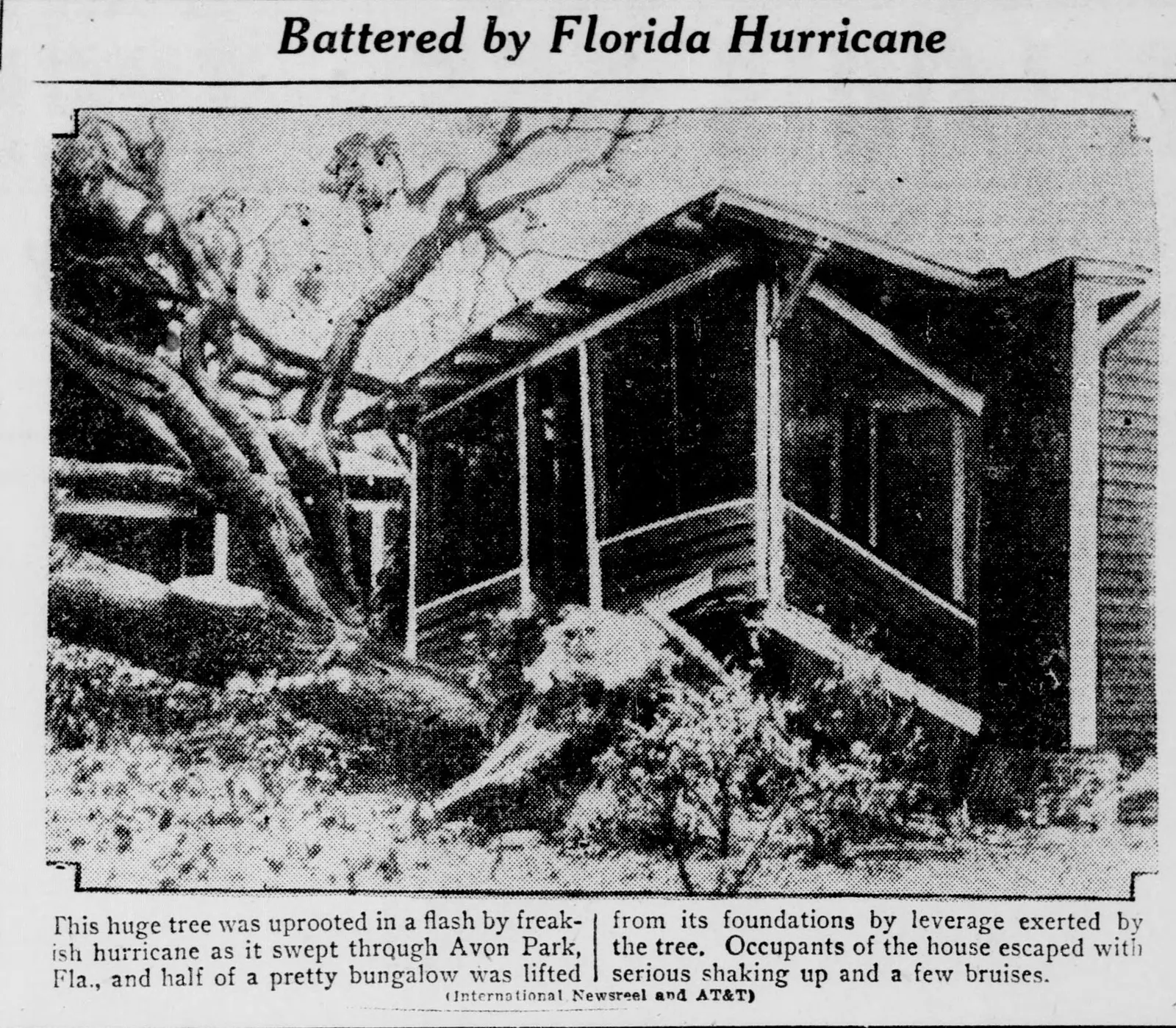
An International Newsreel photograph, printed in the South Bend News-Times of 26 September 1928, of a large tree uprooted by the hurricane of 16-17 September 1928 at Avon Park and the screened bungalow it lifted off its foundations, with the caption beneath it.
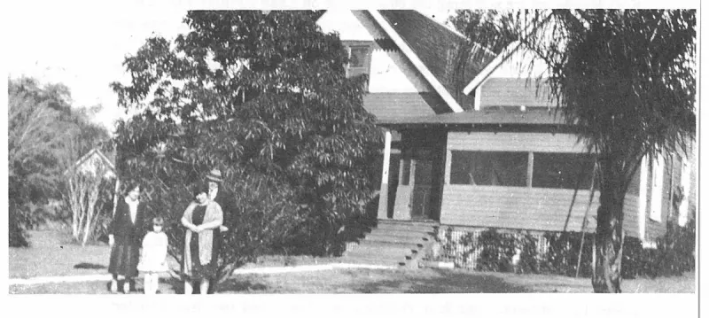
Before coming to Florida, Rev. and Mrs. Shockley had both been instructors at the Asbury Methodist College at Wilmore, Ky. Upon arriving in Frostproof he taught school and after moving to Avon Park he taught here in 1908-09. Plate on page 79 of The First Hundred Years of Avon Park, Florida (1976).
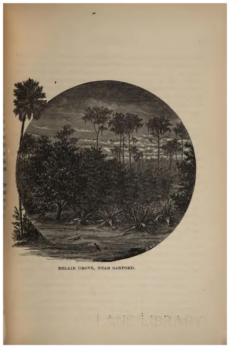
Henry Sanford's Belair grove, one of the show places of Florida citrus in the 1880s.
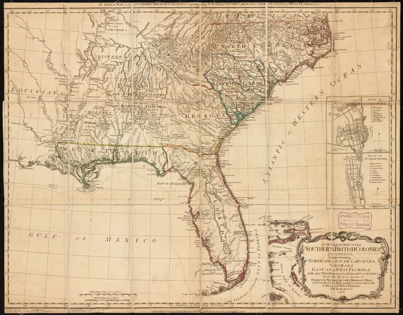
Romans's 1776 general map of the southern British colonies, whose Florida peninsula is drawn from coastal survey and leaves the south-central interior, including what became Highlands County, entirely blank.
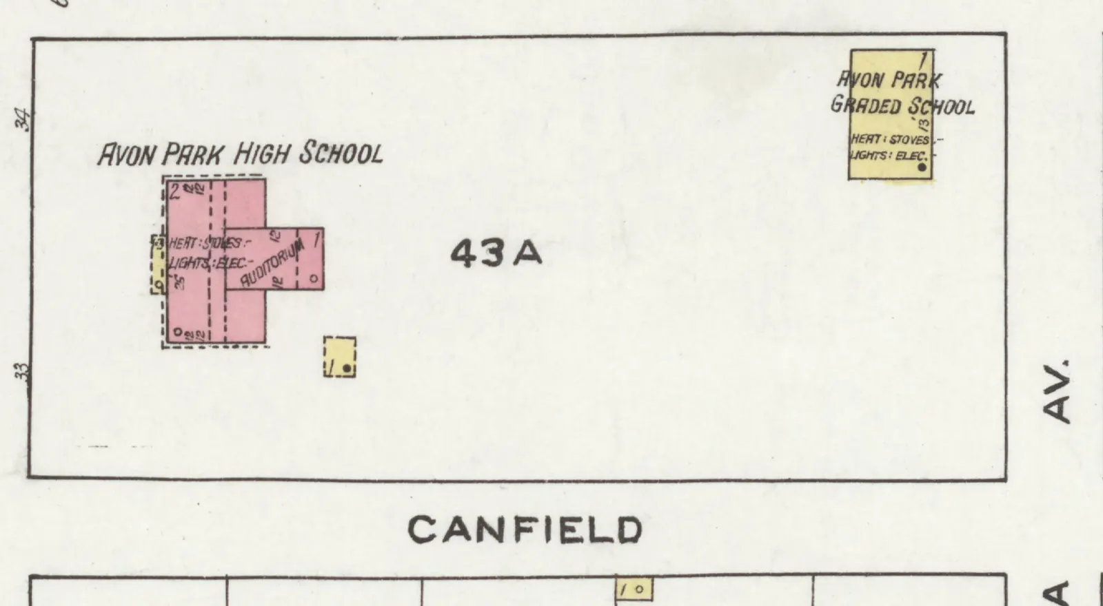
Detail of sheet 1 of the Sanborn fire insurance map of Avon Park, November 1920, showing block 43A between Lake and Verona avenues and Camphor and Canfield streets: the two-story brick Avon Park High School with its auditorium wing at the west end, heated by stoves and lit by electricity, and the one-story frame Avon Park Graded School at the northeast corner.
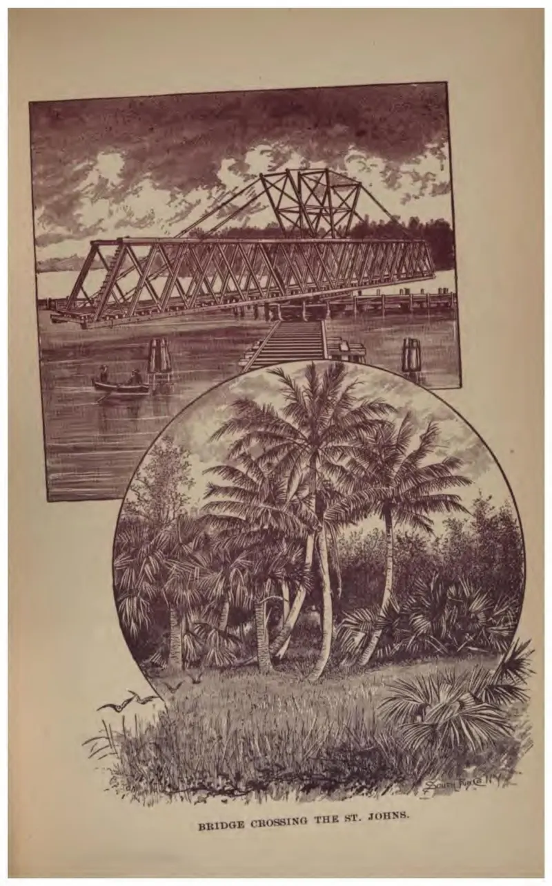
An iron railroad bridge over the St. Johns River, with a palmetto scene below it.
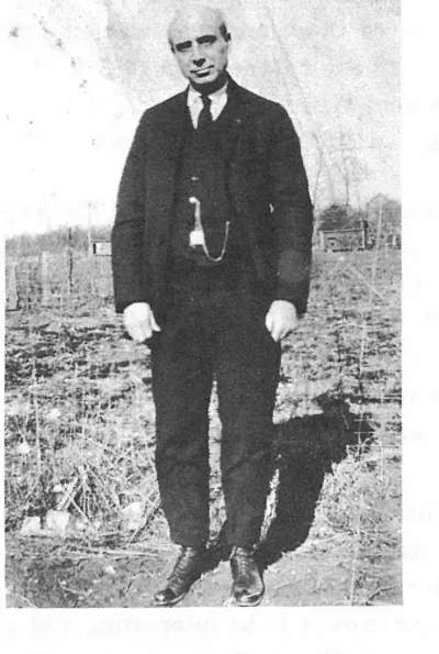
Charles H. Pardee came from Hagerstown, Md. in 1925. His wife, Mary, and the children came by train. Mr. Pardee drove down in his long, slick FRANKLIN car, one of the first cars with a self starter. Plate on page 91 of The First Hundred Years of Avon Park, Florida (1976).
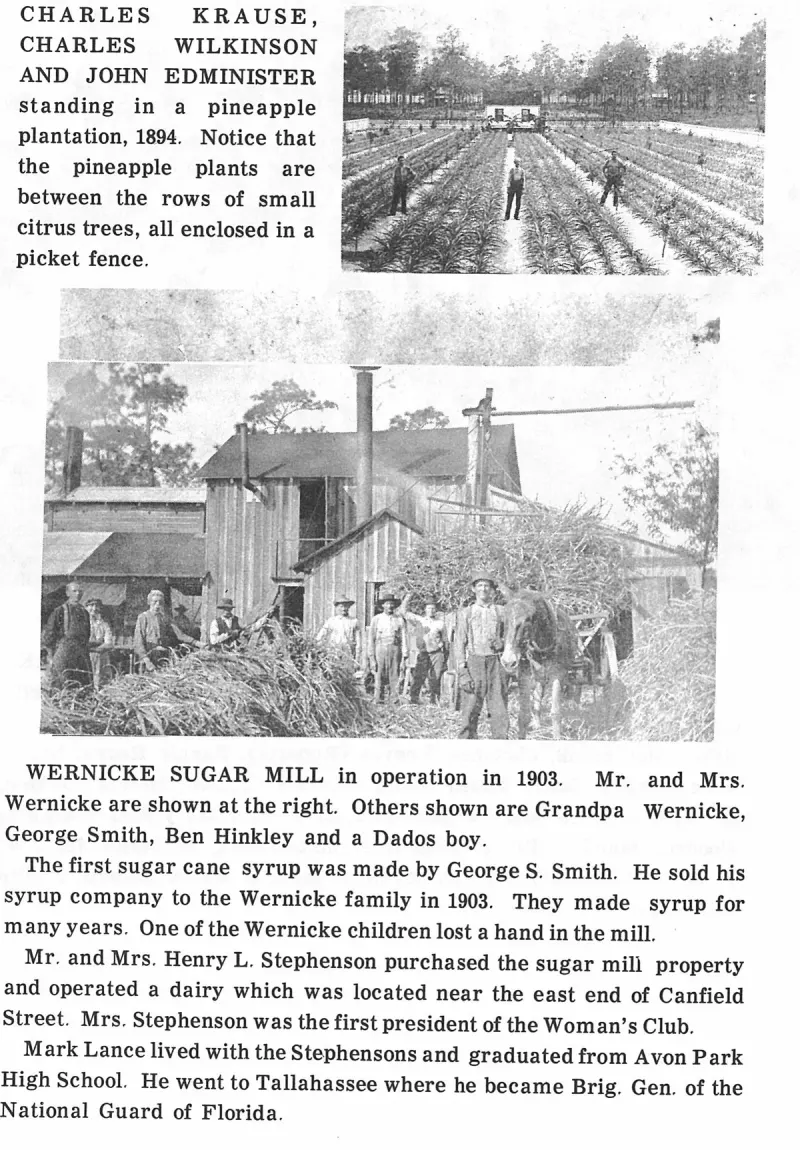
CHARLES KRAUSE, CHARLES WILKINSON AND JOHN EDMINISTER standing in a pineapple plantation, 1894. Notice that the pineapple plants are between the rows of small citrus trees, all enclosed in a picket fence. Plate on page 140 of The First Hundred Years of Avon Park, Florida (1976).
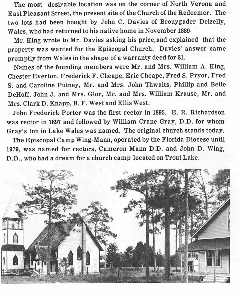
Church of the Redeemer (Episcopal), founded in 1894–1895. Plate on page 103 of The First Hundred Years of Avon Park, Florida (1976).
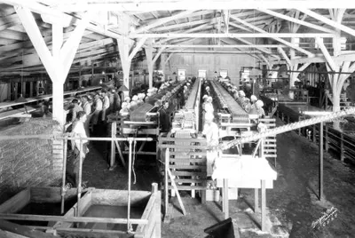
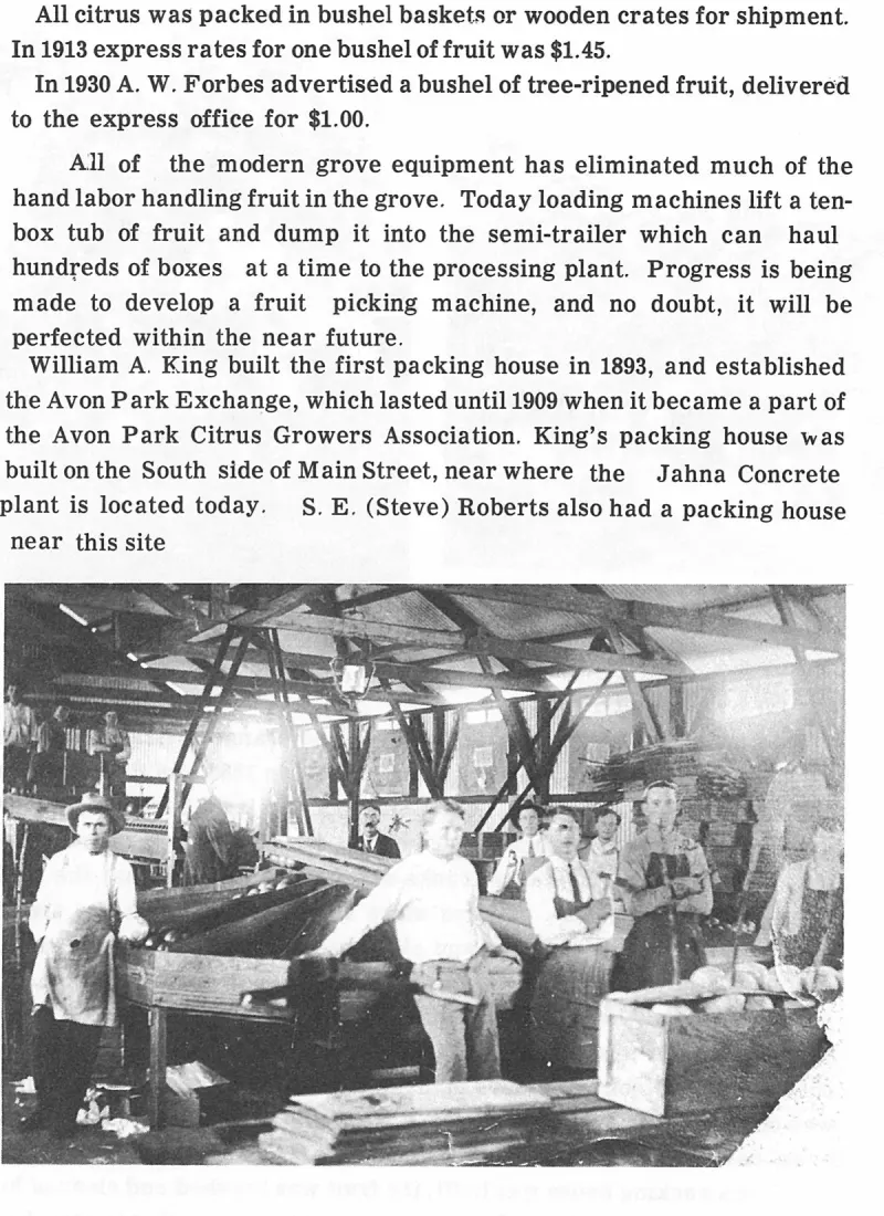
Interior view of a citrus packing house at Avon Park: workers in white uniforms line the long grading and packing tables under an open timber-framed roof, with wooden field crates of fruit stacked in the foreground and an overhead conveyor system.
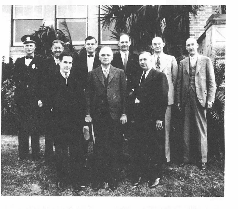
CITY CABINET MEMBERS: January 30, 1934. J. J. (Bob) Still, Police Chief; F. S. Jordon, Fred Smith, S. J. Pendleton, S. C. Pardee, City Attorney; W. T. Hall, Francis Shockley, City Clerk; Marcus E. Covington, Mayor; and J. L. Masters. Plate on page 192 of The First Hundred Years of Avon Park, Florida (1976).
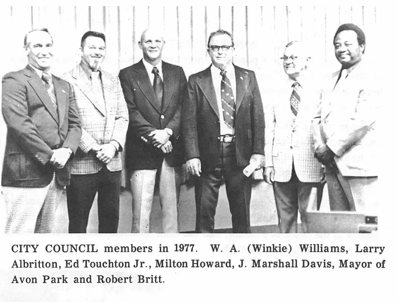
CITY COUNCIL members in 1977. W. A. (Winkie) Williams, Larry Albritton, Ed Touchton Jr., Milton Howard, J. Marshall Davis, Mayor of Avon Park and Robert Britt. Plate on page 206 of The First Hundred Years of Avon Park, Florida (1976).
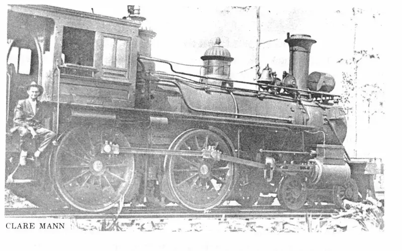
Clare Mann. Plate on page 128 of The First Hundred Years of Avon Park, Florida (1976).
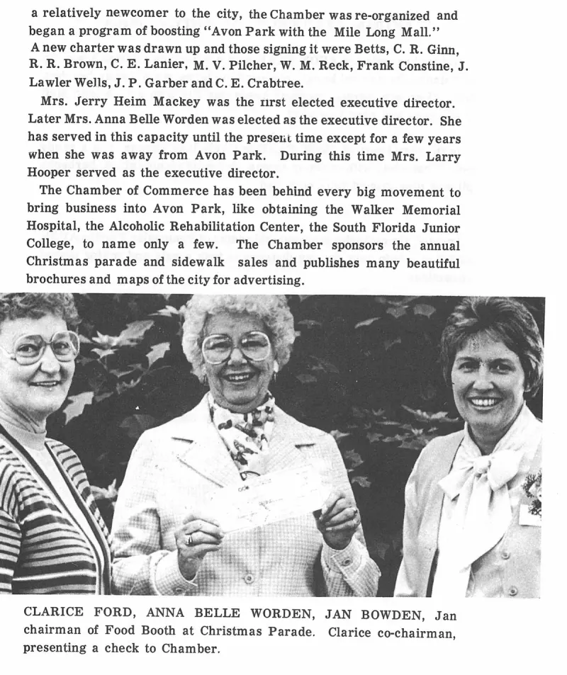
CLARICE FORD, ANNA BELLE WORDEN, JAN BOWDEN, Jan chairman of Food Booth at Christmas Parade. Clarice co-chairman, presenting a check to Chamber. Plate on page 214 of The First Hundred Years of Avon Park, Florida (1976).
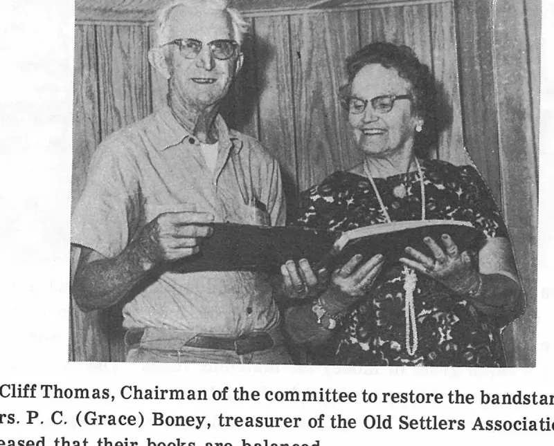
Cliff Thomas, Chairman of the committee to restore the bandstand, and Mrs. P. C. (Grace) Boney, treasurer of the Old Settlers Association, are pleased that their books are balanced. Plate on page 190 of The First Hundred Years of Avon Park, Florida (1976).
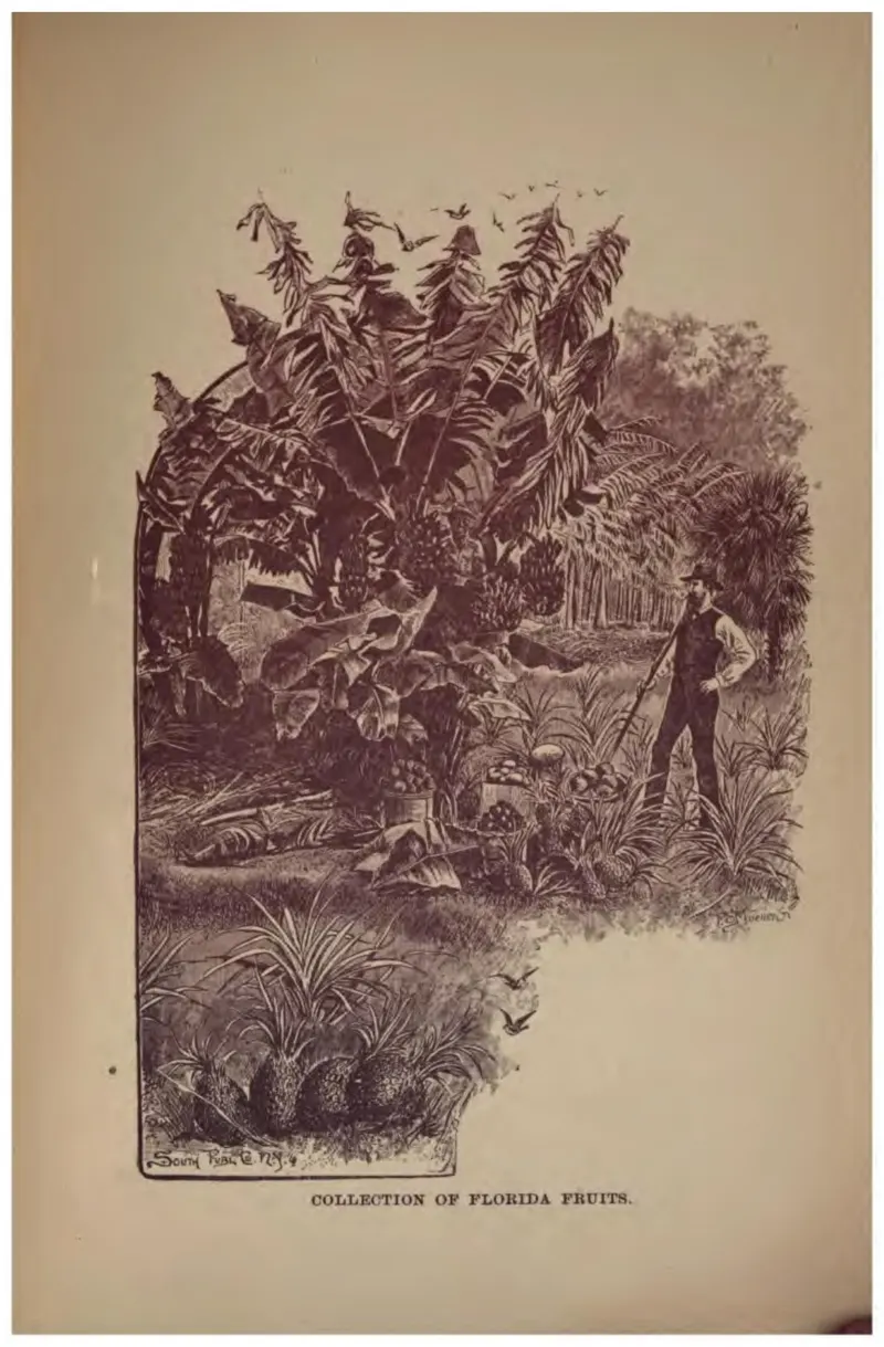
Bananas, pineapples and other fruits massed together, with a figure at work behind.
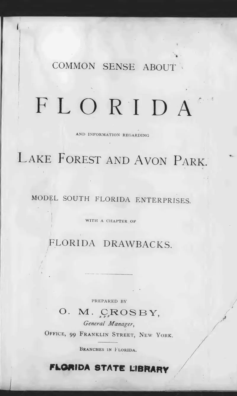
Title page of O. M. Crosby's 1888 promotional book on Lake Forest and Avon Park.
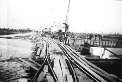
The bridge over Charlotte Harbor, whose construction was advocated for by DeSoto County Commissioner John Hagan Sr.
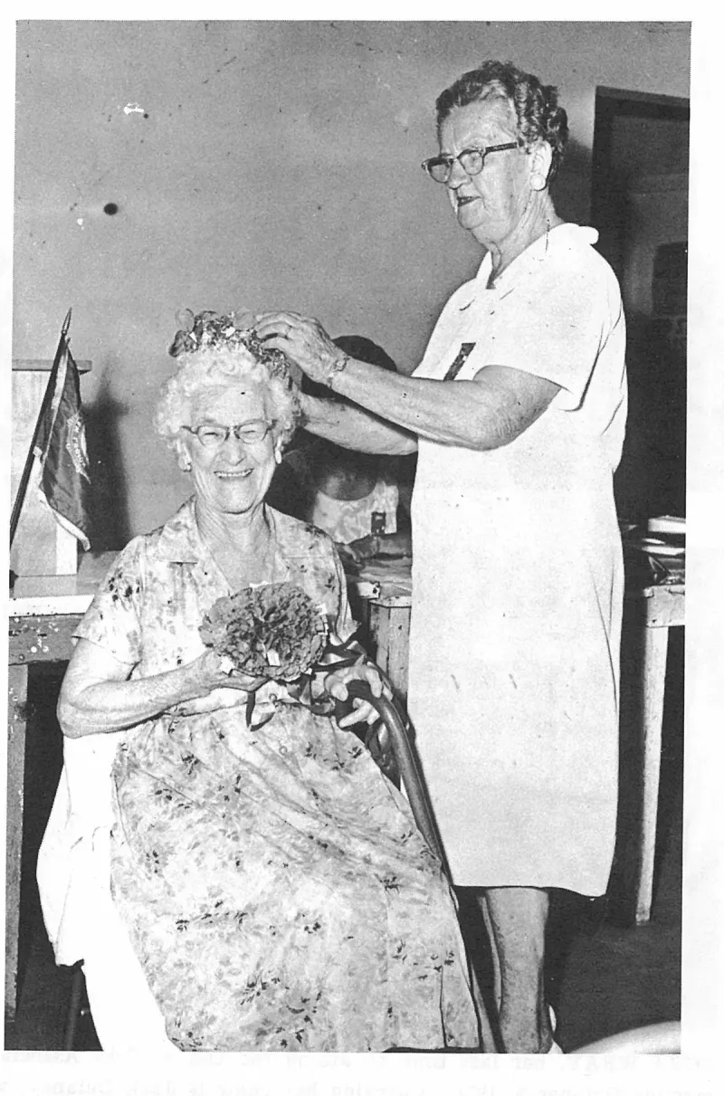
CORA WRAY crowned "Mother of the Year" and "Queen of the American Legion Auxiliary" by Rena Smith. Plate on page 70 of The First Hundred Years of Avon Park, Florida (1976).
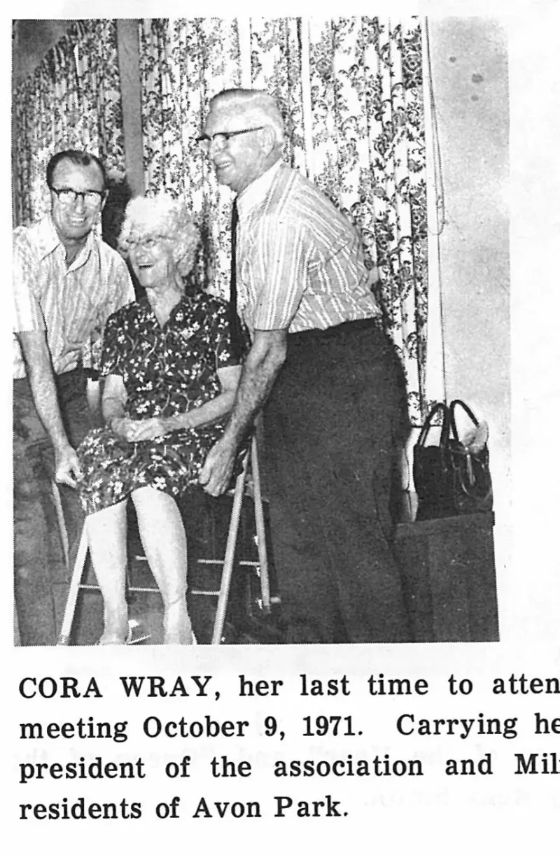
CORA WRAY, her last time to attend the Old Settlers Association meeting October 9, 1971. Carrying her chair is Jack Delaney, vice-president of the association and Milford Dilley, both are lifetime residents of Avon Park. Plate on page 71 of The First Hundred Years of Avon Park, Florida (1976).
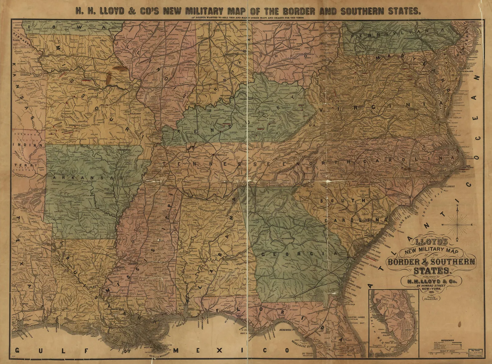
Features the 'Tropical Trunk Line' and various railway and steamboat connections.
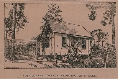
An engraving captioned COSY CORNER COTTAGE, FRONTING PANSY LAKE, signed HARPER — COL. O., showing W. E. Pabor's own small gabled house at Pabor Lake with a screened porch, banana plants and pine woods behind. Cropped from page 173 of the Pabor Lake Pineapple of 15 November 1895.
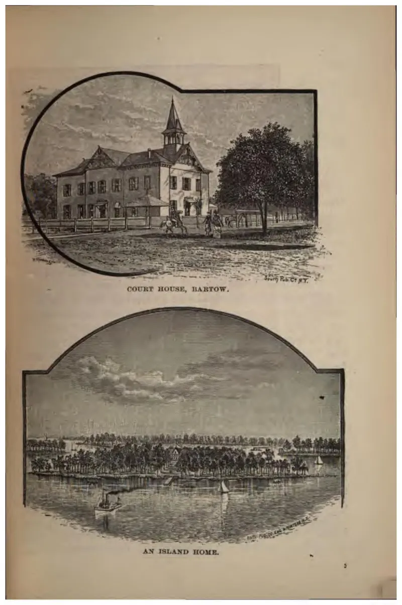
Two vignettes: the Polk County court house at Bartow, and a house on a wooded island.
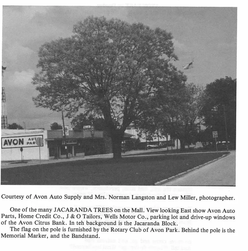
Courtesy of Avon Auto Supply and Mrs. Norman Langston and Lew Miller, photographer. Plate on page 266 of The First Hundred Years of Avon Park, Florida (1976).
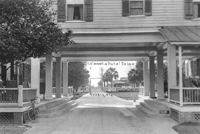
Cummer road asphalt plant, W. P. Kennedy Construction company - Avon Park, Florida.
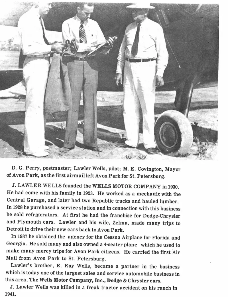
D. G. Perry, postmaster; Lawler Wells, pilot; M. E. Covington, Mayor of Avon Park, as the first airmail left Avon Park for St. Petersburg. Plate on page 184 of The First Hundred Years of Avon Park, Florida (1976).
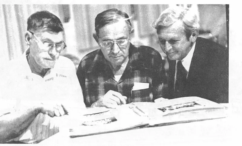
D. M. Earnest, Fred Garrett and J. W. (Billy) Martin, looking over an old scrapbook at the annual meeting of the Old Settlers Historical Society, November 2, 1977. Plate on page 206 of The First Hundred Years of Avon Park, Florida (1976).
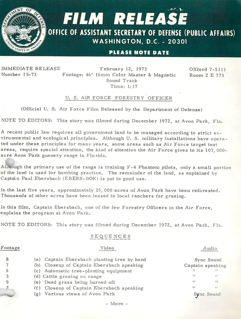
Film release number 15-73 of the Office of the Assistant Secretary of Defense (Public Affairs), 12 February 1973, describing a 46-foot Air Force film shot at Avon Park in December 1972 in which Captain Paul Ebersbach, forestry officer, explains the reforestation of 25,000 acres of the range and the leasing of thousands of acres to local ranchers.
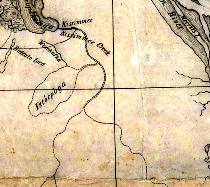
Detail showing the earliest map examined for this subject that names both Kissimmee Creek and Istòcpoga.
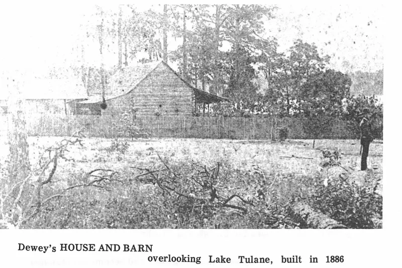
Dewey's HOUSE AND BARN. Plate on page 32 of The First Hundred Years of Avon Park, Florida (1976).
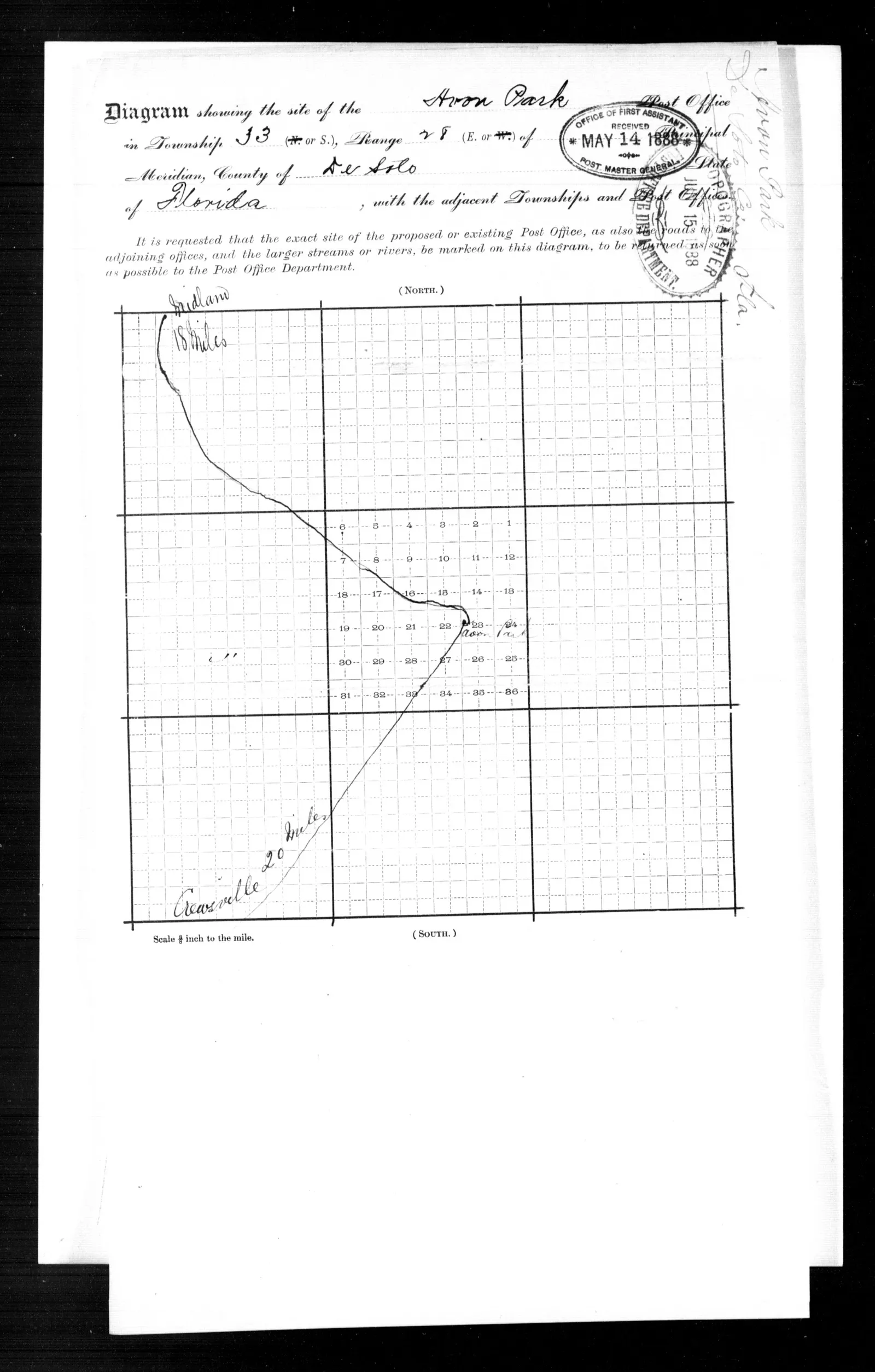
Township diagram submitted with William King's May 1888 location paper, marking the Avon Park post office in section 23, Township 33 South, Range 28 East, with the mail road to Midland, 18 miles, and Crewsville, 20 miles; received by the First Assistant Postmaster General 14 May 1888.
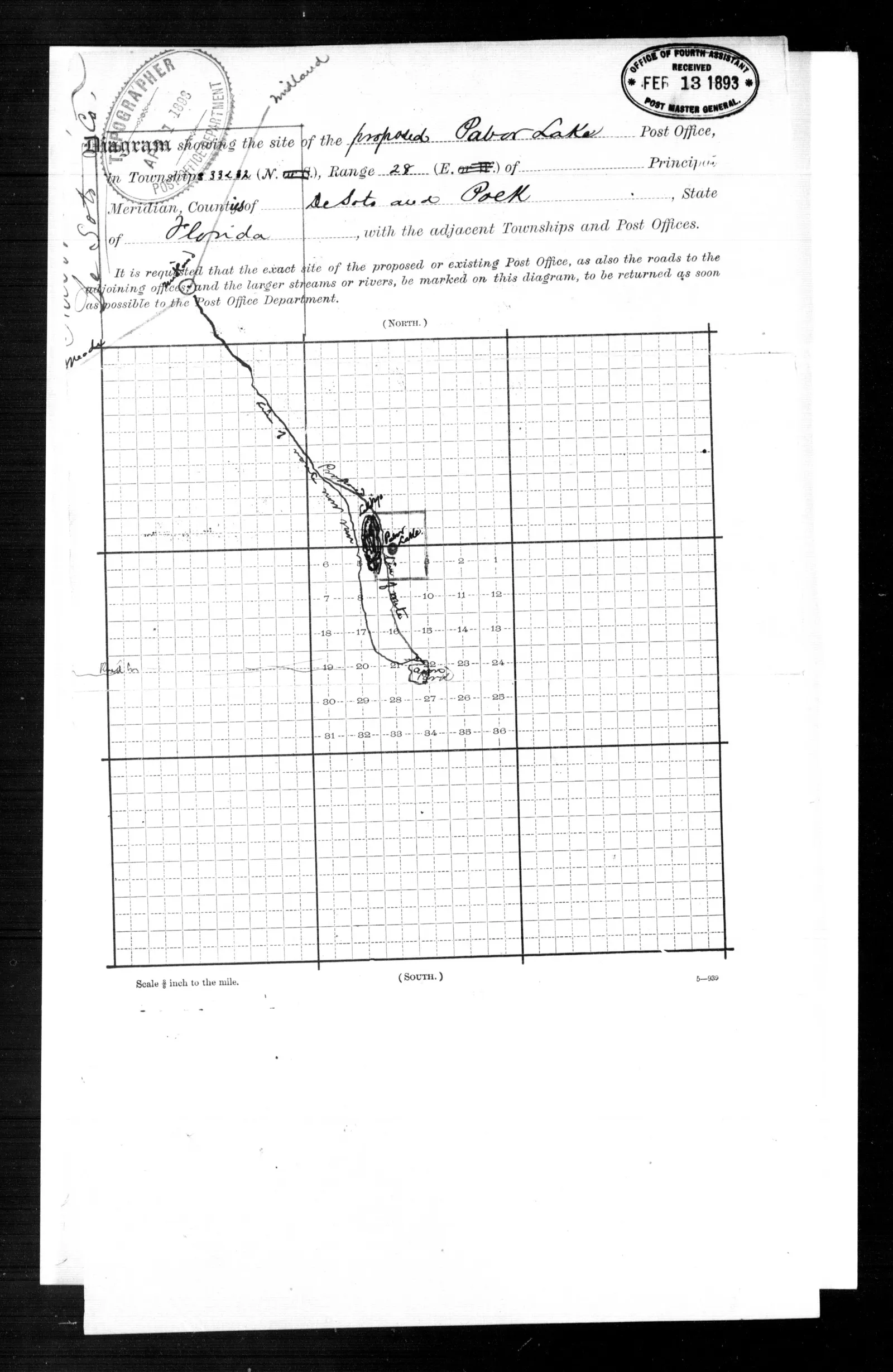
Township diagram submitted with William E. Pabor's location paper, marking the proposed Pabor Lake post office beside the lake in section 4, Township 33 South, Range 28 East, on the road from Fort Meade and Midland to Avon Park; received by the Fourth Assistant Postmaster General 13 February 1893.
Shows townships, completed and projected railroads, and railroad stations.
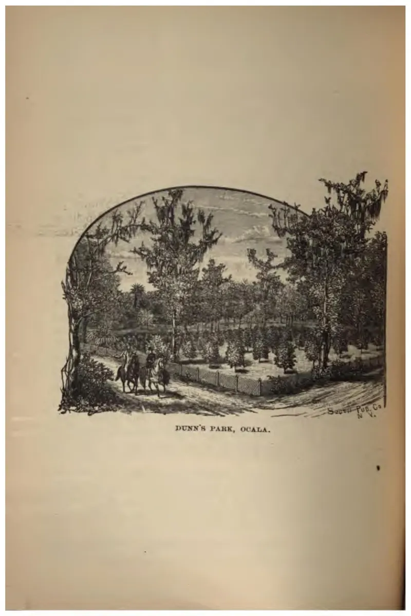
A shaded park at Ocala with figures walking under the trees.
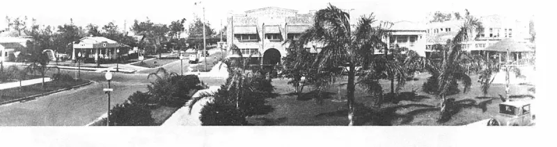
Durrance Block and Lawler Wells Filling Station on the corner. Plate on page 180 of The First Hundred Years of Avon Park, Florida (1976).
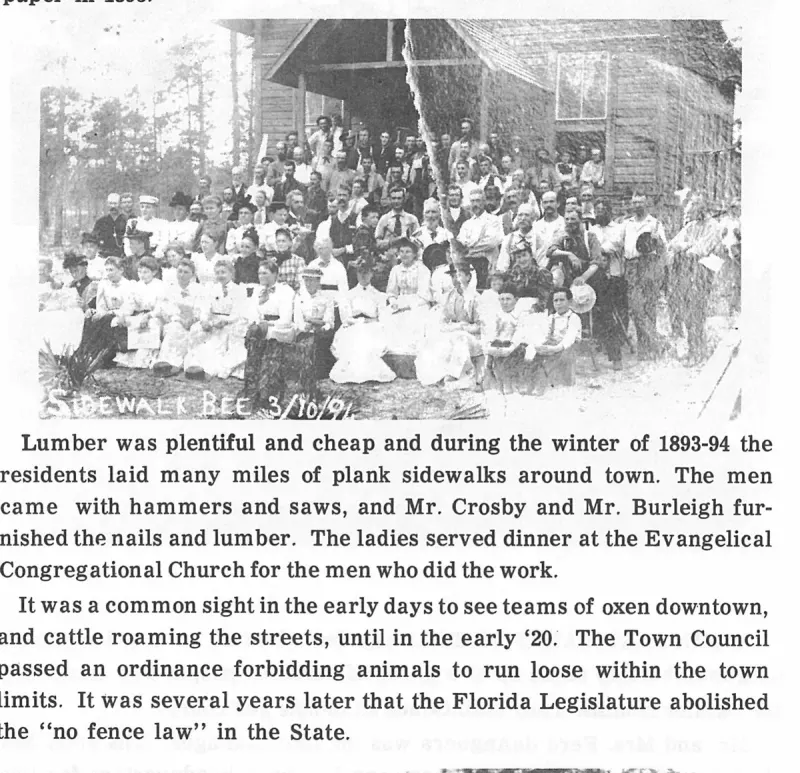
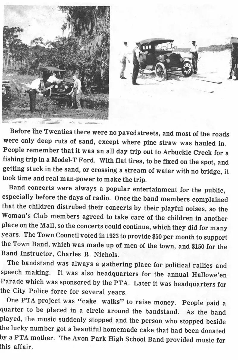
Early Main Street before the creation of the Mall, showing deep sand ruts covered with pine needles. Plate on page 169 of The First Hundred Years of Avon Park, Florida (1976).
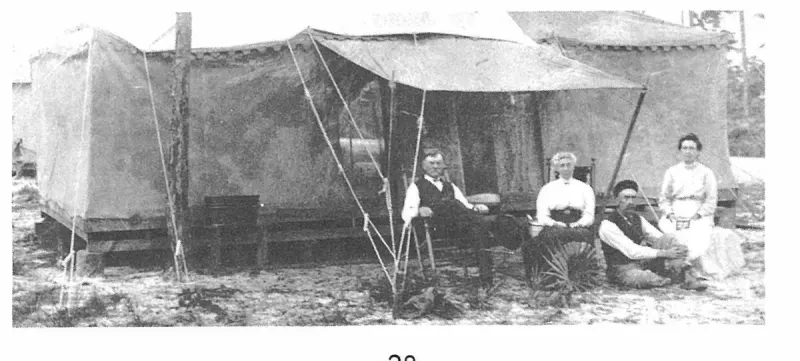
Early promotional map of Avon Park showing the grid layout and surrounding lakes. Plate on page 29 of The First Hundred Years of Avon Park, Florida (1976).
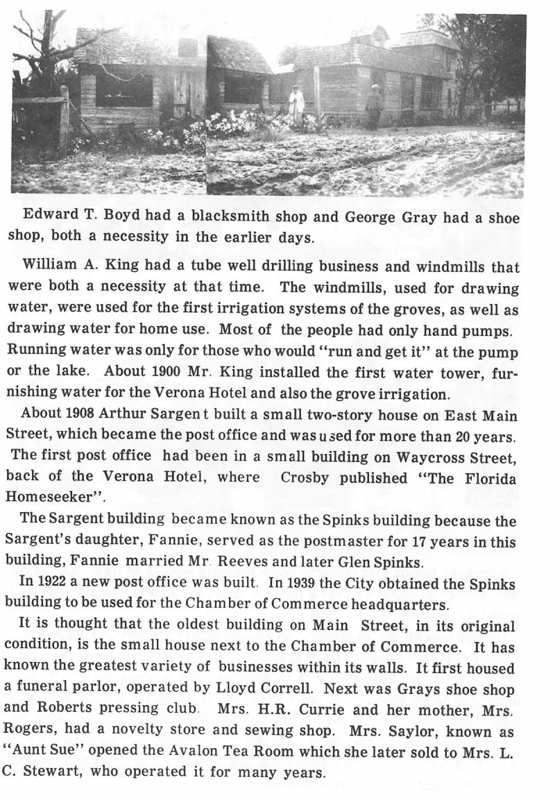
Edward T. Boyd had a blacksmith shop and George Gray had a shoe shop, both a necessity in the earlier days. Plate on page 170 of The First Hundred Years of Avon Park, Florida (1976).
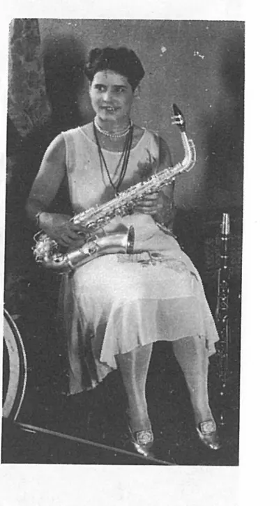
Elena Leighton Lawhon,. Plate on page 150 of The First Hundred Years of Avon Park, Florida (1976).
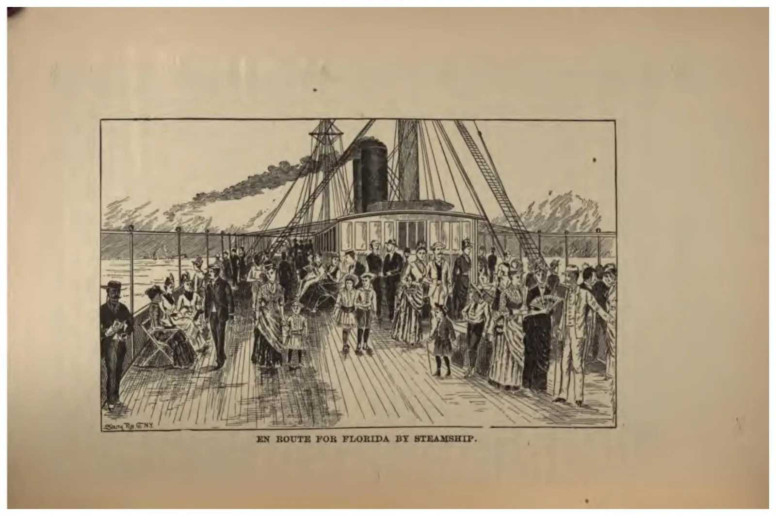
Passengers crowded on the deck of a coastal steamship bound for Florida.
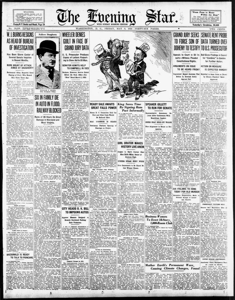
Newspaper clipping from the Evening Star (Washington, D.C.) discussing the Florida Western and Northern Railroad.
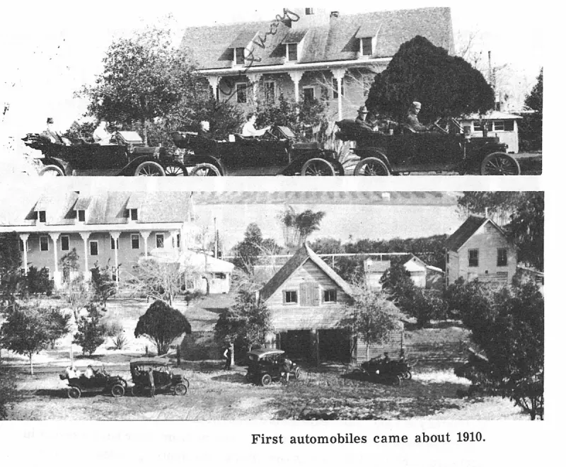
First automobiles came about 1910. Plate on page 46 of The First Hundred Years of Avon Park, Florida (1976).
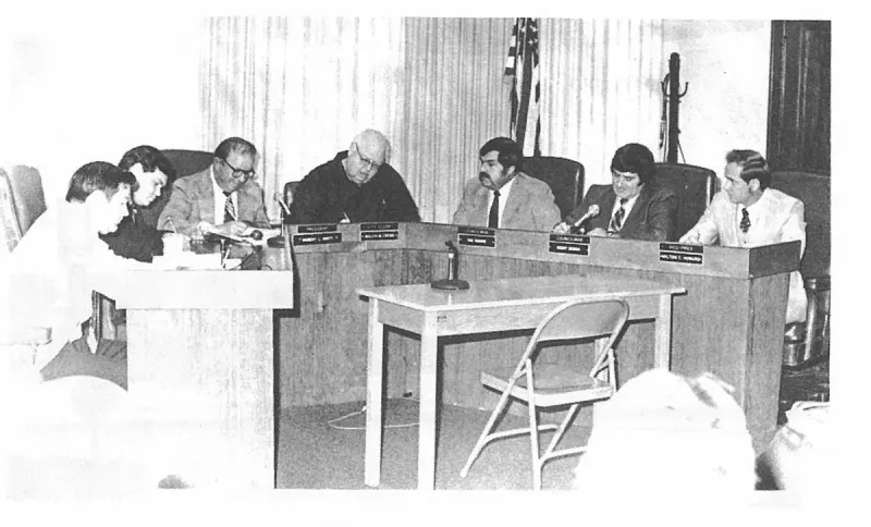
First Council meeting of the new City Council Left to right; Larry Albritton, Mayor David Barefield, Milton Howard, City Clerk Malcolm Crews, Tom Tataris, Paul Smith and Alex Whitbeck. Plate on page 230 of The First Hundred Years of Avon Park, Florida (1976).
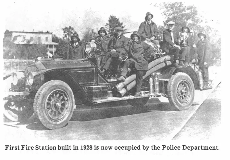
First Fire Station built in 1928 is now occupied by the Police Department. Plate on page 201 of The First Hundred Years of Avon Park, Florida (1976).
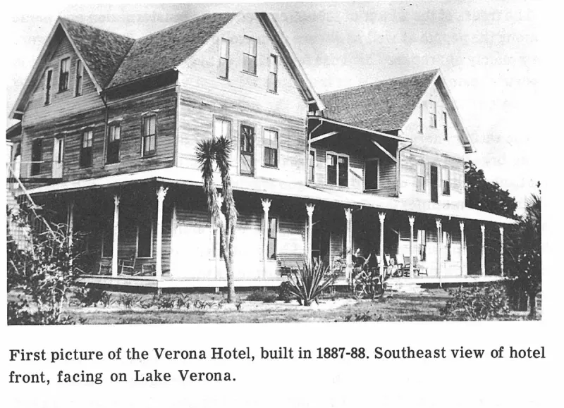
First picture of the Verona Hotel, built in 1887-88. Southeast view of hotel front, facing on Lake Verona. Plate on page 41 of The First Hundred Years of Avon Park, Florida (1976).
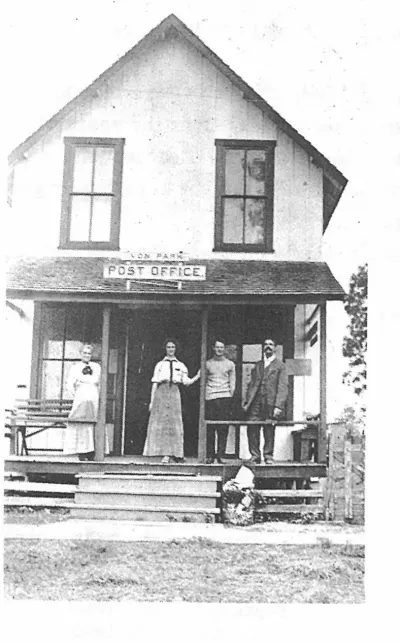
First Postoffice. Plate on page 85 of The First Hundred Years of Avon Park, Florida (1976).
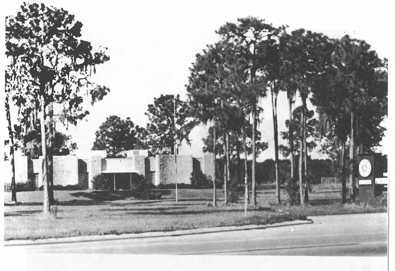
FLORIDA STATE FIREMEN'S HEADQUARTERS Hwy 27 South of Avon Park. Plate on page 233 of The First Hundred Years of Avon Park, Florida (1976).
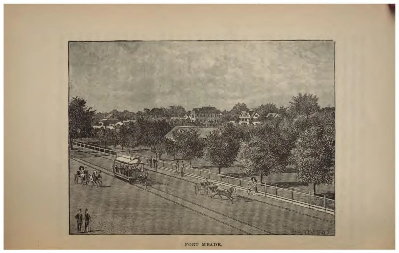
The main street of Fort Meade with a mule-drawn streetcar and houses among trees.
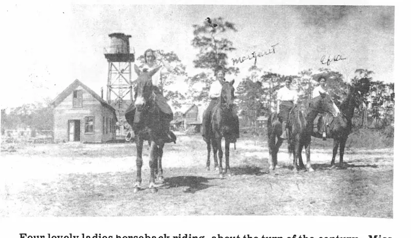
Four lovely ladies horseback riding, about the turn of the century. Miss Margaret Woodruff, who later became Mrs. Demos Mandis and Miss Efra Raulerson, are the only two identified. Plate on page 76 of The First Hundred Years of Avon Park, Florida (1976).
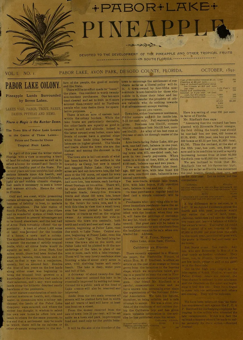
Front page of the premier issue of The Pabor Lake Pineapple, published in October 1892.
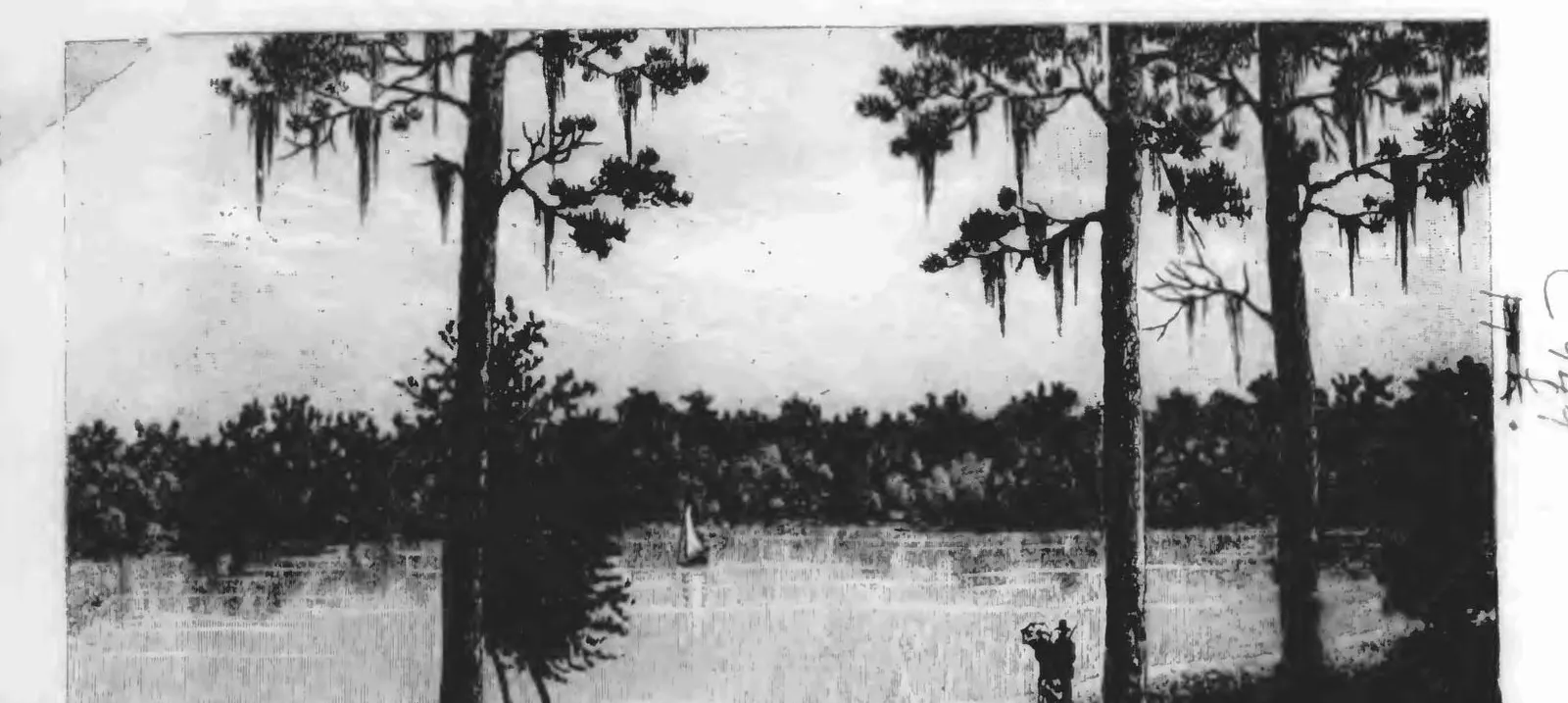
Uncaptioned photographic plate from Crosby's 1888 book: a lake through pines and Spanish moss, with a sailboat and two figures. The lake is not named in the book.
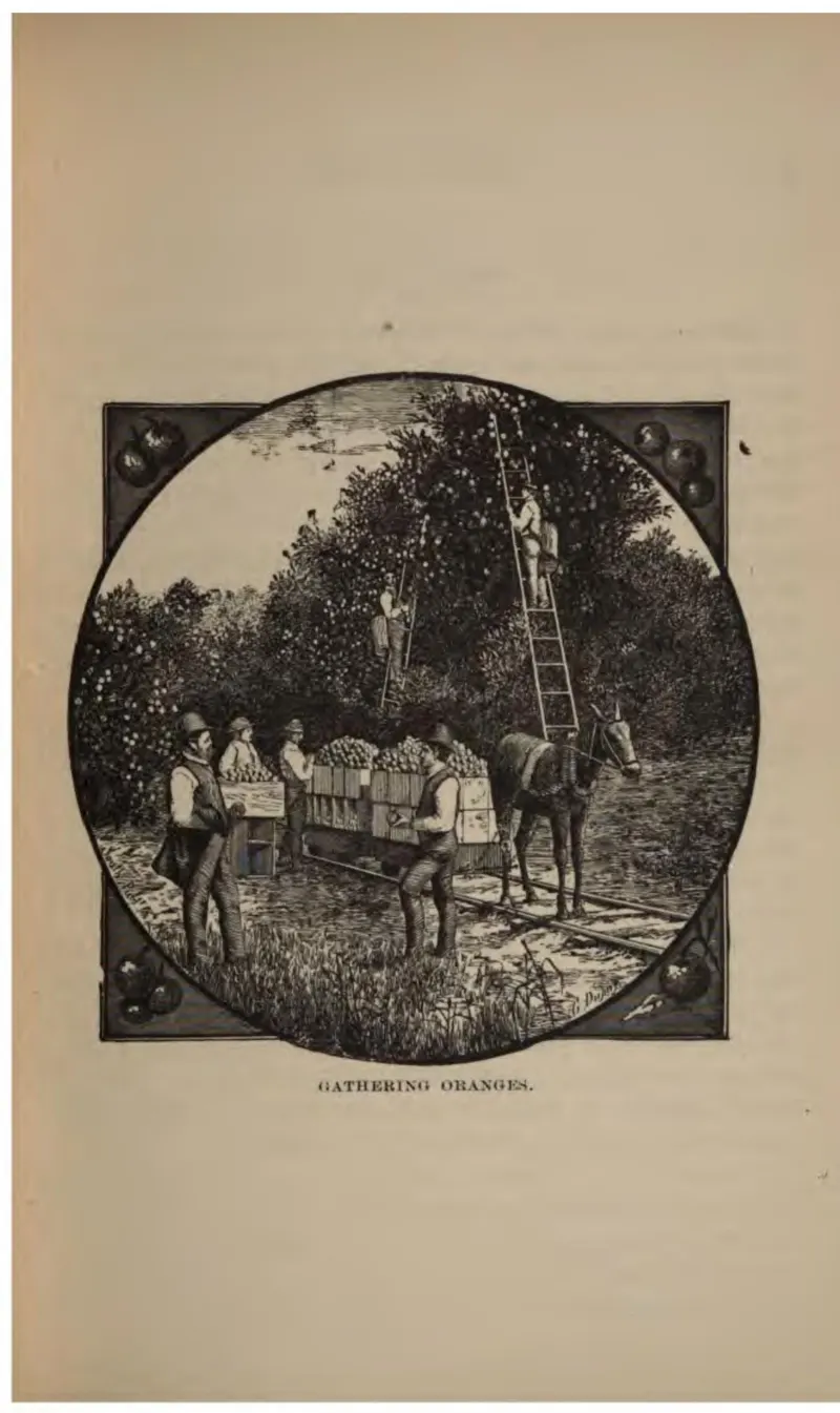
Pickers with a ladder and a loaded field crate, a horse and cart waiting.
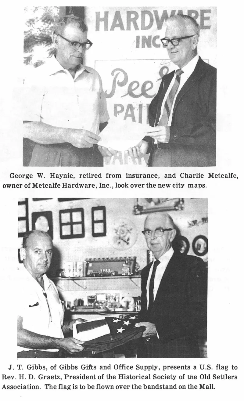
George W. Haynie, retired from insurance, and Charlie Metcalfe, owner of Metcalfe Hardware, Inc., look over the new city maps. Plate on page 205 of The First Hundred Years of Avon Park, Florida (1976).
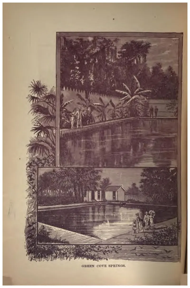
The spring pool and bathing house at Green Cove Springs, in two vignettes.
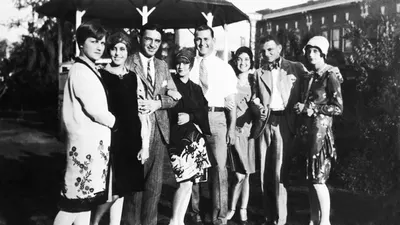
Group of people posing in Avon Park, Florida in 1927.
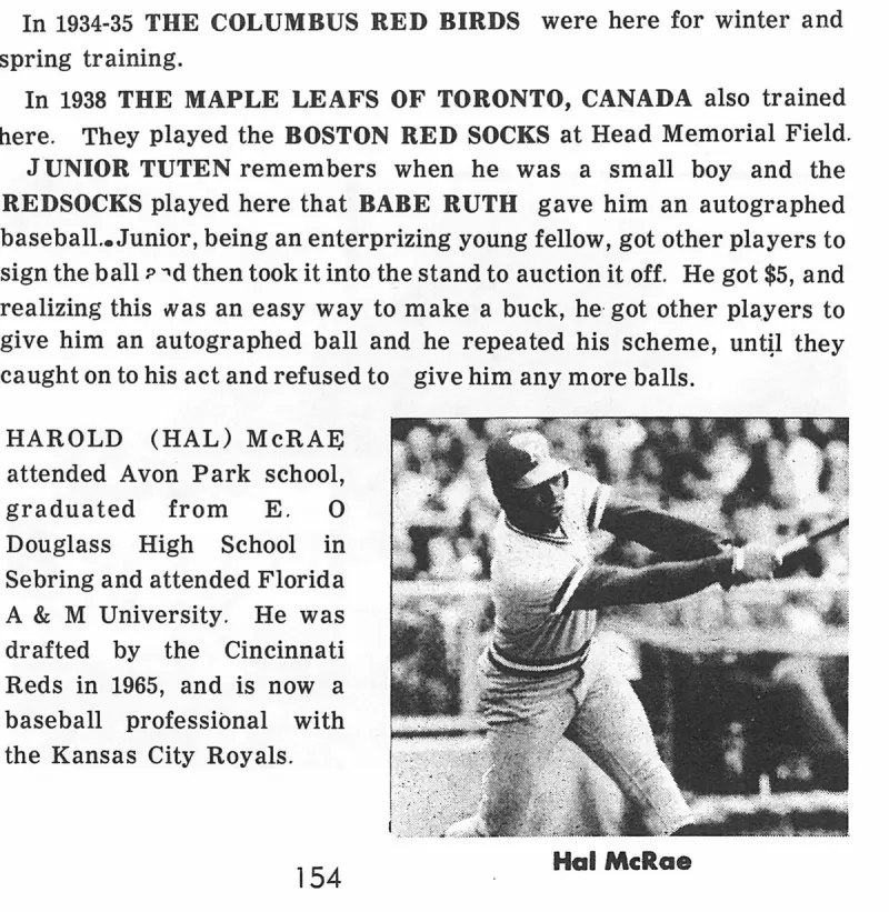
Hal McRae. Plate on page 155 of The First Hundred Years of Avon Park, Florida (1976).
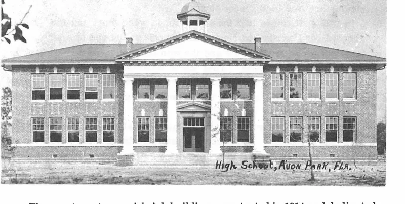
High School, Avon Park, Fla. Plate on page 116 of The First Hundred Years of Avon Park, Florida (1976).
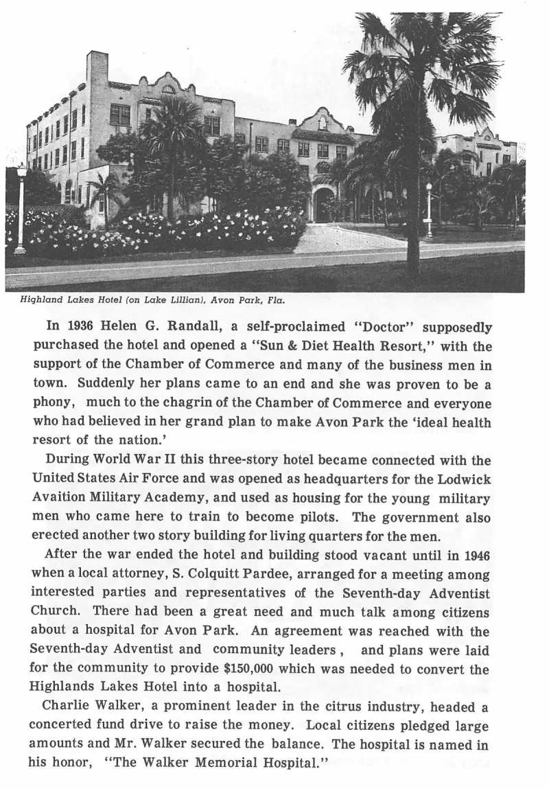
Highland Lakes Hotel (on Lake Lillian), Avon Park, Fla. Plate on page 162 of The First Hundred Years of Avon Park, Florida (1976).
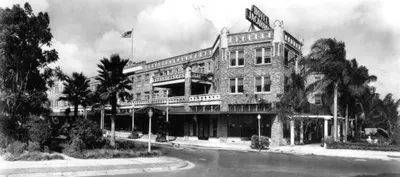
A 1935 photoprint of the Hotel Jacaranda by Robert E. Dahlgren.
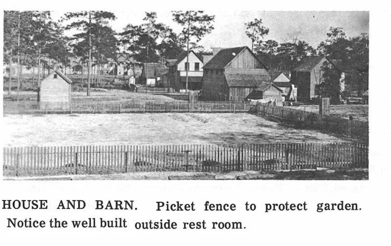
HOUSE AND BARN. Picket fence to protect garden. Notice the well built outside rest room. Plate on page 32 of The First Hundred Years of Avon Park, Florida (1976).
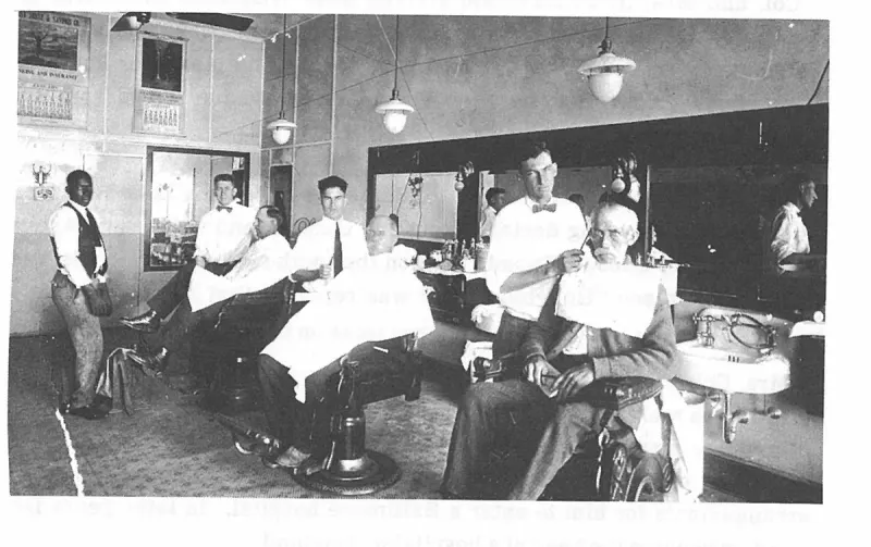
In 1920 Peter C. Boney purchased a half interest in a barber shop with Jim Simmons. This picture, made in 1923, shows Boney, Waters, and Cline as the barbers. Plate on page 134 of The First Hundred Years of Avon Park, Florida (1976).
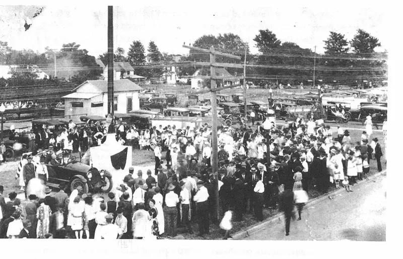
In 1922 Col. and Mrs. Davidson donated a flag pole to the City to be erected on the Mall. The 110 foot pole was dedicated on Nov. 11, 1922. Plate on page 188 of The First Hundred Years of Avon Park, Florida (1976).
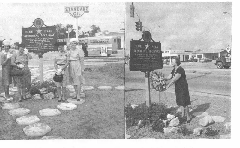
In 1965 the Garden Club erected a marker at the west end of the Mall designating Hwy 27 as a "Blue Star Memorial Highway," honoring the Gold Star Mothers of Avon Park. Plate on page 196 of The First Hundred Years of Avon Park, Florida (1976).
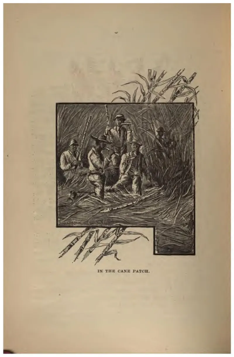
Black field workers cutting sugar cane, drawn for a northern readership.
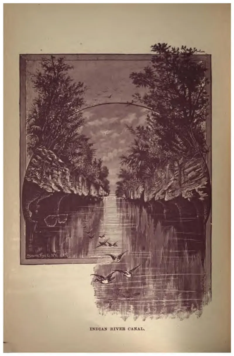
The cut of the Indian River canal running straight between wooded banks, with birds on the water.
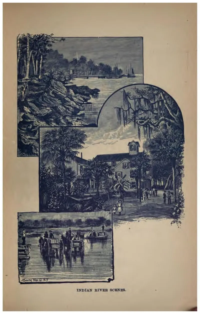
Four vignettes of the Indian River: sailing craft, a hotel among trees, and a boat landing.
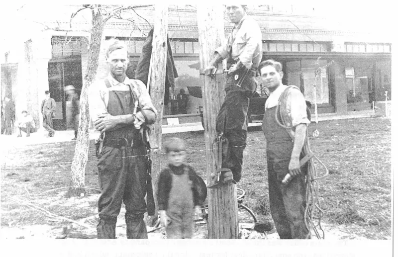
Installing the first telephone pole in 1914. First National Bank in the background, J. R. Merritt, Gene Branner (on pole), Billy Yohee and Eddie Clark, (4 years old). Plate on page 83 of The First Hundred Years of Avon Park, Florida (1976).
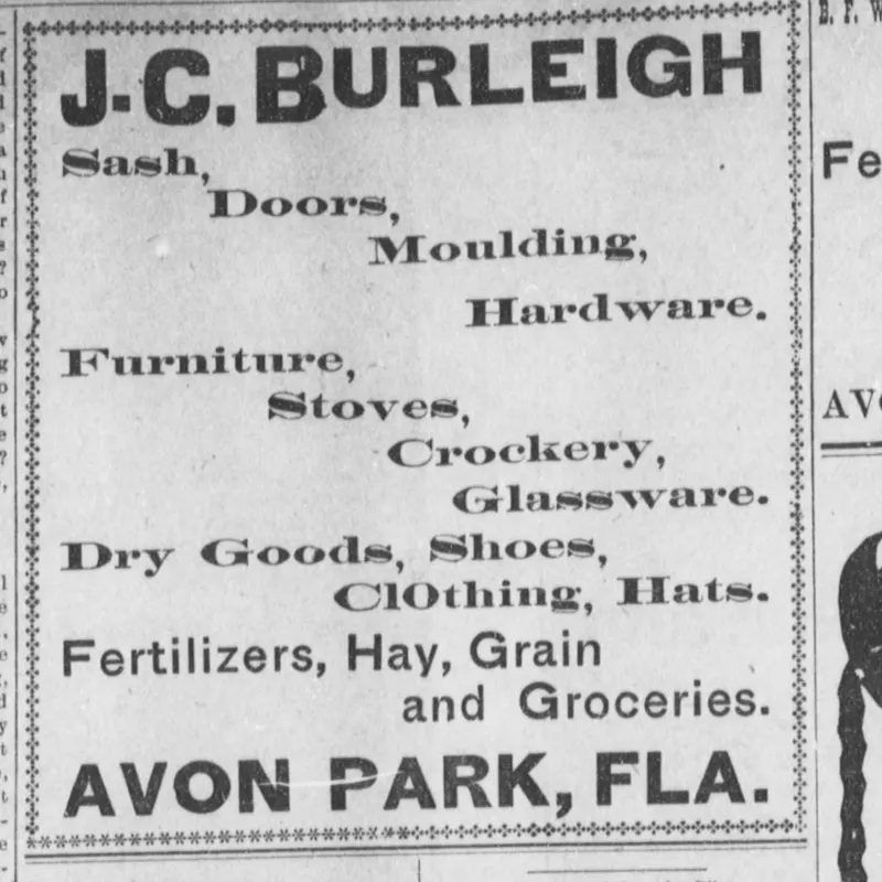
Display advertisement for J. C. Burleigh of Avon Park, Florida, offering sash, doors, molding, hardware, furniture, stoves, crockery, glassware, dry goods, shoes, clothing, hats, fertilizers, hay, grain and groceries, printed on the Avon Park page of The De Soto County News (Arcadia) on 18 August 1905.
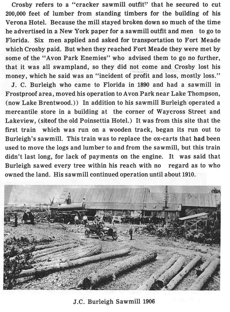
J.C. Burleigh Sawmill 1906. Plate on page 72 of The First Hundred Years of Avon Park, Florida (1976).
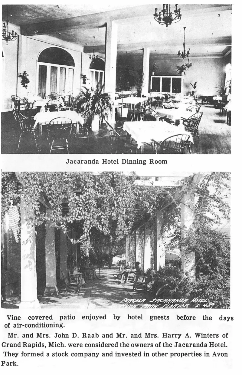
Jacaranda Hotel Dinning Room. Plate on page 151 of The First Hundred Years of Avon Park, Florida (1976).
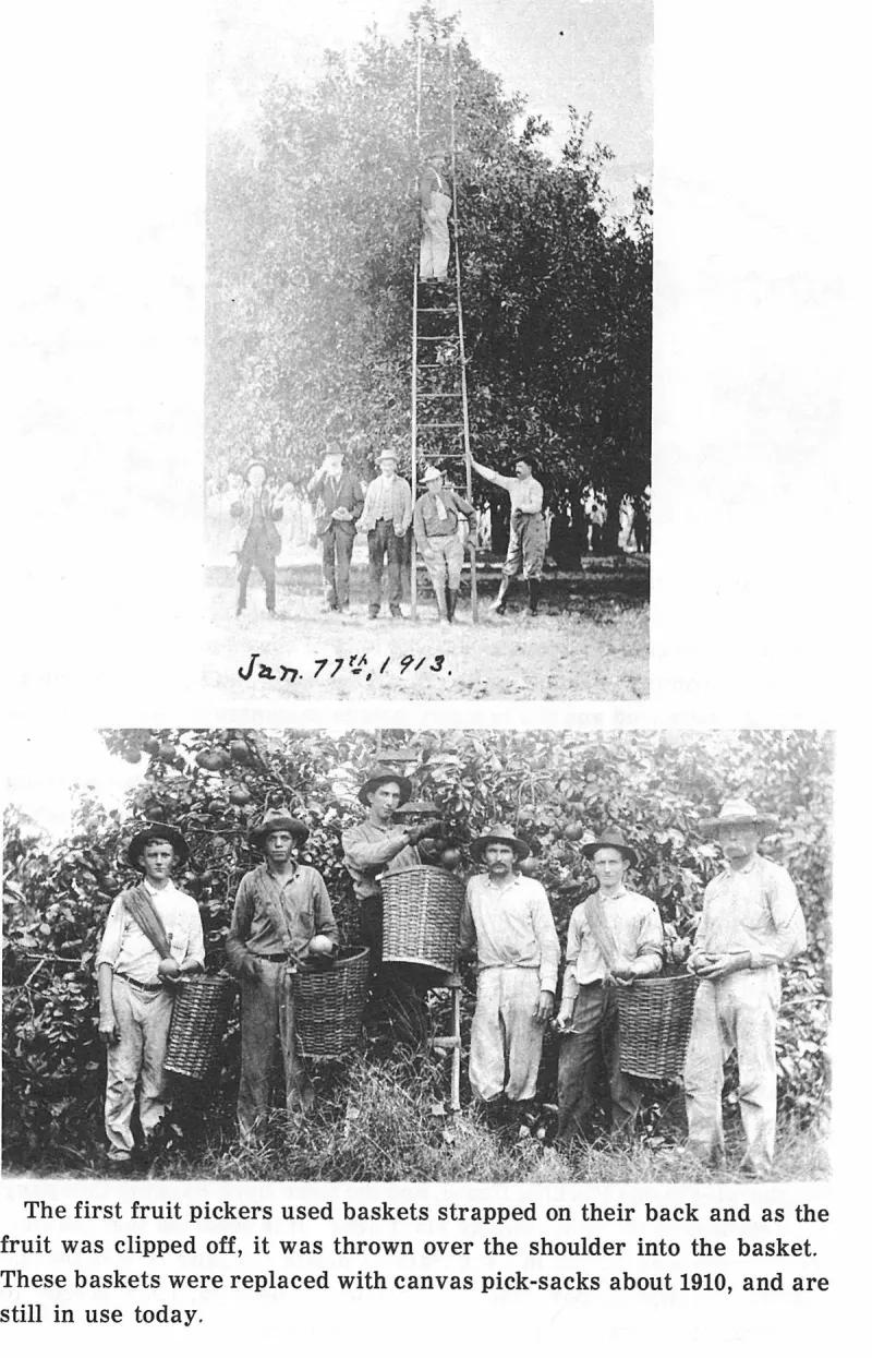
Jan. 17th, 1913. Plate on page 144 of The First Hundred Years of Avon Park, Florida (1976).
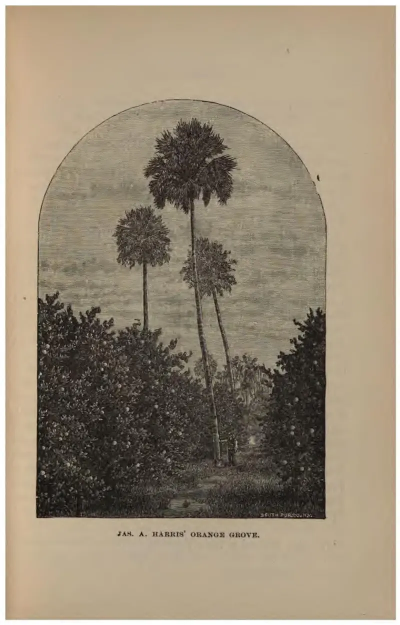
A mature orange grove with cabbage palms rising above it.
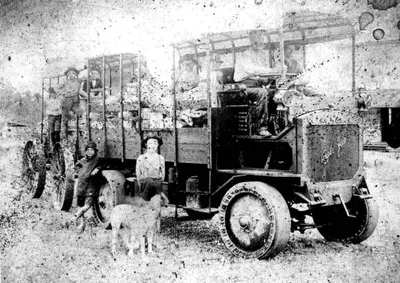
A loaded motor truck with four men and boys at Midland, Polk County; dated circa 1900 by the archive, but the truck points to the late 1910s or 1920s.
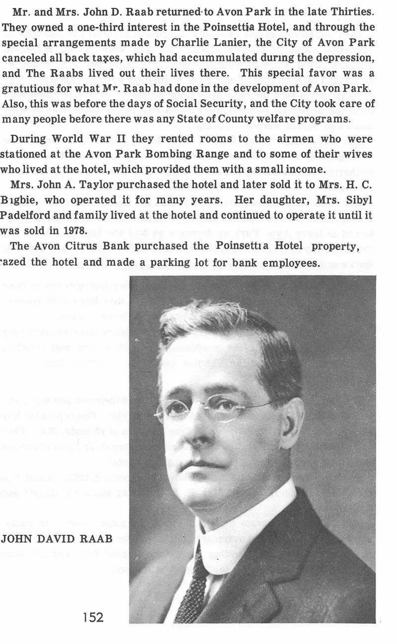
John David Raab. Plate on page 153 of The First Hundred Years of Avon Park, Florida (1976).
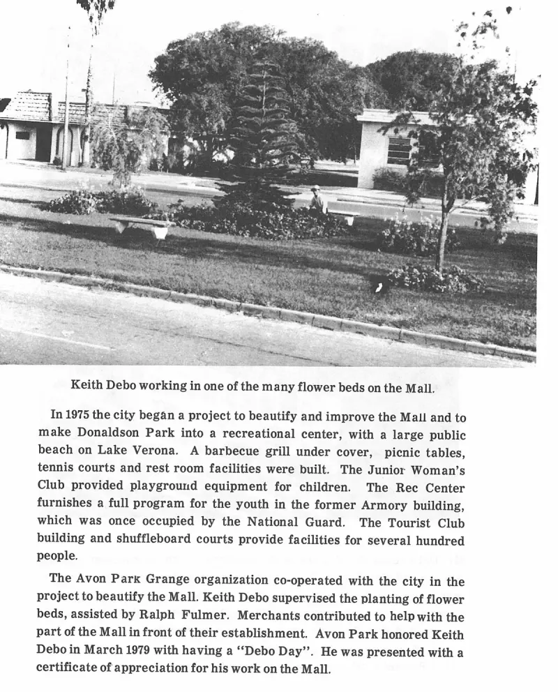
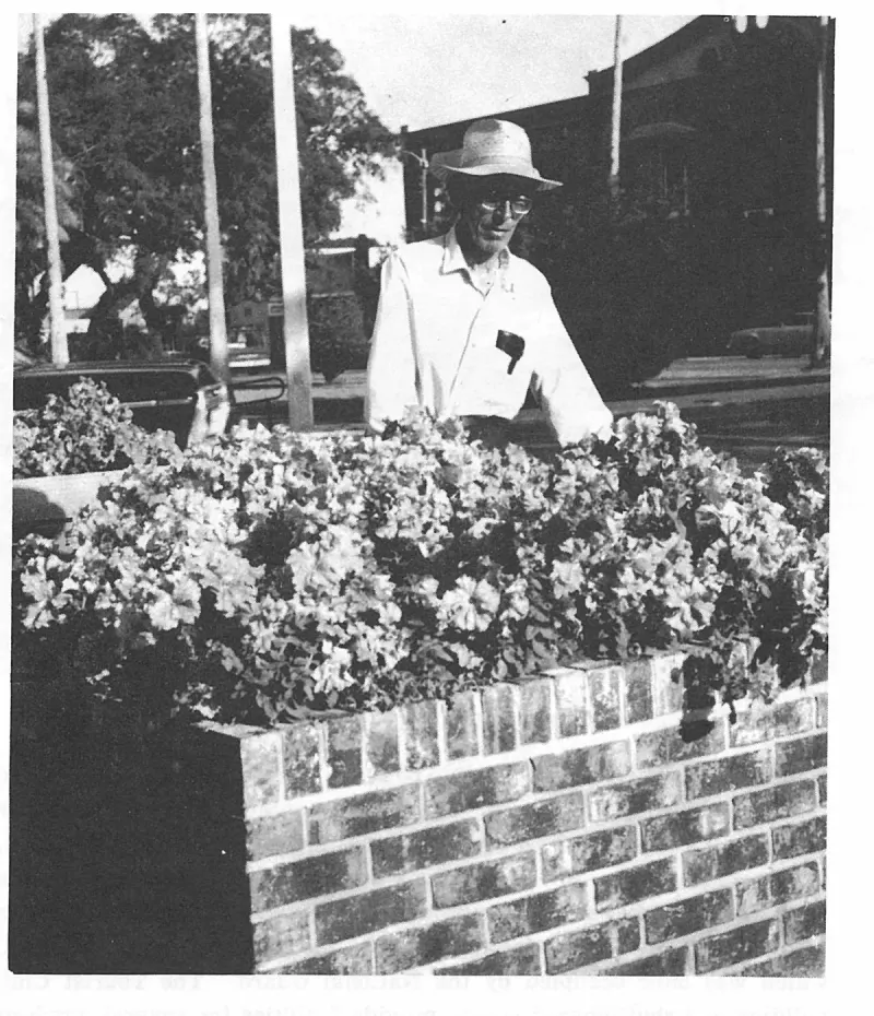
Keith Debo working in one of the many flower beds on the Mall. Plate on page 194 of The First Hundred Years of Avon Park, Florida (1976).
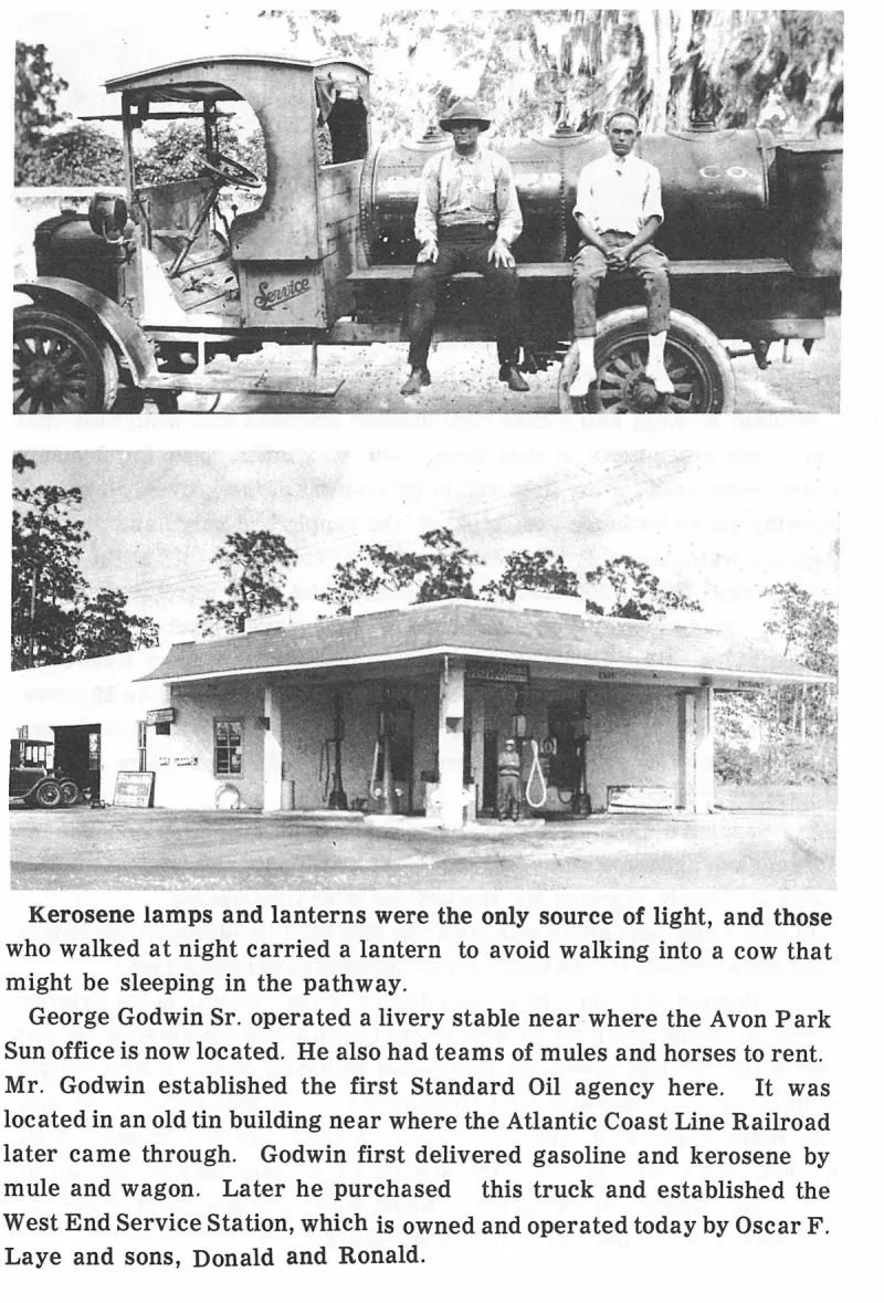
Kerosene lamps and lanterns were the only source of light, and those who walked at night carried a lantern to avoid walking into a cow that might be sleeping in the pathway. Plate on page 171 of The First Hundred Years of Avon Park, Florida (1976).
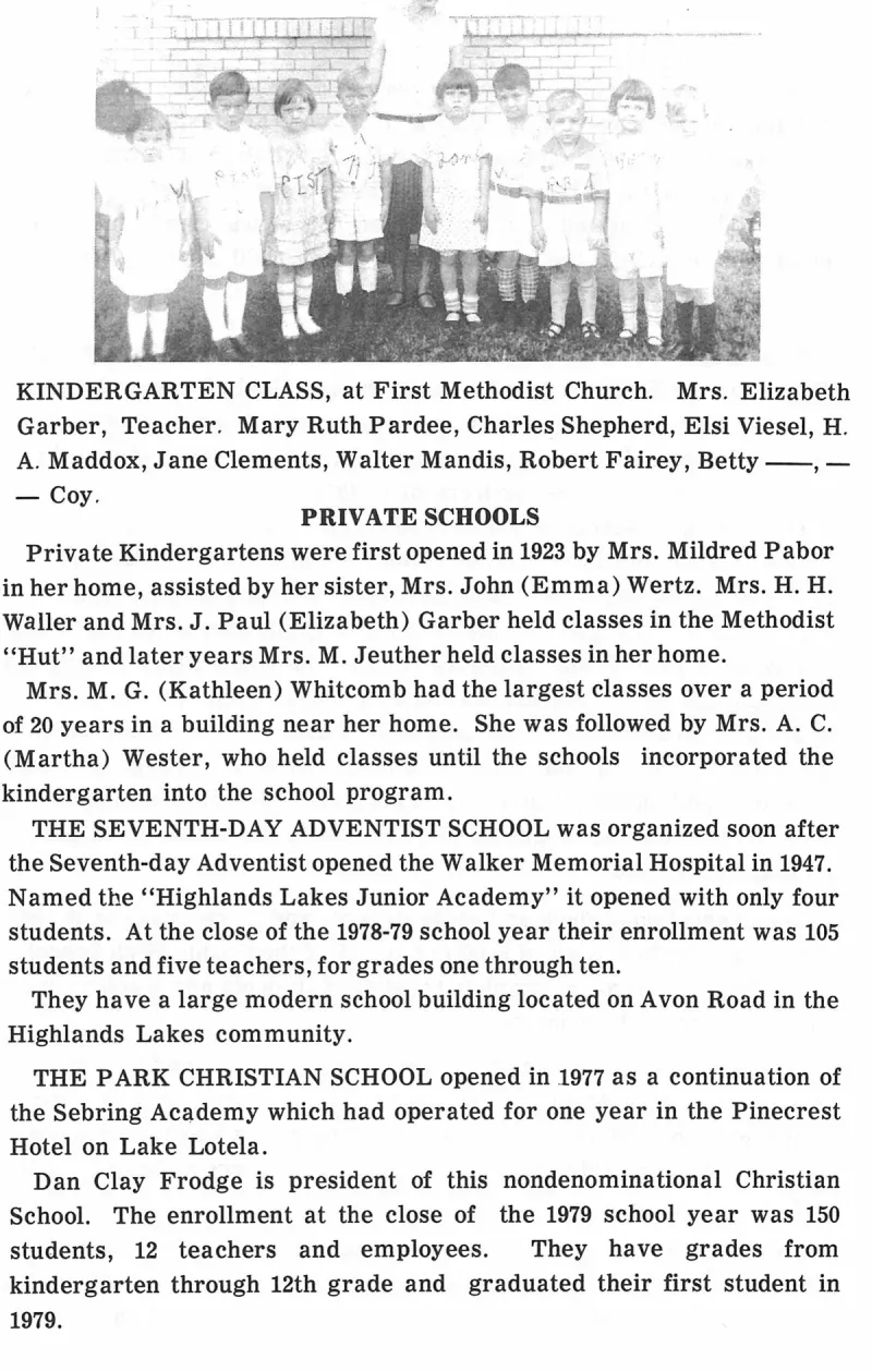
KINDERGARTEN CLASS, at First Methodist Church. Mrs. Elizabeth Garber, Teacher. Mary Ruth Pardee, Charles Shepherd, Elsi Viesel, H. A. Maddox, Jane Clements, Walter Mandis, Robert Fairey, Betty ——, —— Coy. Plate on page 123 of The First Hundred Years of Avon Park, Florida (1976).
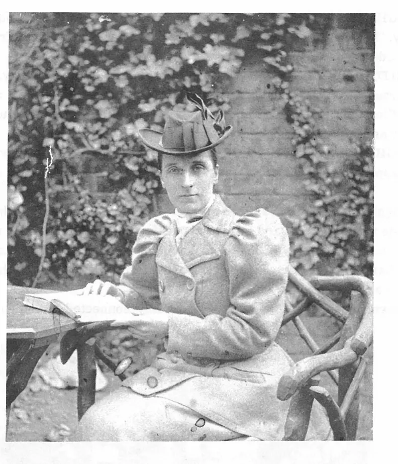
LADY BUNBURY writing in her diary, circa 1898. Plate on page 77 of The First Hundred Years of Avon Park, Florida (1976).
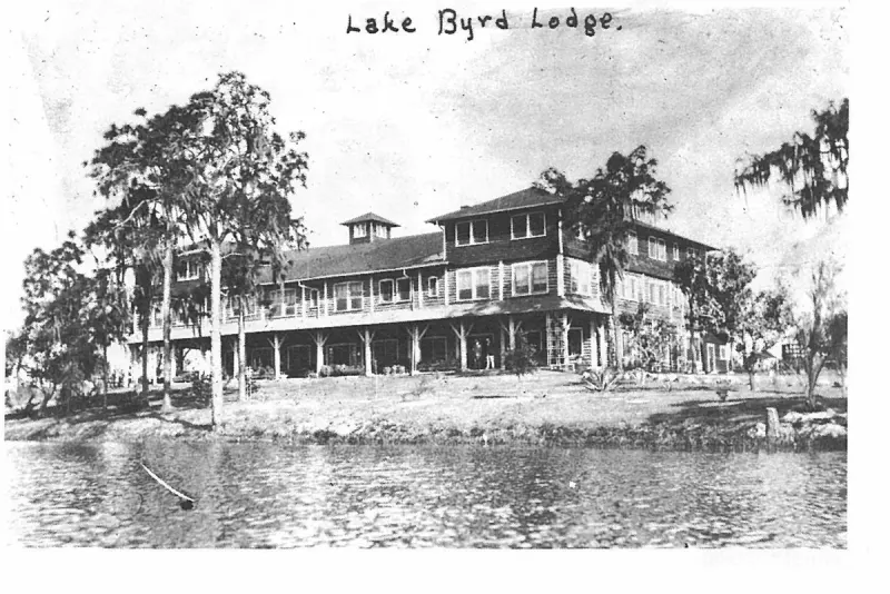
LAKE BYRD LODGE was built in 1919 as a club house for the Florida-Pittsburgh Company. D. B. Farnell was the builder of this rustic structure, made completely of bay logs that were hewn smooth, sized and fitted together. Plate on page 167 of The First Hundred Years of Avon Park, Florida (1976).
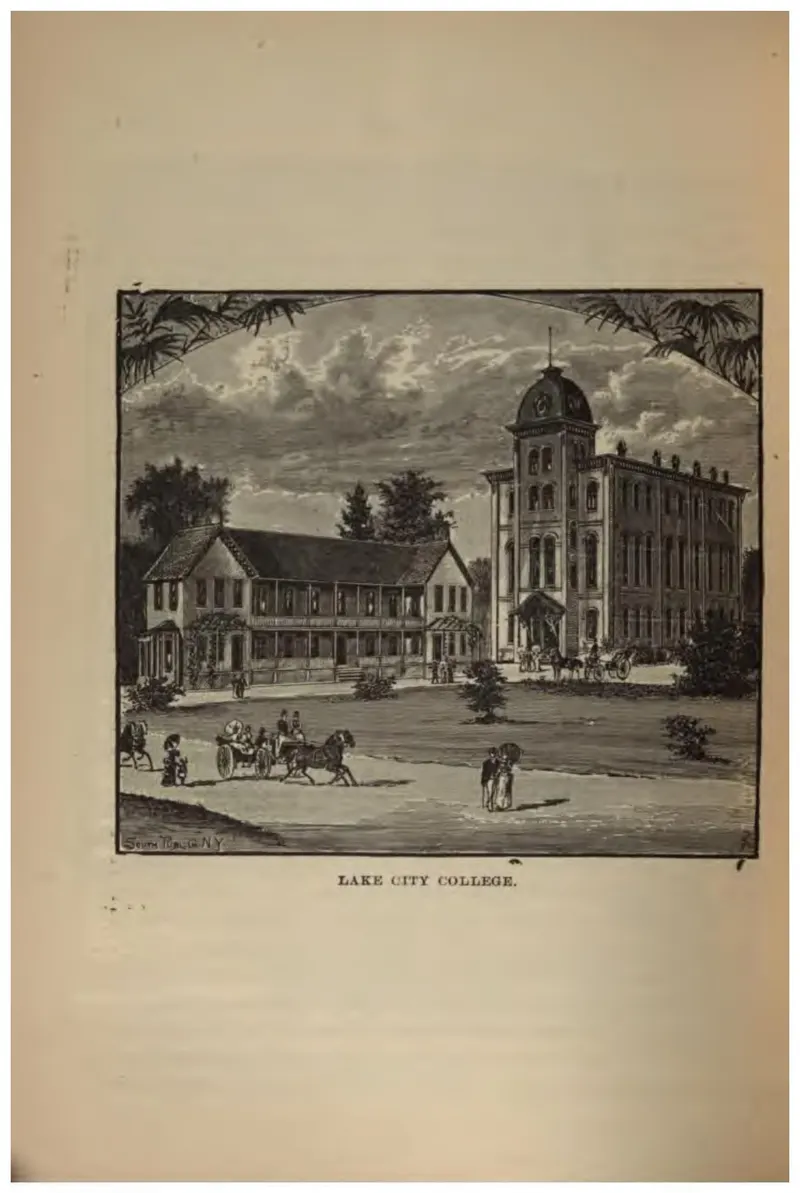
The college buildings at Lake City with a carriage on the drive.
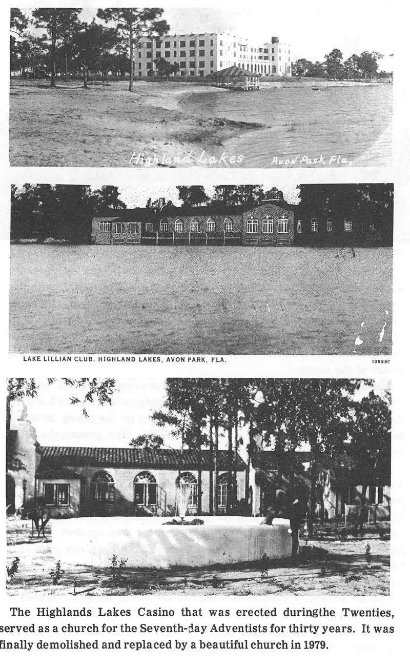
Lake Lillian Club, Highland Lakes, Avon Park, Fla. 10999c. Plate on page 163 of The First Hundred Years of Avon Park, Florida (1976).
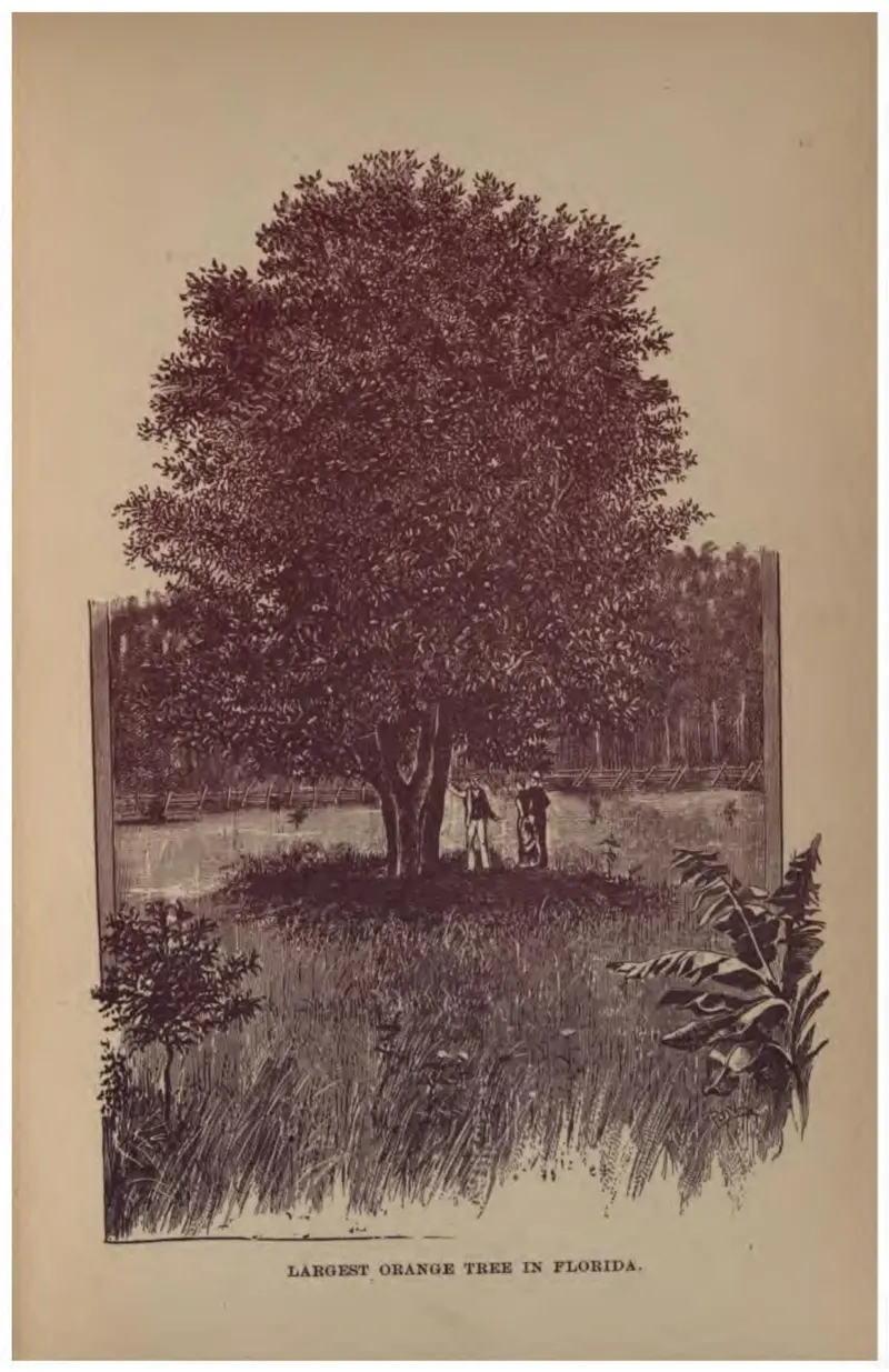
A single spreading orange tree with two figures beneath it for scale.
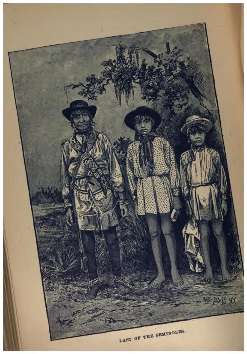
Three Seminole men and boys in patchwork clothing, posed in the open. The caption asserts the Seminoles were vanishing, which was the settler view of the period and was wrong.
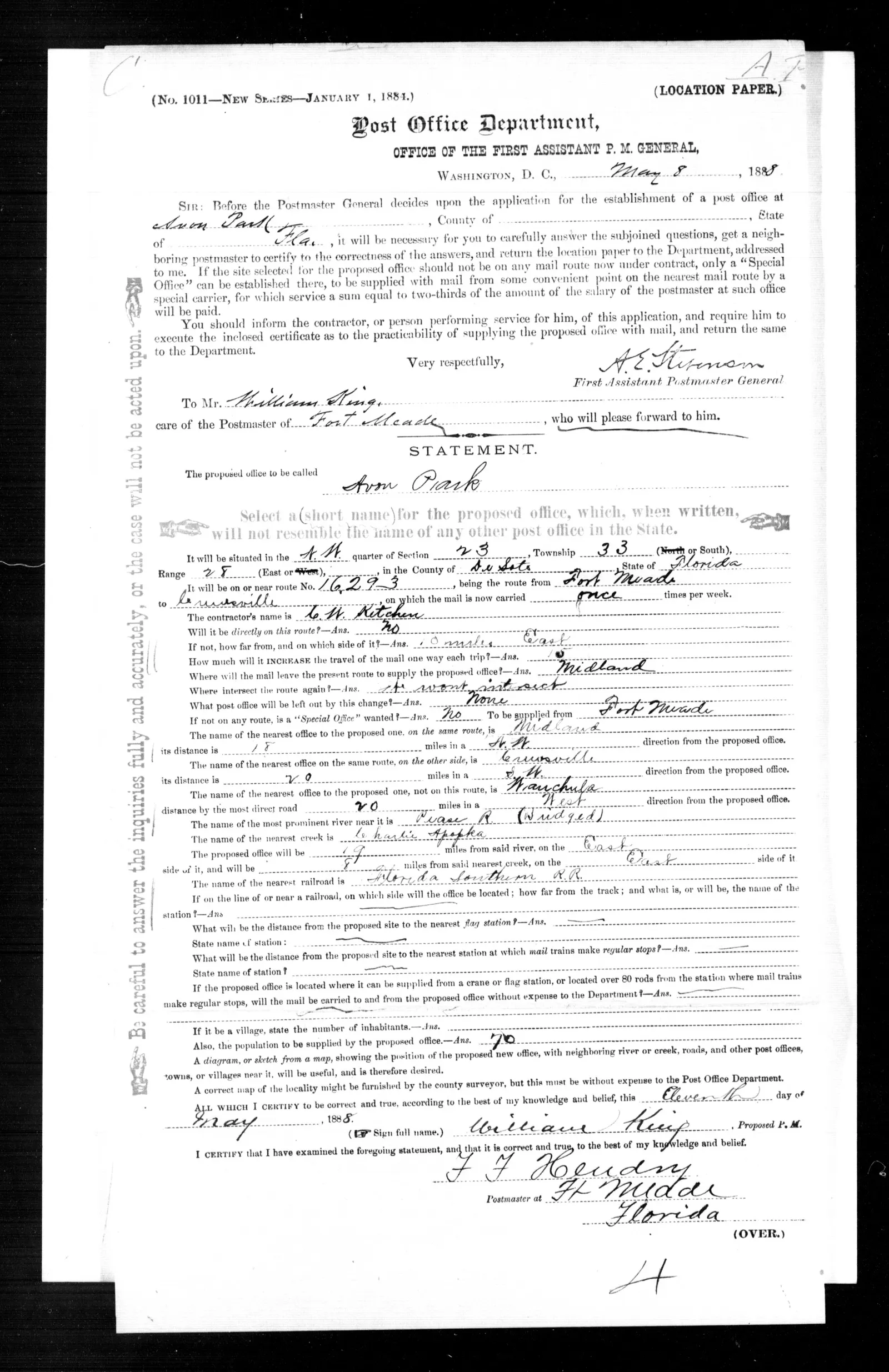
Post Office Department location paper for the establishment of a post office at Avon Park, De Soto County, Florida, issued 8 May 1888, completed and signed by William King as proposed postmaster on 11 May 1888 and certified by F. F. Hendry, postmaster at Fort Meade.
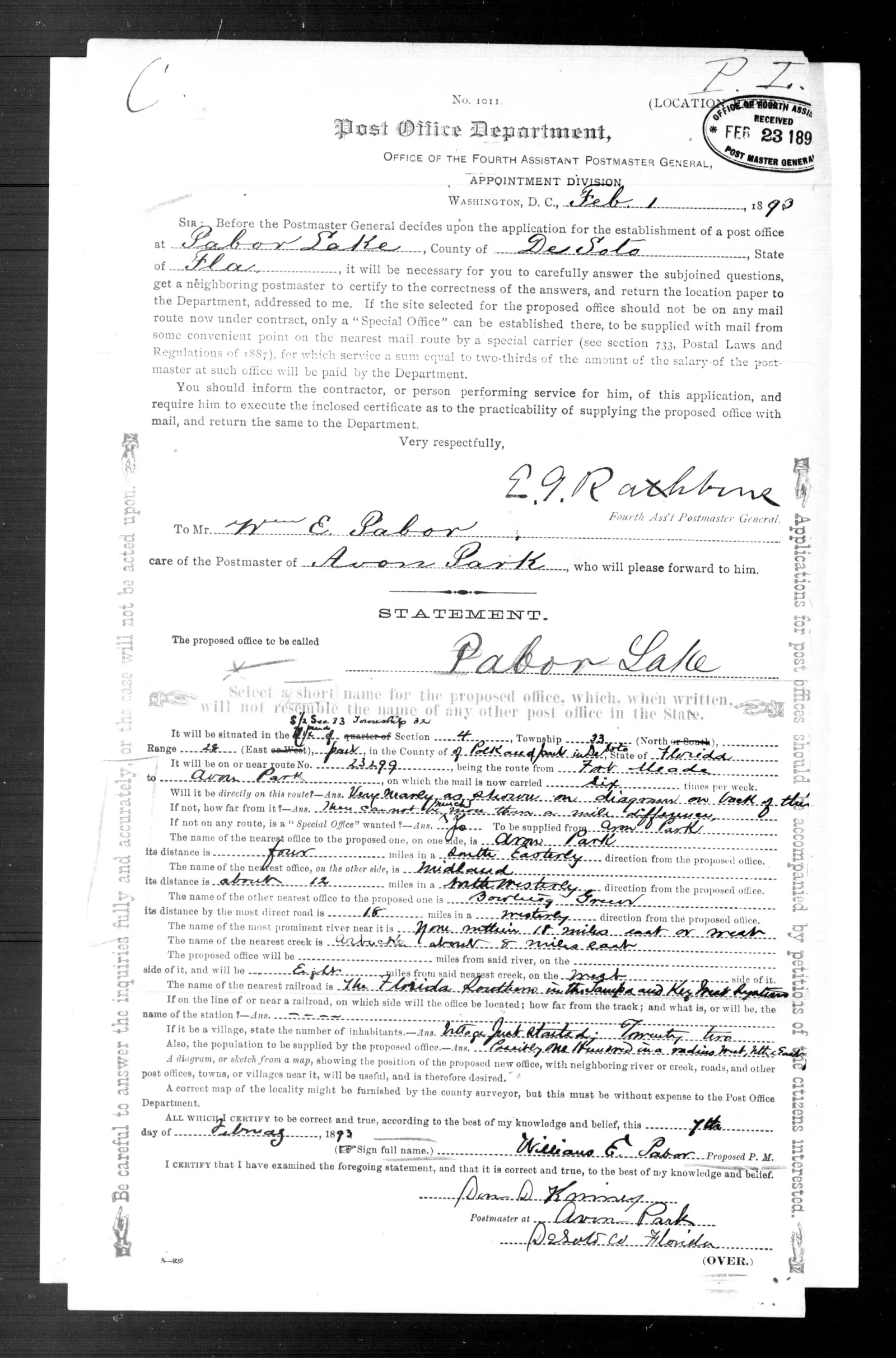
Post Office Department location paper for the establishment of a post office at Pabor Lake, De Soto County, Florida, issued 1 February 1893, completed and signed by William E. Pabor as proposed postmaster on 7 February 1893 and certified by Dorr D. Kinney, postmaster at Avon Park.
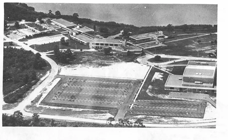
Looking southeast across the campus of South Florida Junior College. Parking spaces and Community Auditorium in the foreground. Lake Glenada in the background. Plate on page 222 of The First Hundred Years of Avon Park, Florida (1976).
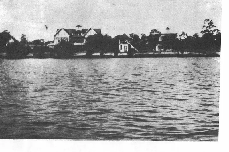
Looking west across Lake Verona shows the bandstand when it was built in 1897, in front of the Hotel. Plate on page 44 of The First Hundred Years of Avon Park, Florida (1976).
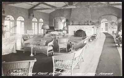
Lounge, Pine Crest Lakes Club, Avon Park, Florida
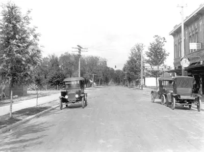
Looking down a still-unpaved Main Street in May 1917, with early automobiles at the curb and the hanging sign of the Avon Park Drug Company on the brick business block to the right.
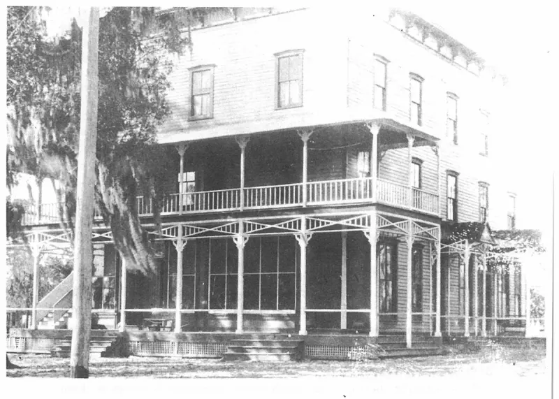
Masonic Temple Before It Was Razed in 1961. Plate on page 49 of The First Hundred Years of Avon Park, Florida (1976).
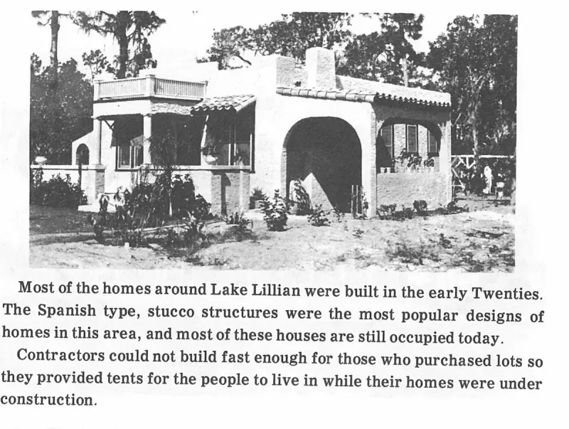
Most of the homes around Lake Lillian were built in the early Twenties. The Spanish type, stucco structures were the most popular designs of homes in this area, and most of these houses are still occupied today. Plate on page 166 of The First Hundred Years of Avon Park, Florida (1976).
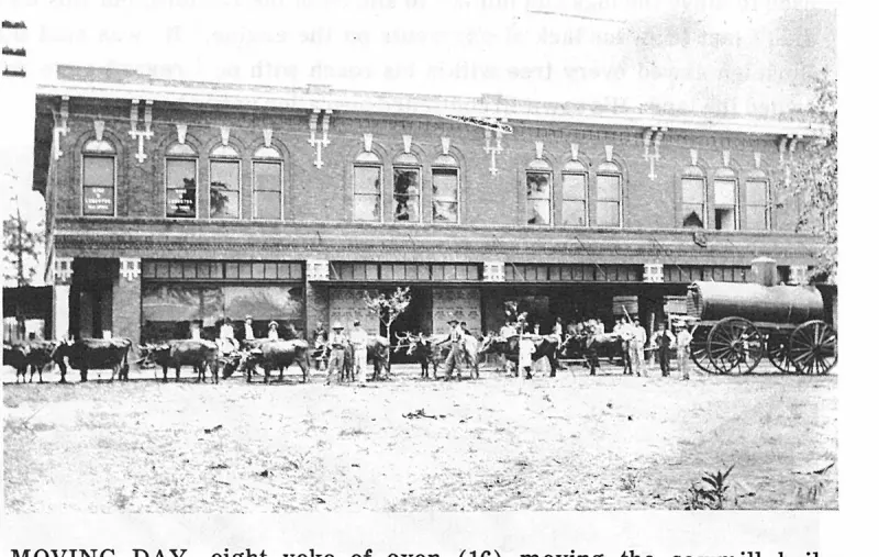
MOVING DAY, eight yoke of oxen (16) moving the sawmill boiler down Main Street by The First National Bank. Plate on page 73 of The First Hundred Years of Avon Park, Florida (1976).
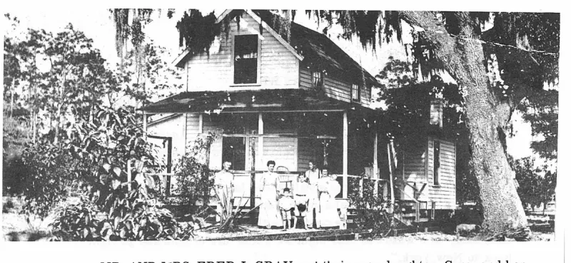
MR. AND MRS. FRED J. GRAY and their only daughter, Cora, and her husband, Fred Elmore (Mutt) Wray, and their three oldest sons,, Frederick Ellis, Vincent Dewitt and Lawrence Earl, in his mother's arms. Plate on page 69 of The First Hundred Years of Avon Park, Florida (1976).
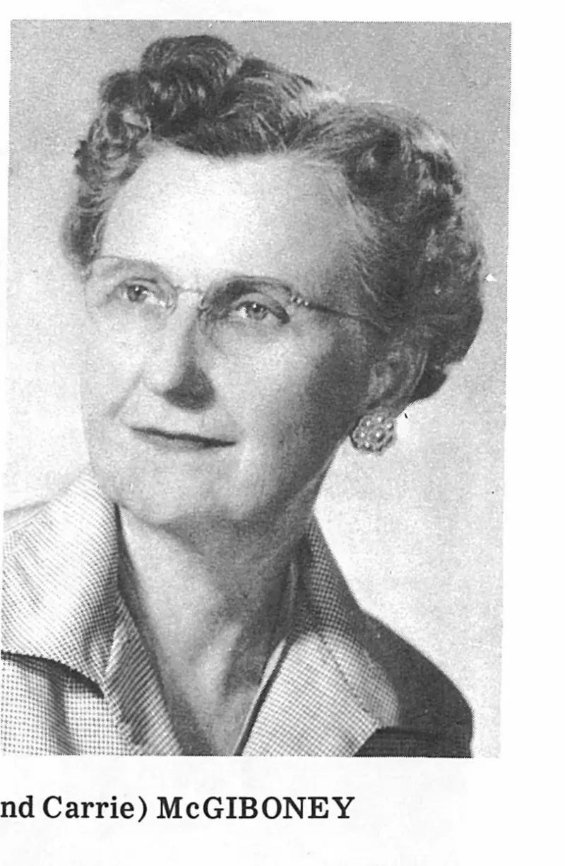
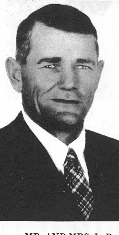
MR. AND MRS. L. D. (Love and Carrie) McGIBONEY. Plate on page 136 of The First Hundred Years of Avon Park, Florida (1976).
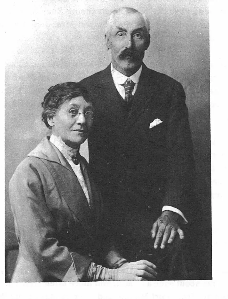
Mr. and Mrs. William A. King, celebrating their 25th Wedding Anniversary April 30, 1906. Plate on page 36 of The First Hundred Years of Avon Park, Florida (1976).
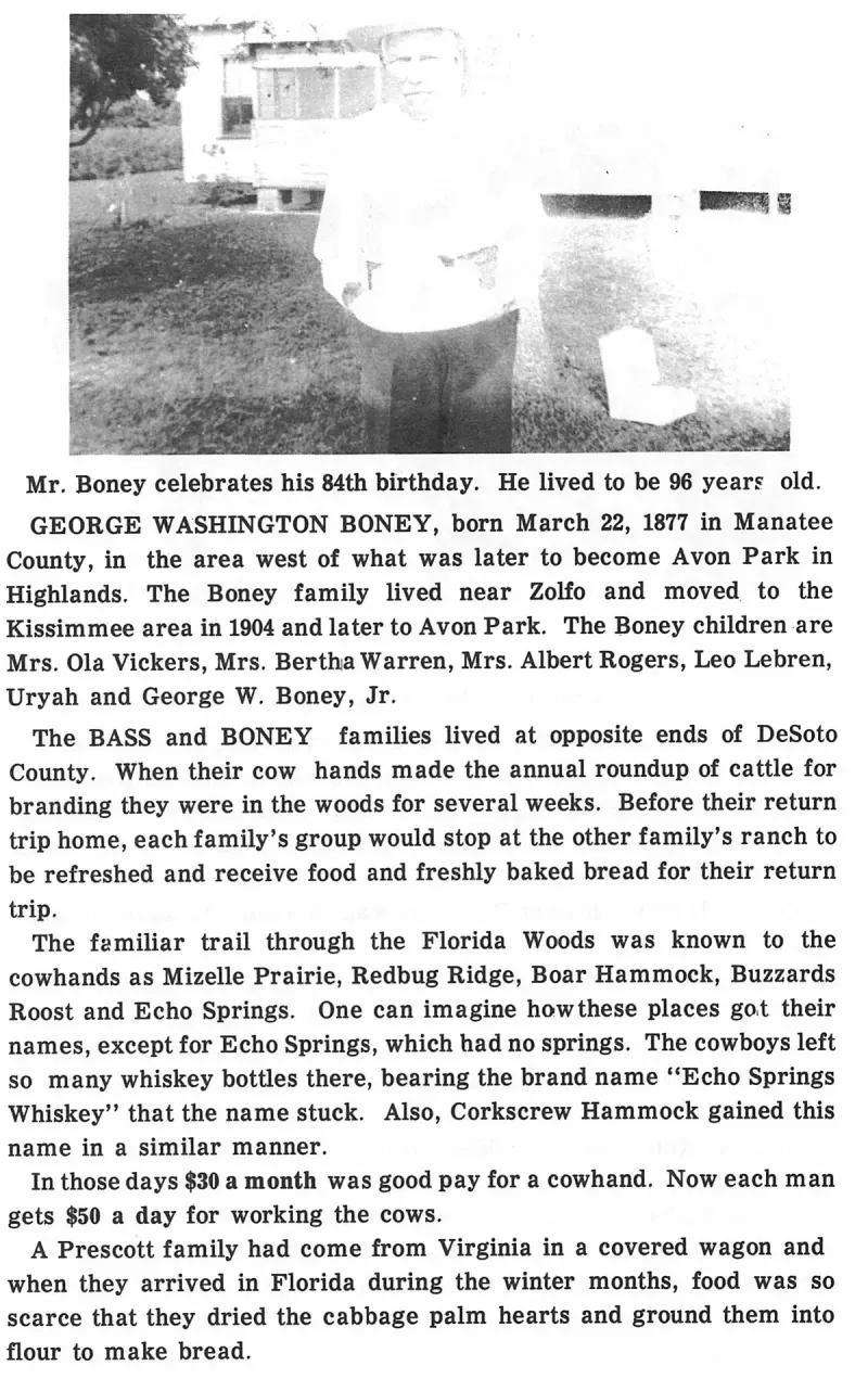
Mr. Boney celebrates his 84th birthday. He lived to be 96 years old. Plate on page 139 of The First Hundred Years of Avon Park, Florida (1976).
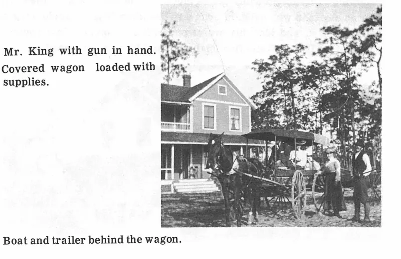
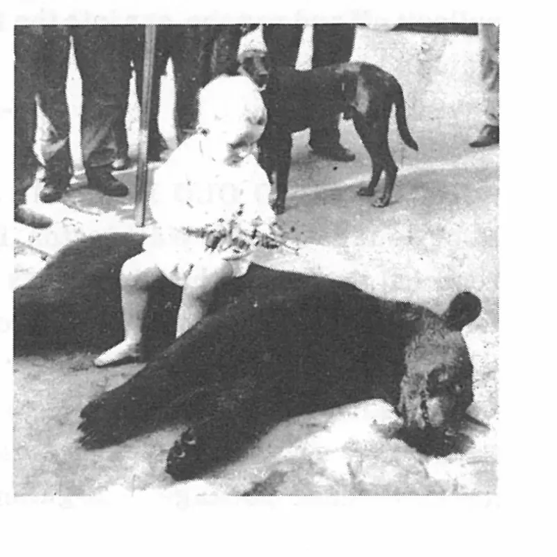
Mr. King with gun in hand. Plate on page 57 of The First Hundred Years of Avon Park, Florida (1976).
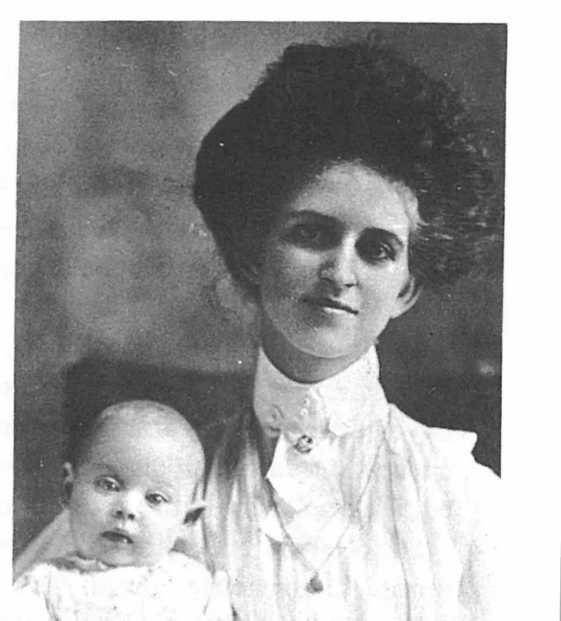
Mrs. Glen Spinks, and daughter, Christine, who grew up and married Francis Roberts. Plate on page 85 of The First Hundred Years of Avon Park, Florida (1976).
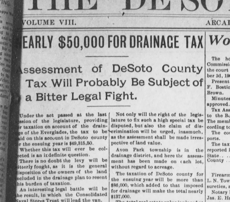
Front-page report in The De Soto County News (Arcadia) of 13 October 1905 on the Everglades drainage tax levied on DeSoto County under the act of 1905, noting that Avon Park township lay in the drainage district and that its lots had been assessed without regard to acreage.
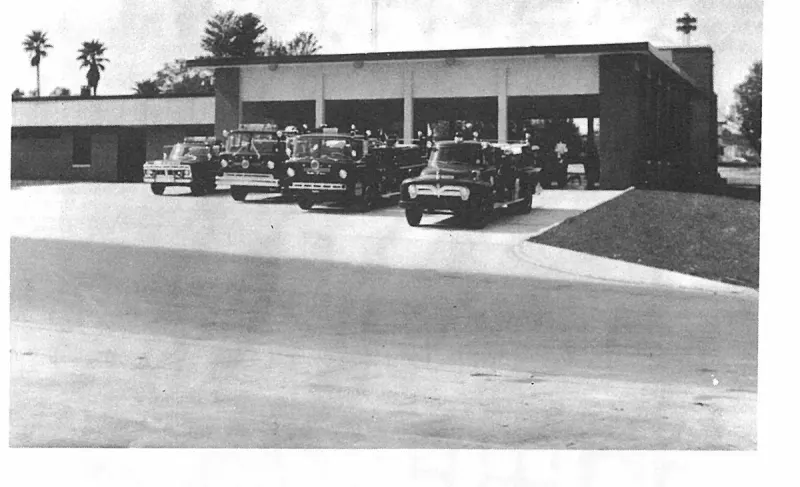
New Fire Station Built in 1979. Plate on page 204 of The First Hundred Years of Avon Park, Florida (1976).
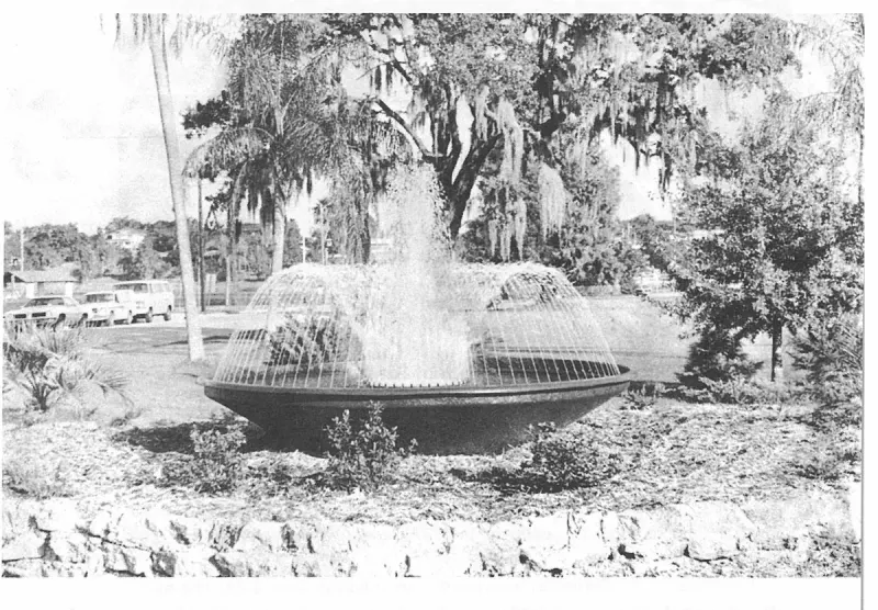
Newest addition to the Mall is this water fountain in front of Badcock Home Furnishing store. Tom Hardesty, photographer. Plate on page 223 of The First Hundred Years of Avon Park, Florida (1976).
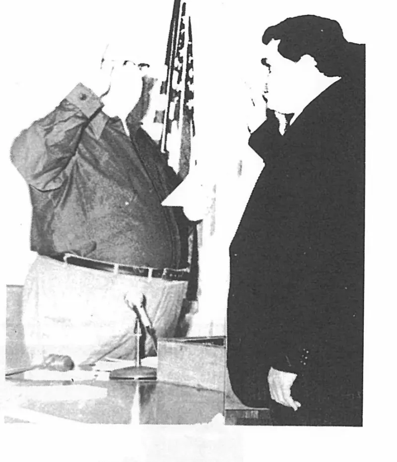
Newly elected Mayor, David Barefield, right, taking the Oath of Office from City Clerk, Malcolm Crews, January 2, 1980. Plate on page 230 of The First Hundred Years of Avon Park, Florida (1976).
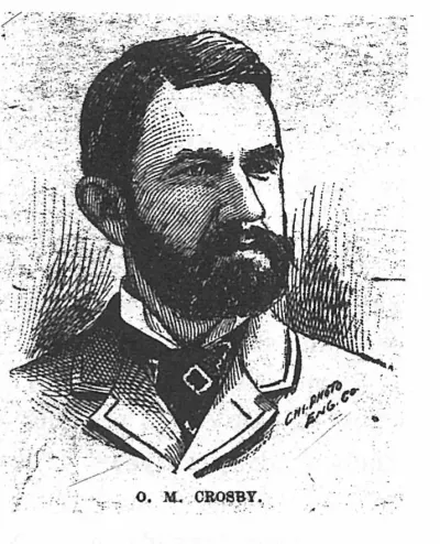
O. M. Crosby. Plate on page 18 of The First Hundred Years of Avon Park, Florida (1976).
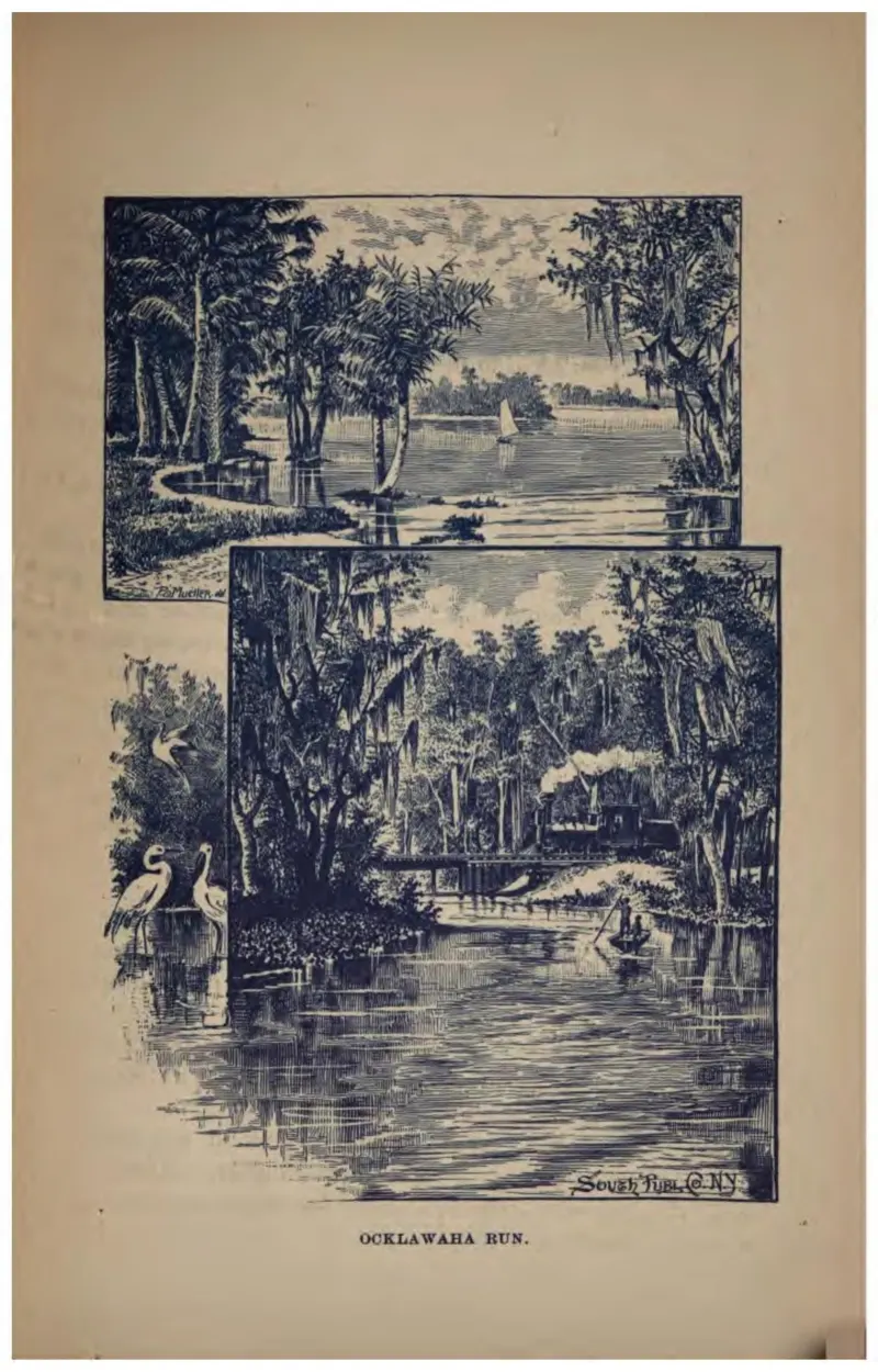
A steamboat working up the narrow, overhung Ocklawaha River, with a heron in the foreground.
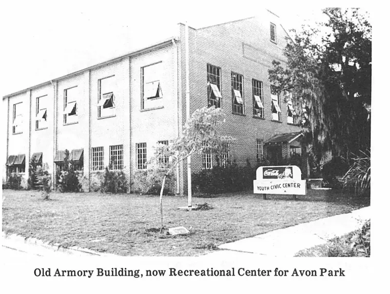
Old Armory Building, now Recreational Center for Avon Park. Plate on page 200 of The First Hundred Years of Avon Park, Florida (1976).
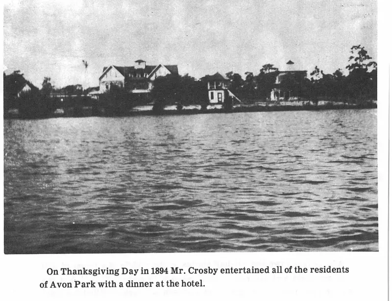
On Thanksgiving Day in 1894 Mr. Crosby entertained all of the residents of Avon Park with a dinner at the hotel. Plate on page 43 of The First Hundred Years of Avon Park, Florida (1976).
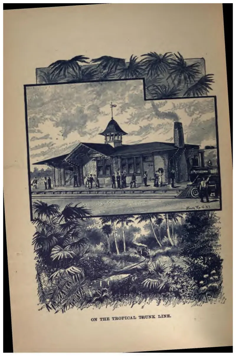
A railroad depot with a waiting train, framed by palms — the Tropical Trunk Line's advertising image.
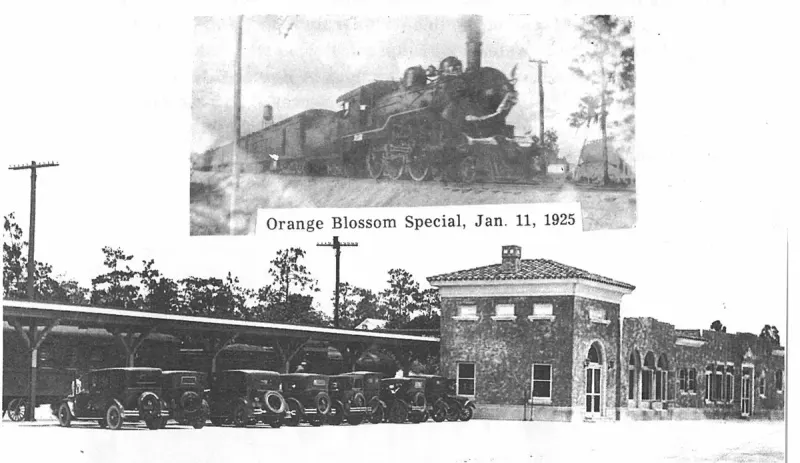
Orange Blossom Special, Jan. 11, 1925. Plate on page 127 of The First Hundred Years of Avon Park, Florida (1976).
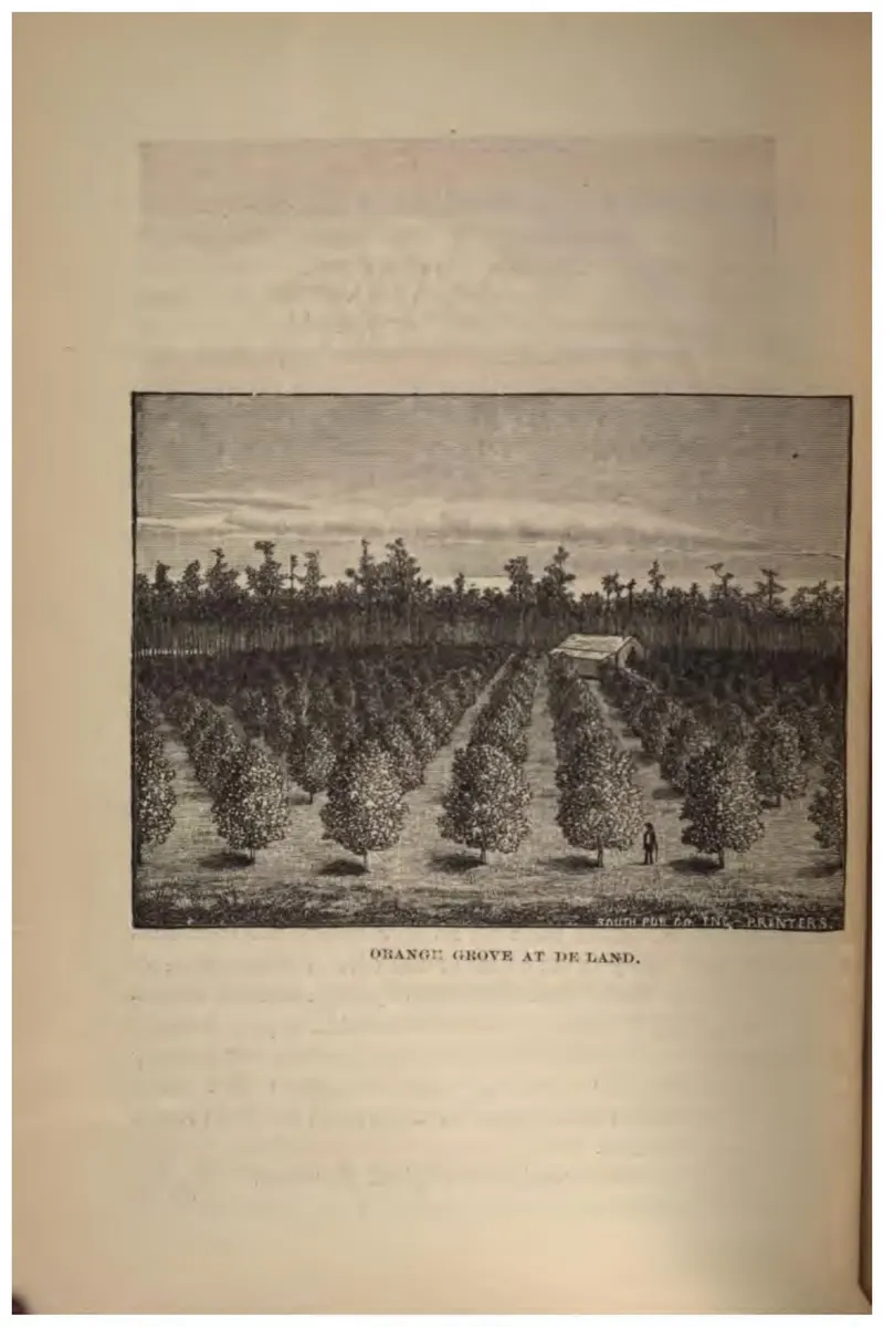
Rows of young orange trees in a cleared grove at De Land.
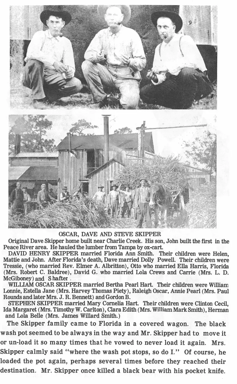
Oscar, Dave and Steve Skipper. Plate on page 137 of The First Hundred Years of Avon Park, Florida (1976).
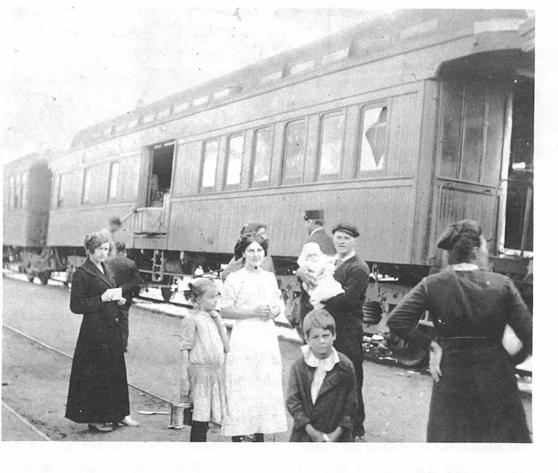
Other agents for the Coast Line were C. A. Denmark and J. N. McDugald who was the agent when the Coast Line merged with the Seaboard Railroad in 1967. The Coastline station was torn down in 1970. Plate on page 126 of The First Hundred Years of Avon Park, Florida (1976).
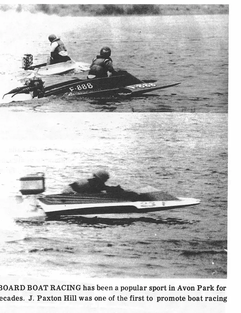
OUTBOARD BOAT RACING has been a popular sport in Avon Park for three decades. J. Paxton Hill was one of the first to promote boat racing here. Plate on page 220 of The First Hundred Years of Avon Park, Florida (1976).
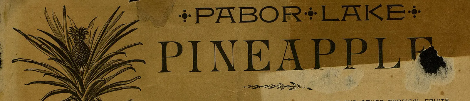
Masthead of the first issue of the Pabor Lake Pineapple, datelined Pabor Lake, Avon Park, DeSoto County, Florida.
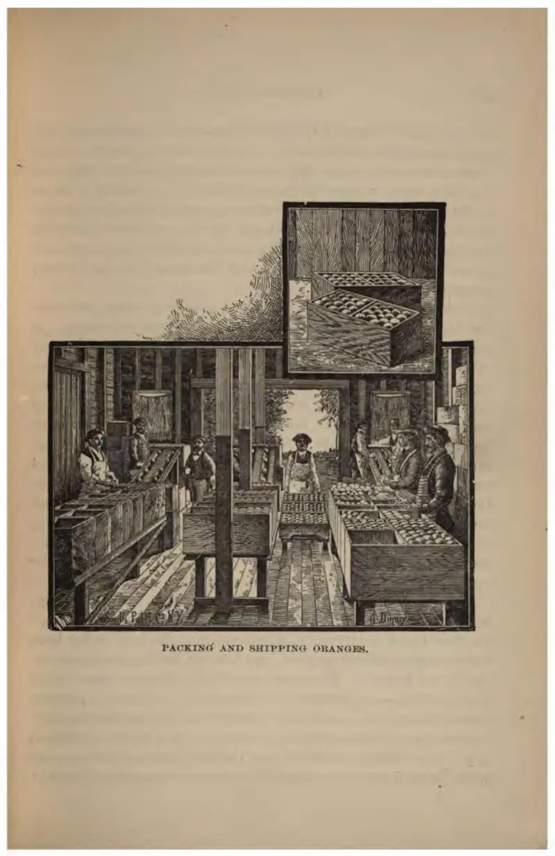
Inside a packing house: sorting tables, wrapping, and boxes being nailed shut for shipment.
Masthead stating entered at the postoffice at Pabor Lake, Fla., as second-class mail matter, July 25, 1893.
Page 4 of the April 1893 issue announcing the establishment of the Pabor Lake post office.
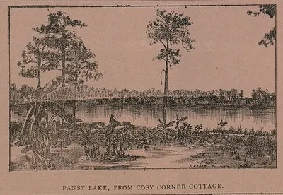
An engraving captioned PANSY LAKE, FROM COSY CORNER COTTAGE, signed by the same Ohio engraver, showing open water fringed with pines and palmetto — one of the earliest depictions of the ground at Pabor Lake. Cropped from page 173 of the Pabor Lake Pineapple of 15 November 1895.
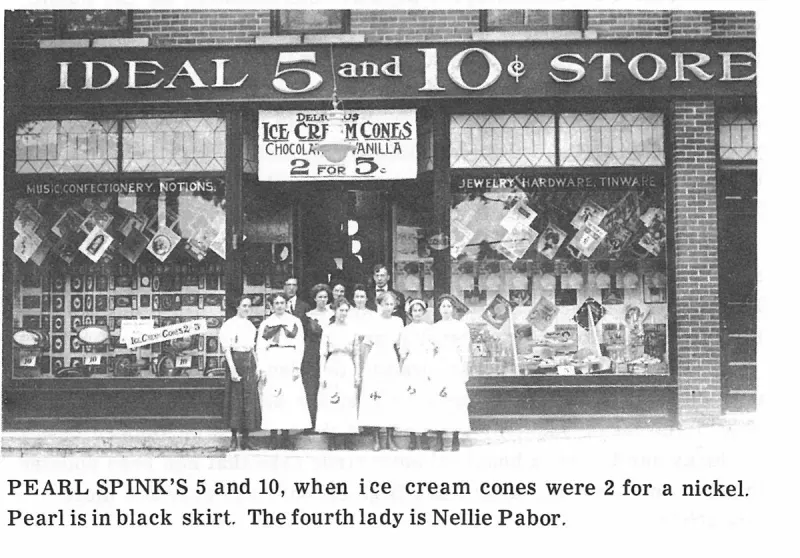
PEARL SPINK'S 5 and 10, when ice cream cones were 2 for a nickel. Pearl is in black skirt. The fourth lady is Nellie Pabor. Plate on page 187 of The First Hundred Years of Avon Park, Florida (1976).
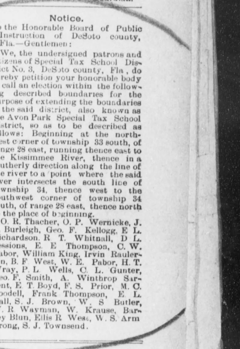
Legal notice printed in The De Soto County News (Arcadia) on 2 February 1906: the petition of thirty-one patrons and citizens of Special Tax School District No. 3, the Avon Park district, asking the DeSoto County Board of Public Instruction to call an election to extend the district's boundaries from Township 33 South, Range 28 East east to the Kissimmee River and south through Township 34.
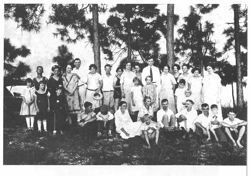
Picnic, Celebrating the First 25 Years in Avon Park. Plate on page 141 of The First Hundred Years of Avon Park, Florida (1976).
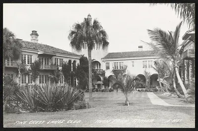
Pine crest Lakes Club, Avon Park, Florida
Pine Crest Lakes Country Club in Avon Park, Florida, between 1900 and 1940.
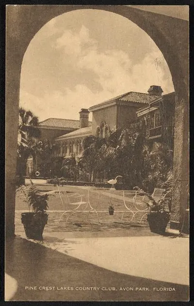
Pine Crest Lakes Country Club, Avon Park, Florida
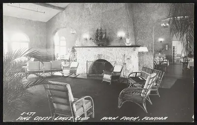
Pine Crest Lakes Country Club, Avon Park, Florida
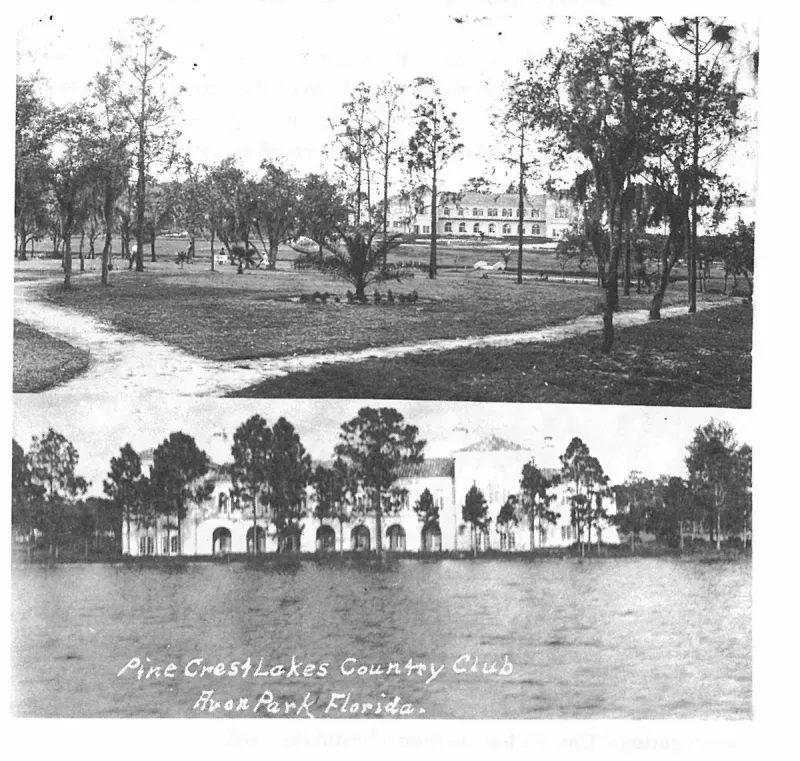
PINECREST LAKES HOTEL, was built in 1925 as a private club with membership made up of a group of northern people who came only for winter months. They maintained an 18-hole golf course. Plate on page 168 of The First Hundred Years of Avon Park, Florida (1976).
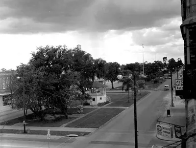
Shows the planted medians/parks integrated into the street layout of early Avon Park (the 'Main Street Mall' greenspace).
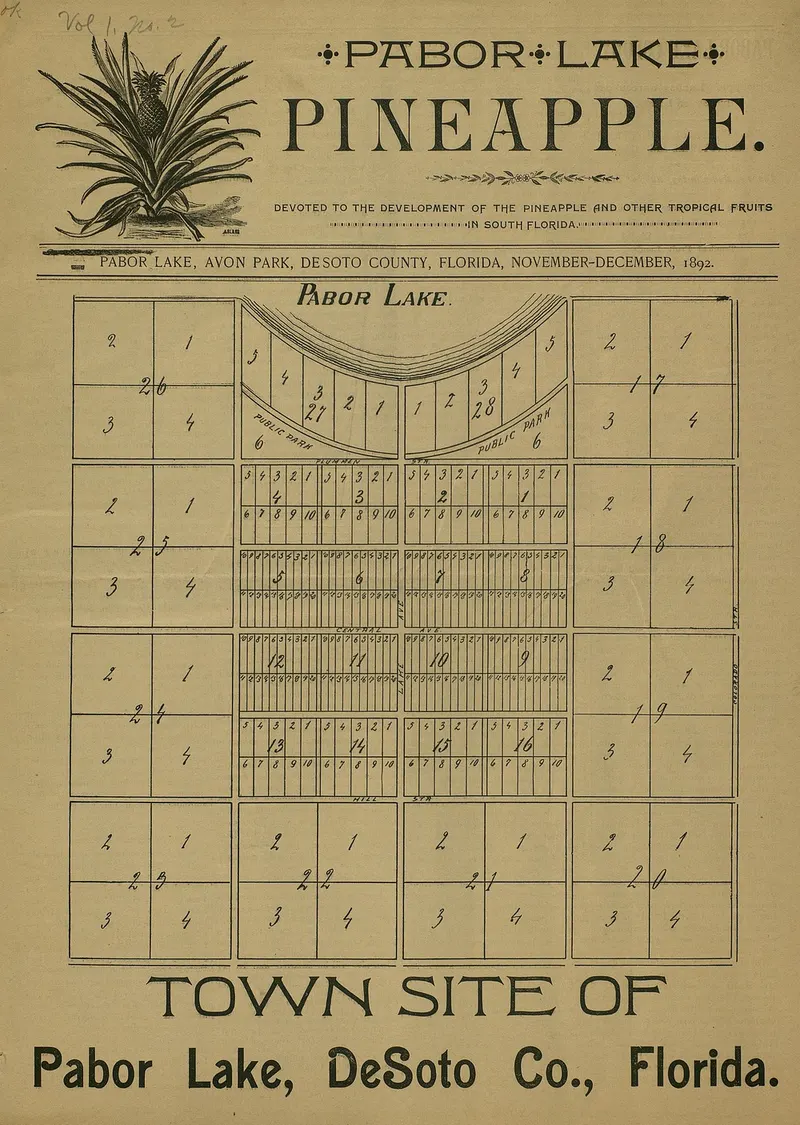
Plat map of the Pabor Lake town site published on the front page of the November-December 1892 issue of The Pabor Lake Pineapple.
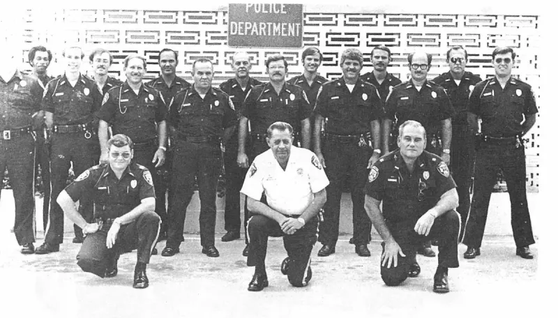
POLICE FORCE OF AVON PARK 1979-80. Captain, Robert Singletary, Chief, Robert Brooks and Captain, Frank Cratty. Plate on page 200 of The First Hundred Years of Avon Park, Florida (1976).
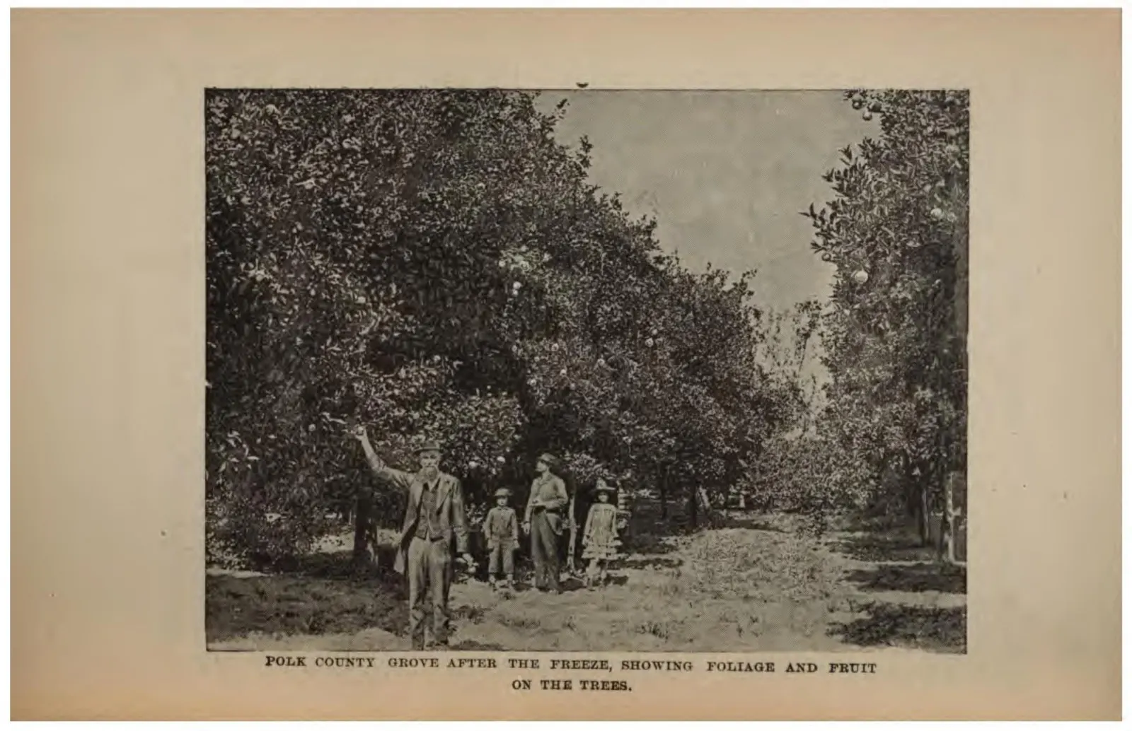
A Polk County orange grove said to be carrying foliage and fruit after a freeze, with pickers beneath the trees.
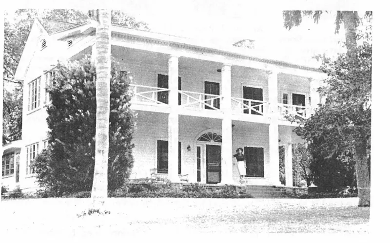
Present owners of Hollyhurst are Mr. and Mrs. Ross Backus. Plate on page 136 of The First Hundred Years of Avon Park, Florida (1976).
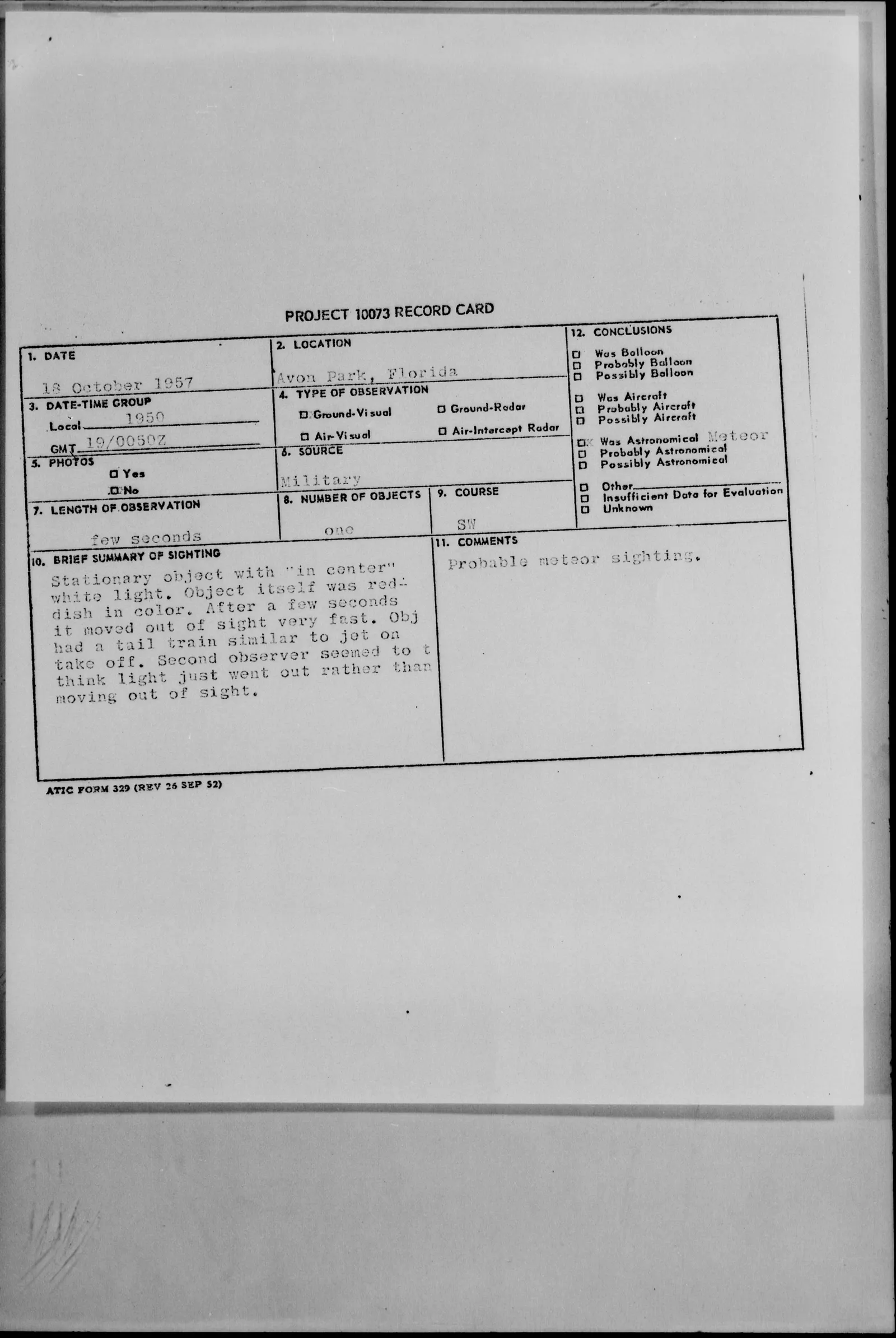
Air Technical Intelligence Center record card for the reddish light with a white center seen by two aircraft controllers at the Avon Park Bombing Range on the night of 18 October 1957, concluded to be a meteor.
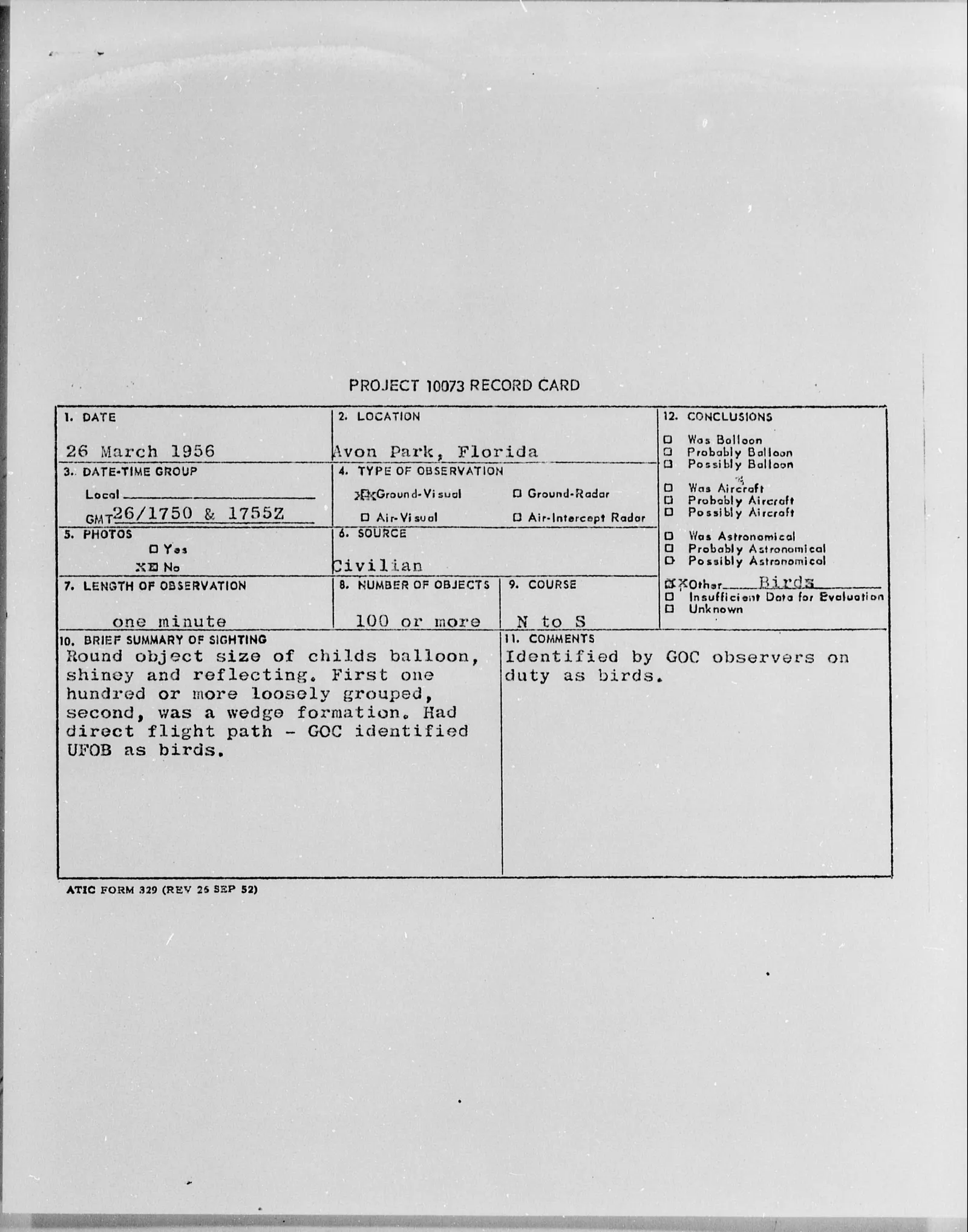
Air Technical Intelligence Center record card for the sighting of a hundred or more shiny round objects over Avon Park on 26 March 1956, concluded to be birds.
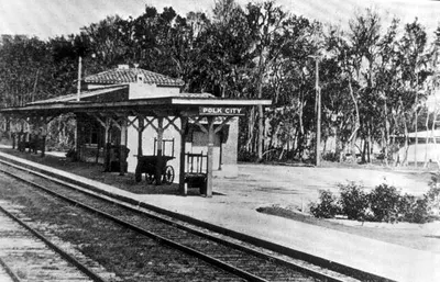
Florida Western and Northern railroad reached Polk City on January 24, 1925 on its maiden run to Palm Beach. The boomtime Spanish style depot had red tile roof and stucco walls.
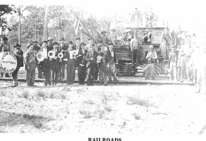
Railroads. Plate on page 124 of The First Hundred Years of Avon Park, Florida (1976).
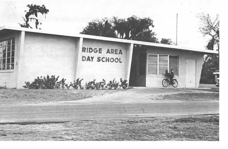
Ridge Area Day School. Plate on page 226 of The First Hundred Years of Avon Park, Florida (1976).
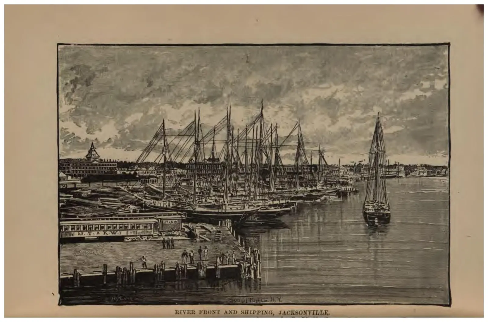
Masted shipping crowded along the St. Johns River wharves at Jacksonville.
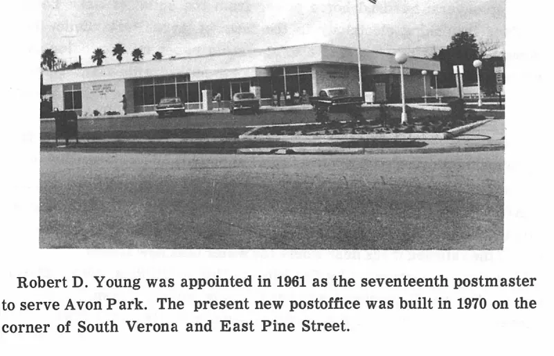
Robert D. Young was appointed in 1961 as the seventeenth postmaster to serve Avon Park. The present new postoffice was built in 1970 on the corner of South Verona and East Pine Street. Plate on page 86 of The First Hundred Years of Avon Park, Florida (1976).
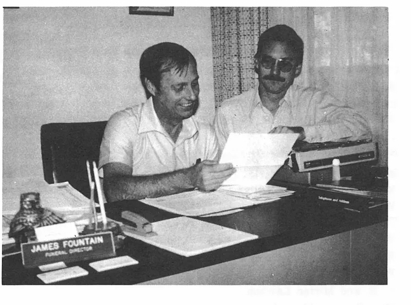
Robert W. Burkhart, President of The Historical Society of the Old Settlers Association, Inc. and James Fountain, Treasurer of the organization, checking the list of Sponsors for the publication of The First Hundred Years of Avon Park. Plate on page 244 of The First Hundred Years of Avon Park, Florida (1976).
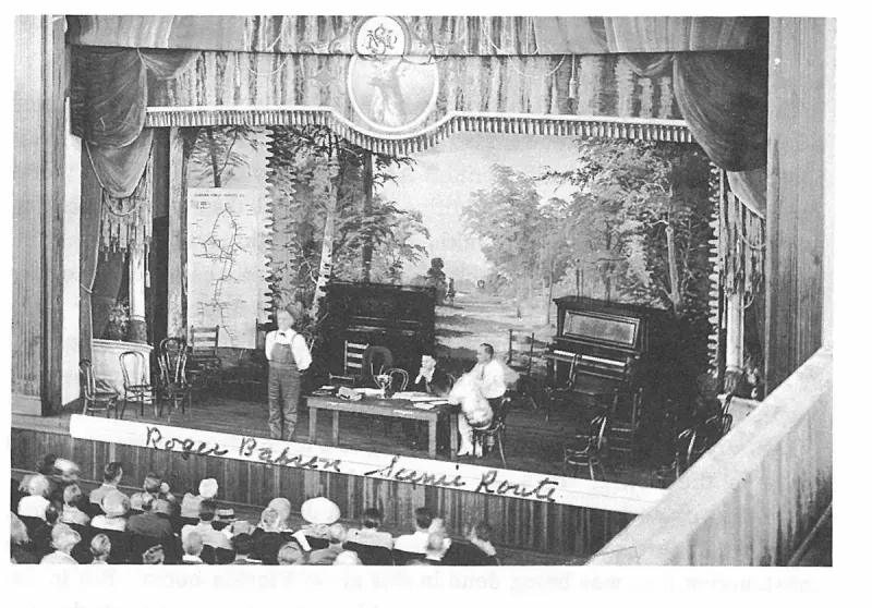
Roger Babson Scenic Route. Plate on page 160 of The First Hundred Years of Avon Park, Florida (1976).
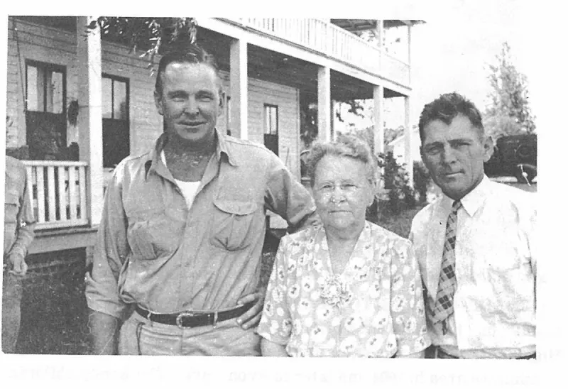
Roscoe, Mother Bass and Mel. Plate on page 138 of The First Hundred Years of Avon Park, Florida (1976).
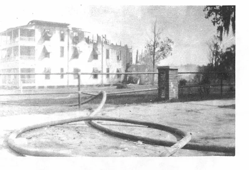
Ruth said her uncle always worried about fire in the hotel and one of her responsibilities was to see that all of the lamps and lanterns were accounted for and cleaned each morning, and oil refilled for the next night. Plate on page 48 of The First Hundred Years of Avon Park, Florida (1976).
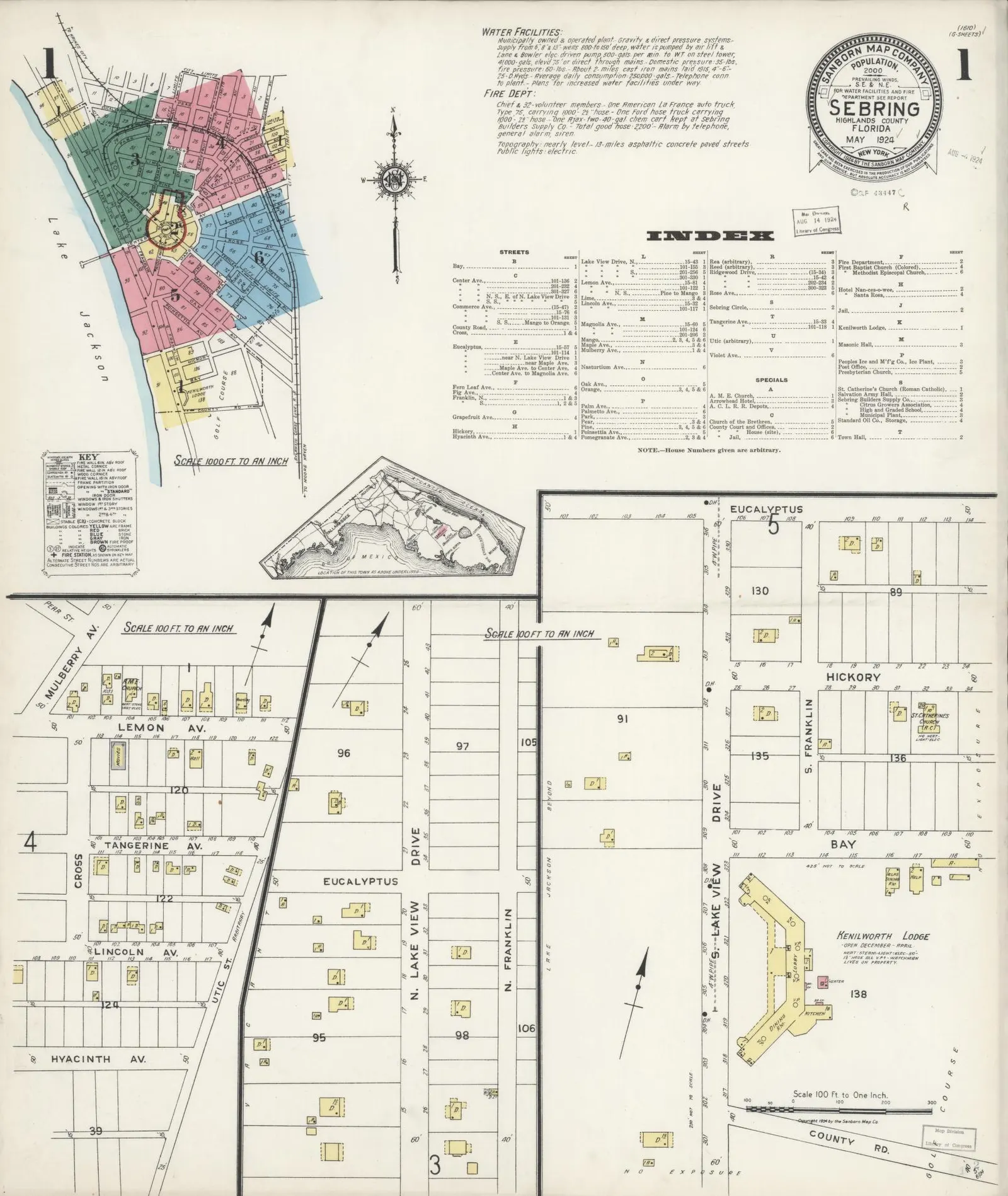
Early plat map of Sebring, useful for historical context of town layouts and property delineations in Highlands County.
Sanborn Fire Insurance map of 1921 for Avon Park, depicting the lumber operations.
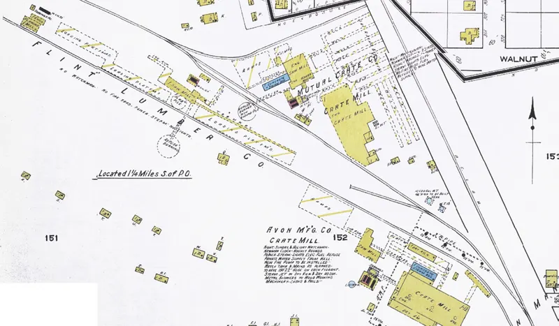
Detail from the November 1920 Sanborn Fire Insurance Map of Avon Park, showing the Mutual Crate Company and Avon Manufacturing Company mills and company houses.
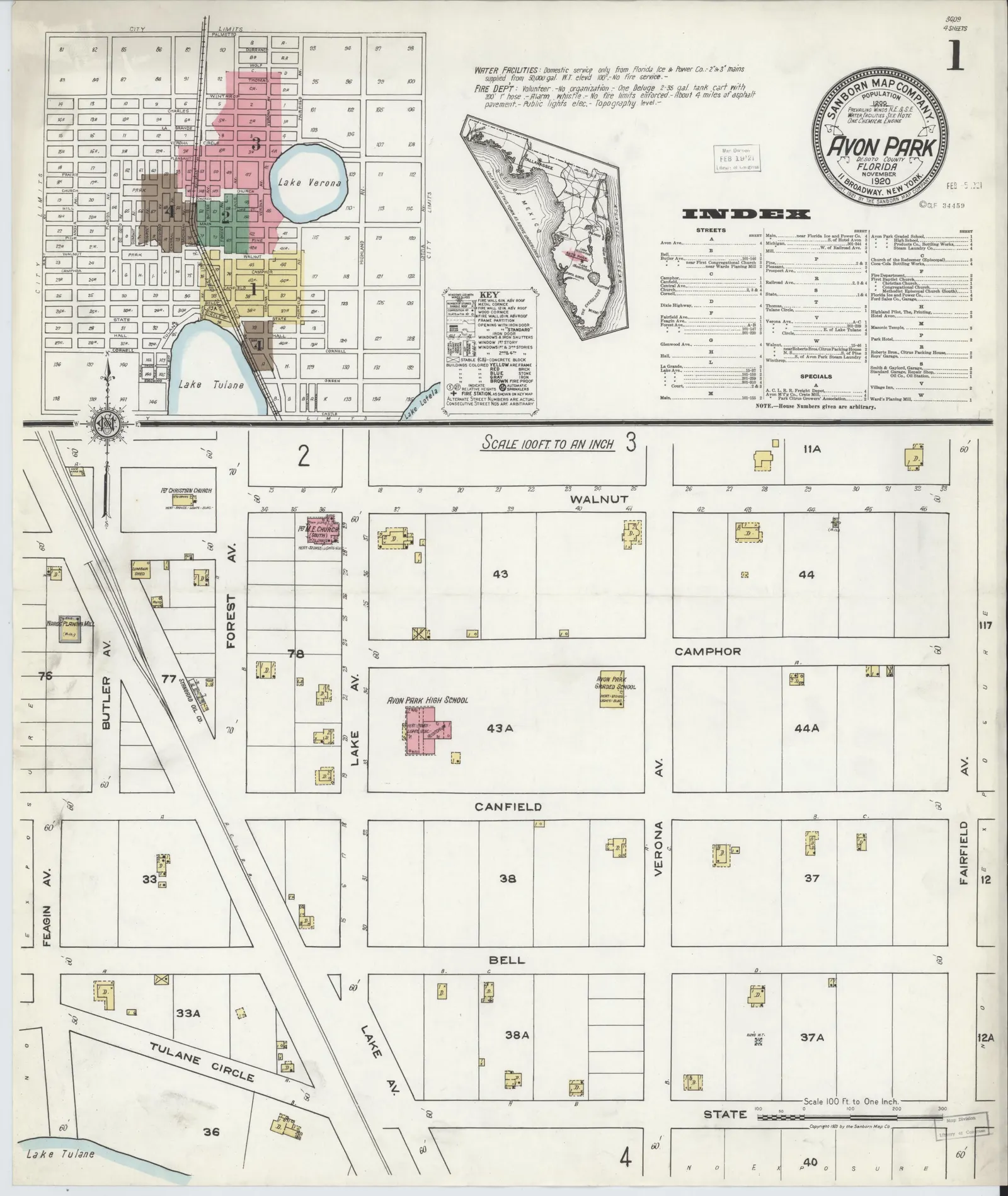
Index sheet: key map of the whole town, block numbers, street index, and the south-central residential blocks with the graded school and the Forest Avenue churches.
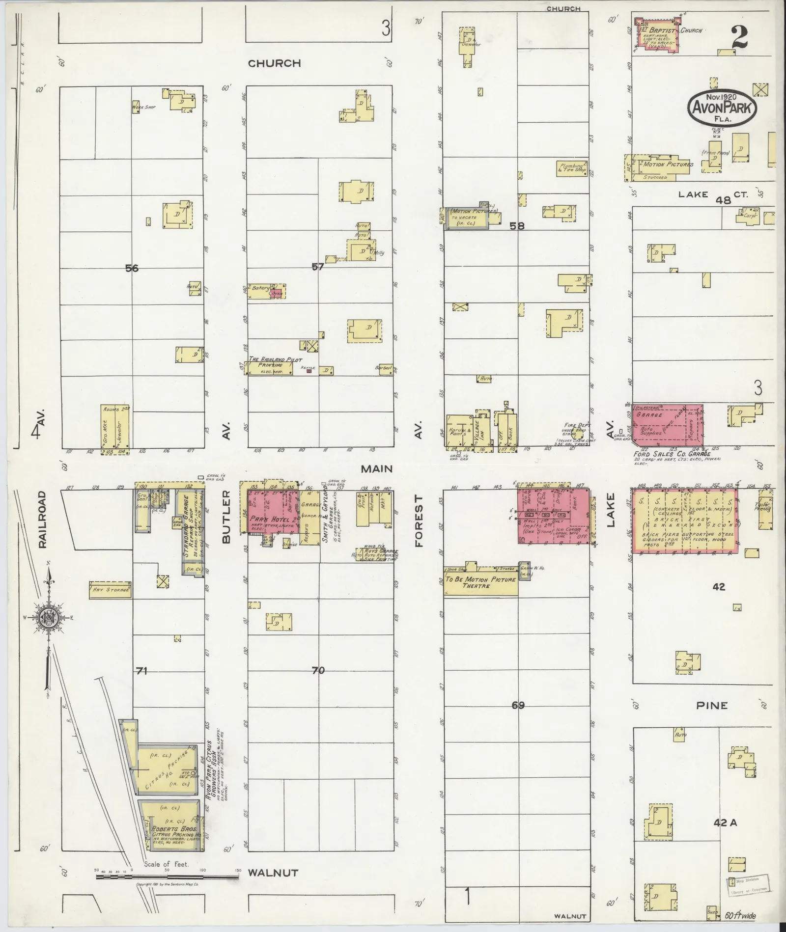
Main Street commercial core at the Atlantic Coast Line crossing, with the Park Hotel, two garages, the citrus packing houses, and the Highlands Pilot printing office.
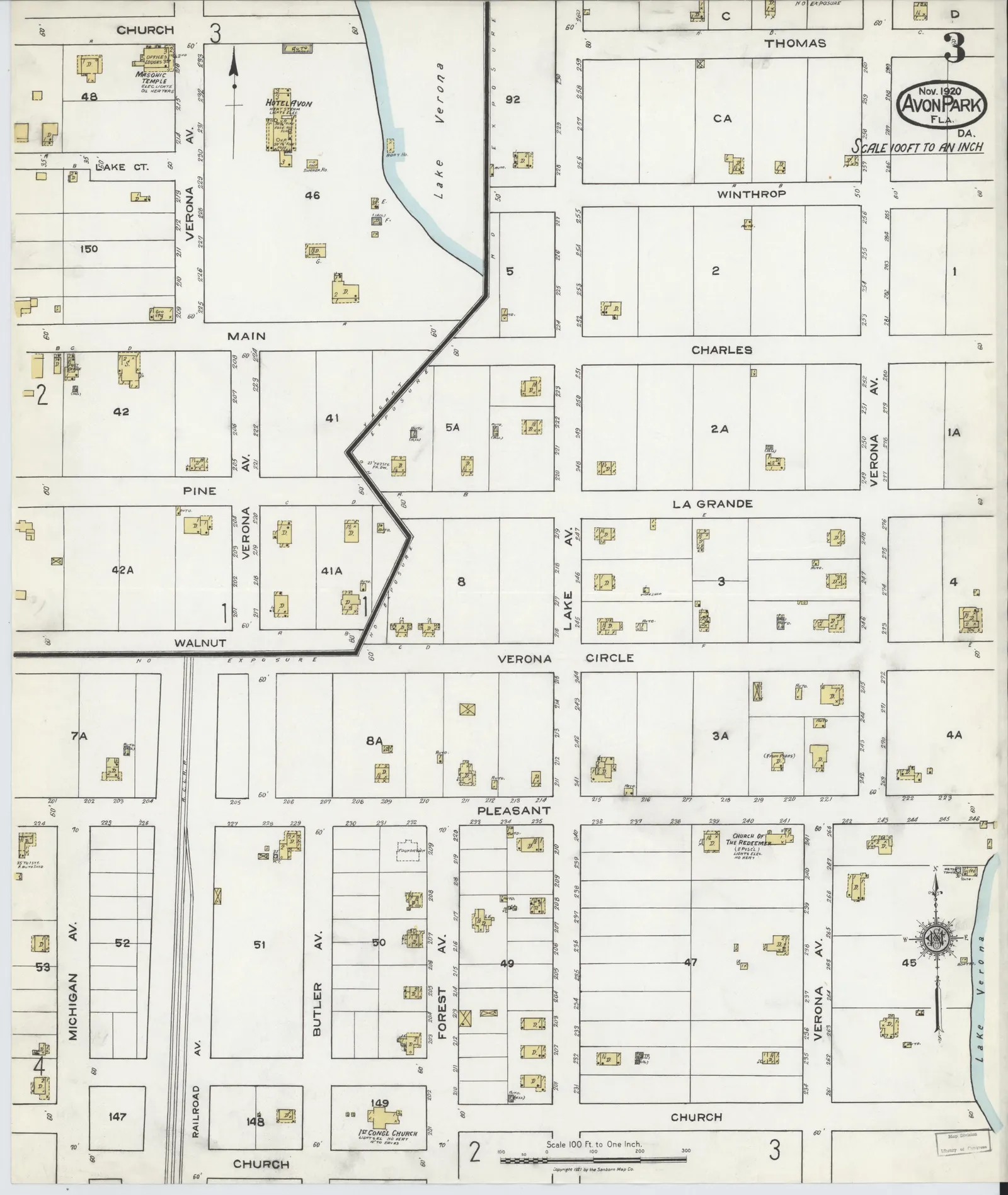
Blocks around Lake Verona: the Hotel Avon, the Masonic Temple, three churches, and the Verona, La Grande, Charles, Winthrop and Thomas residential streets.
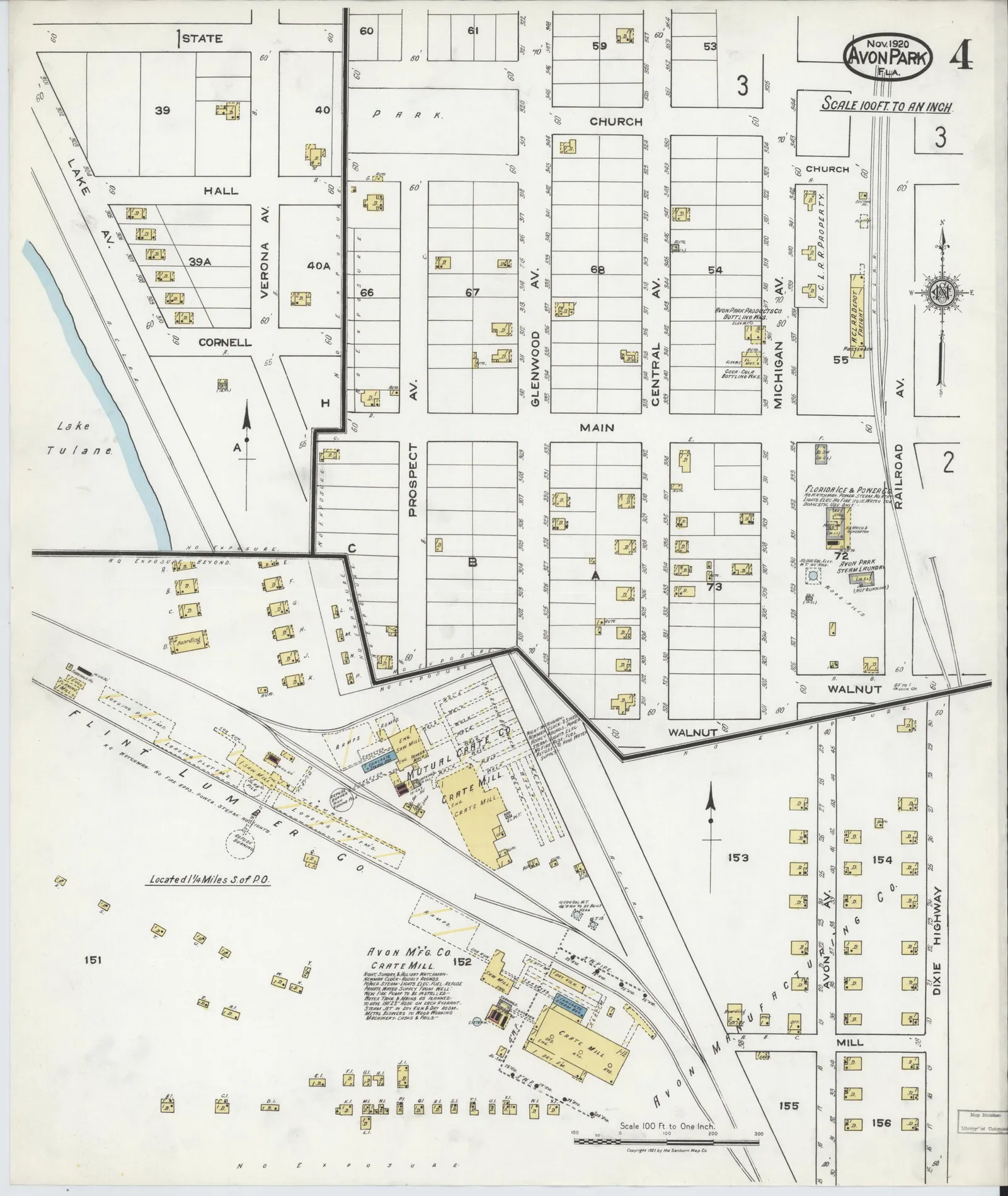
Southwestern residential blocks and the industrial district: the ice plant, the steam laundry, the Atlantic Coast Line depot, and the Flint Lumber Company saw mill.
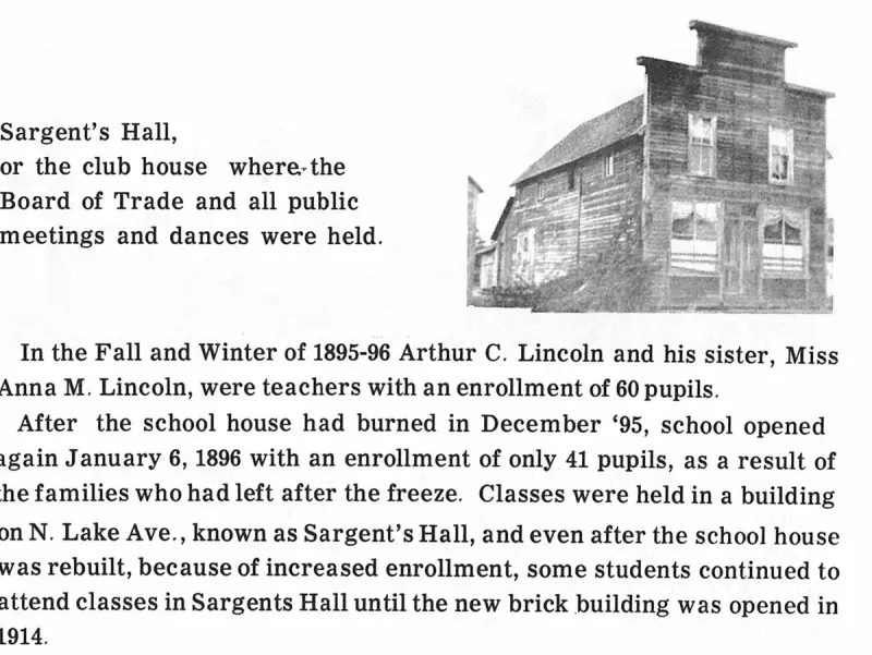
Sargent's Hall,. Plate on page 115 of The First Hundred Years of Avon Park, Florida (1976).
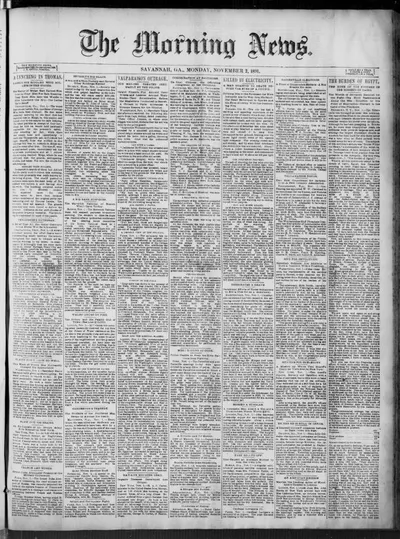
The 2 Nov 1891 Savannah Morning News notice of incorporation for the Florida Development Company containing the misprinted ,50,000 capital stock figure.
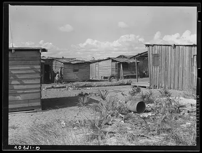
Negro sawmill workers' homes: no light, no privies, one outdoor water pump for whole camp. Childs, Florida
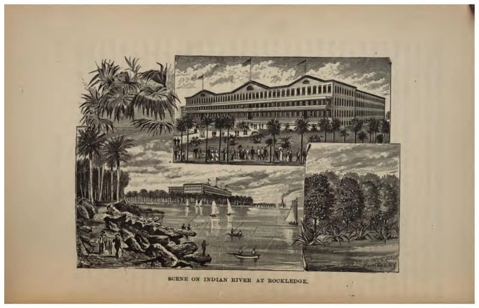
A large frame hotel at Rockledge with the Indian River and its shipping alongside.
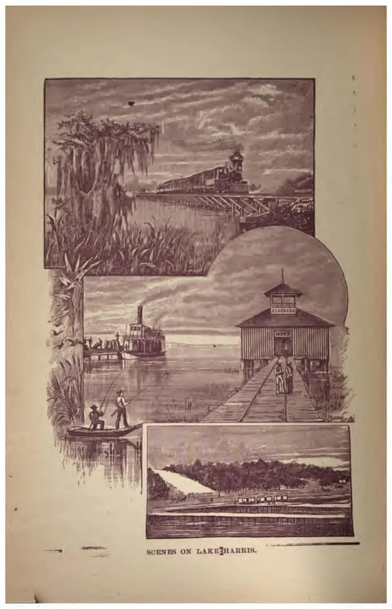
Four vignettes of Lake Harris: a steamer, a landing, a pavilion on a pier, and a distant shore.
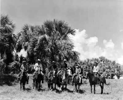
Seminole Indian cowboys cattle ranching at the Brighton Reservation in Glades County, Florida, August 1950.
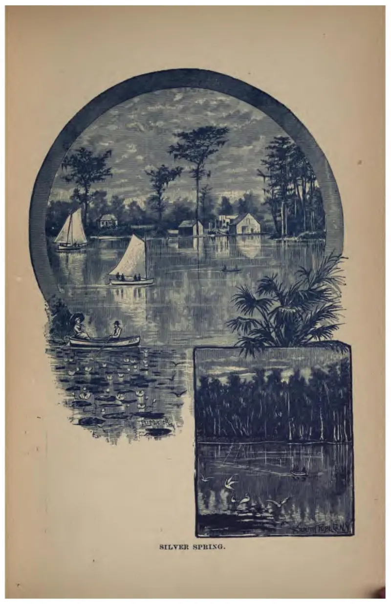
Boats on the spring run at Silver Spring, with a night scene of torch fishing inset.
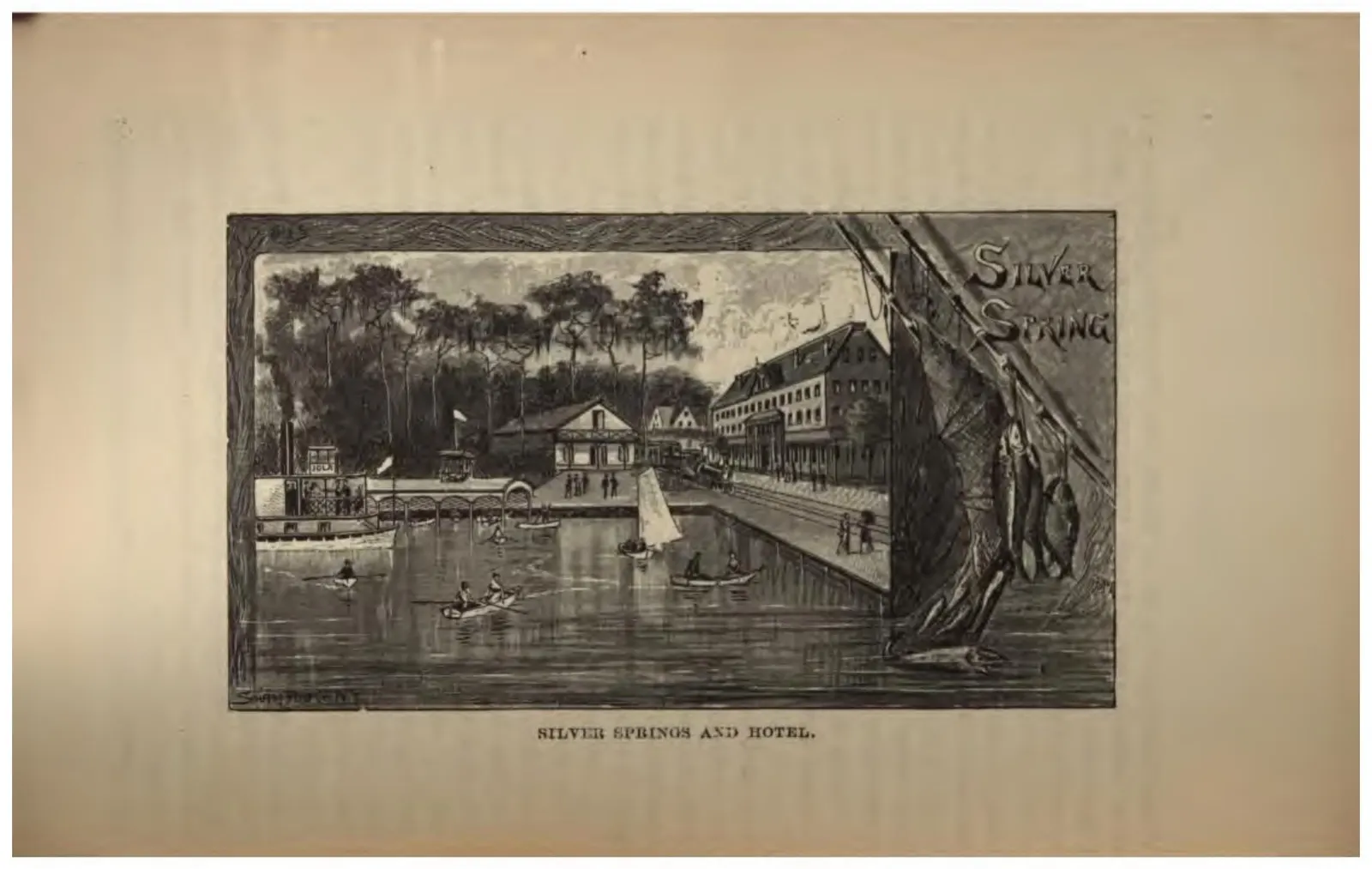
The hotel and landing at Silver Springs, with rowing boats on the spring run.
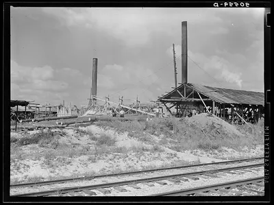
Small sawmill, Childs, Florida, owned by Mr. Warren in Fort Meade, Florida. Negro workers build their own shacks out of old lumber from around there, work ten hours a day for two dollars, six days a week. The children don't go to school.
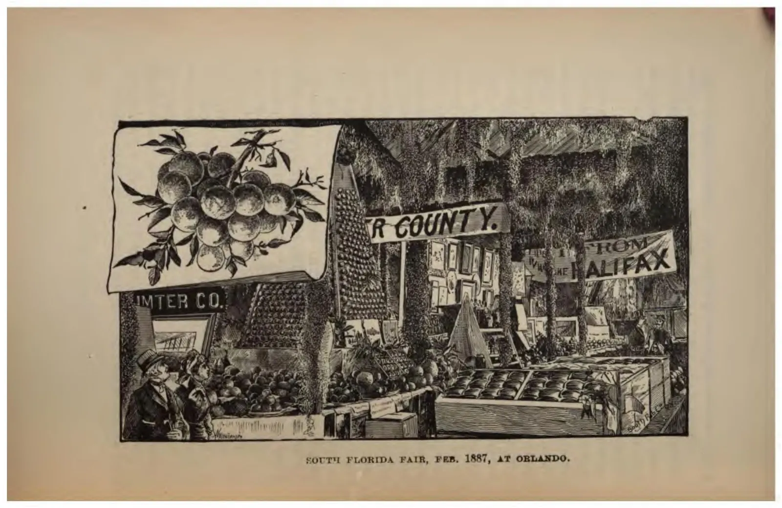
County exhibits at the South Florida Fair at Orlando, with Sumter County and Halifax displays and a wall of oranges.
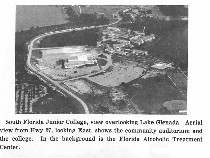
South Florida Junior College, view overlooking Lake Glenada. Aerial view from Hwy 27, looking East, shows the community auditorium and the college. In the background is the Florida Alcoholic Treatment Center. Plate on page 221 of The First Hundred Years of Avon Park, Florida (1976).
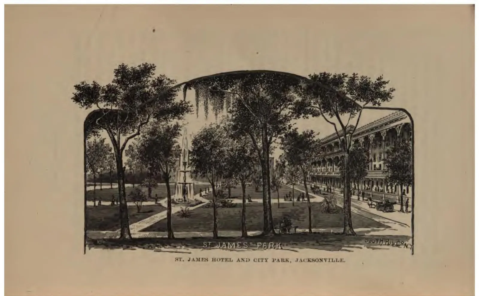
The St. James Hotel behind its city park, the grandest of Jacksonville's tourist hotels.
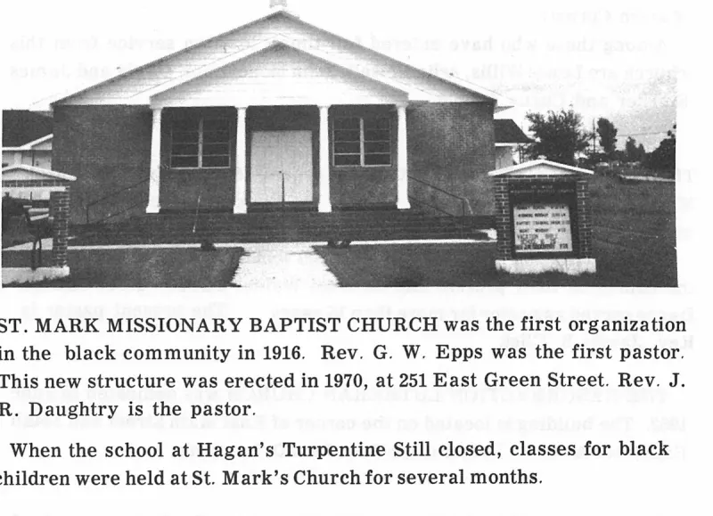
ST. MARK MISSIONARY BAPTIST CHURCH was the first organization in the black community in 1916. Rev. G. W. Epps was the first pastor. This new structure was erected in 1970, at 251 East Green Street. Rev. J. R. Daughtry is the pastor. Plate on page 109 of The First Hundred Years of Avon Park, Florida (1976).
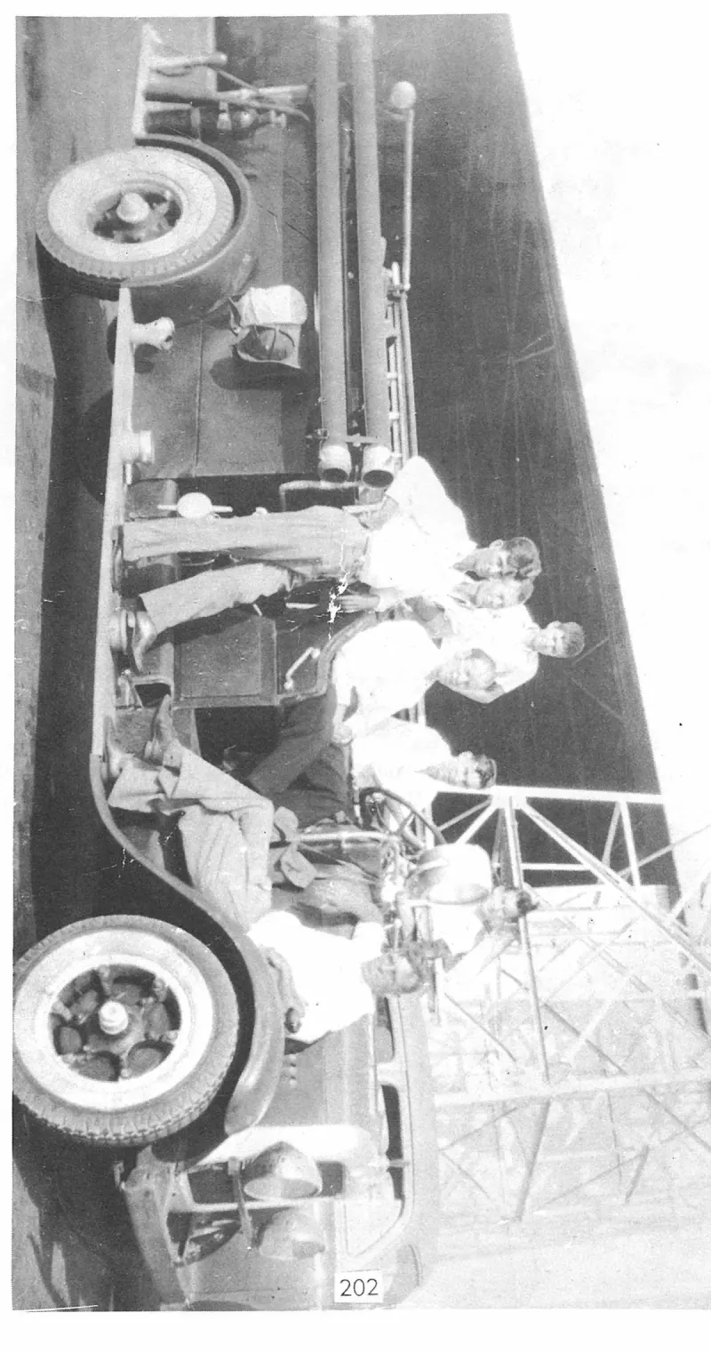
Standing back is Tommy Giddens, C. W. Watson, Pete Prevatt, Skit Martin, Mack Flowers, Charles Howze and George Prevatt. Plate on page 203 of The First Hundred Years of Avon Park, Florida (1976).
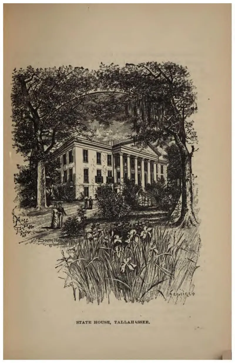
The Florida capitol at Tallahassee behind its trees.
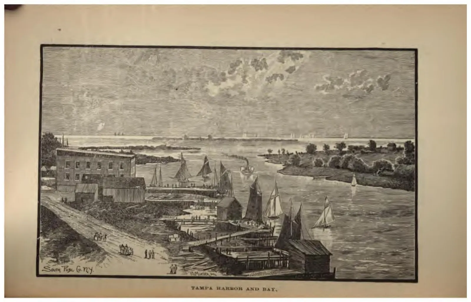
Tampa's waterfront with warehouses, small sailing craft, and the bay beyond.
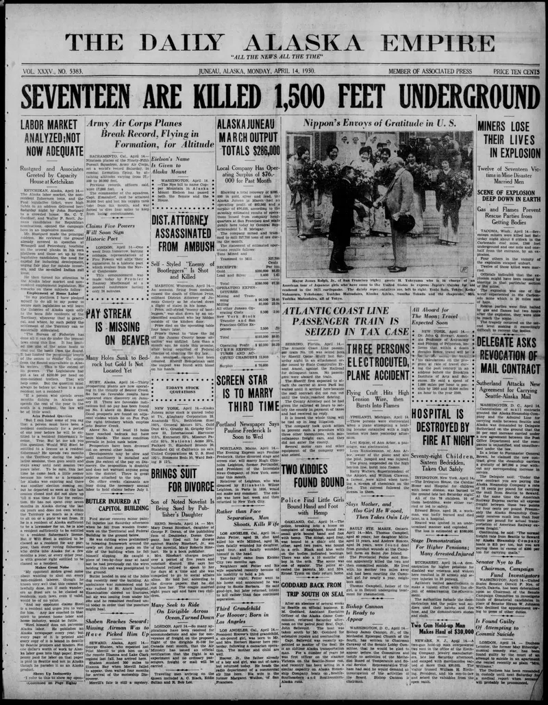
Newspaper front page detailing the seizure of the ACL train by the sheriff at Sebring, who had intended to intercept it in Avon Park.
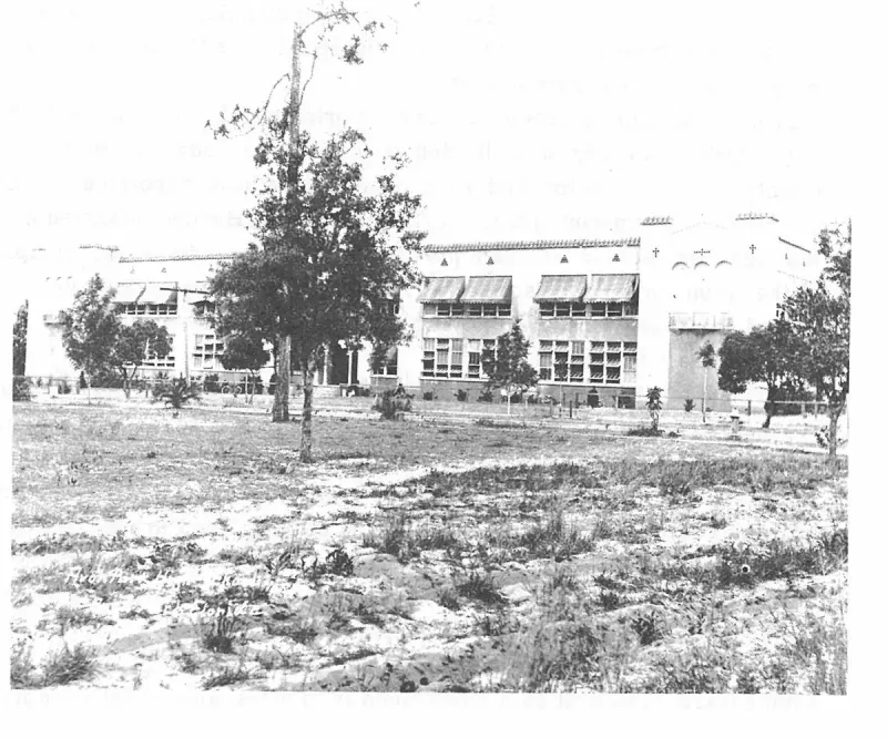
The 1925 Mediterranean-style High School building facing South Verona Avenue. Plate on page 117 of The First Hundred Years of Avon Park, Florida (1976).
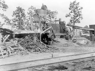
A belt-driven asphalt mixing plant beside a railroad siding, with a heap of scrap lumber and piles of aggregate, set up by the W. P. Kennedy Construction Company to pave Avon Park's streets in 1917.
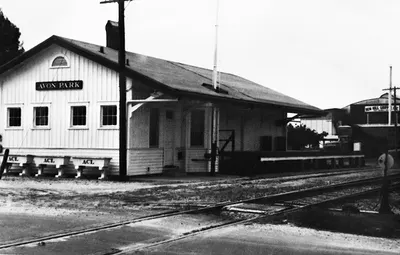
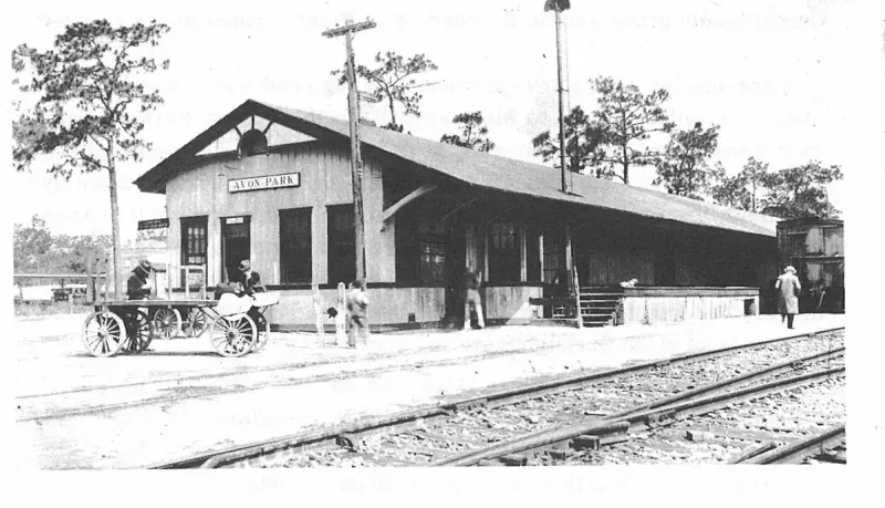
A frame railroad depot with AVON PARK on its nameboard, three baggage carts lettered ACL on the platform, and the running rails in the foreground; the State Archives dates it circa 1900, which cannot be right, because the Atlantic Coast Line did not reach Avon Park until 1912.
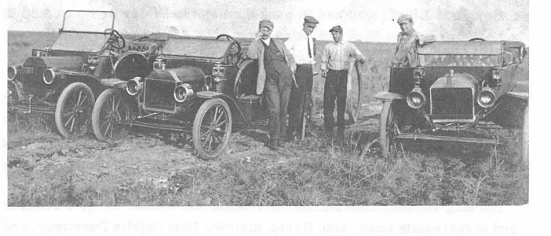
The automobiles Mr. Weitstein used to transport his customers. Notice the old tire pump beside the second man, and the innertube held by the third man. Flat tires were a common occurance on every trip and fixing the tire was done on the spot. Plate on page 98 of The First Hundred Years of Avon Park, Florida (1976).
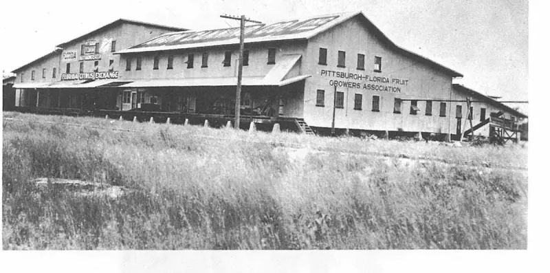
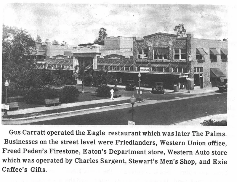
The Avon Park Citrus Growers Association became a part of the Florida Citrus Exchange and built a large house North of Main Street and continued to market fruit as the APCGA until it closed in 1955. Plate on page 145 of The First Hundred Years of Avon Park, Florida (1976).
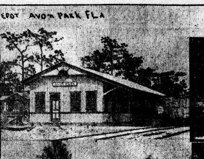
The railway depot at Avon Park, photographed by a visiting winter resident and published in a Connecticut newspaper in May 1913, about a year after the Atlantic Coast Line branch reached the town.
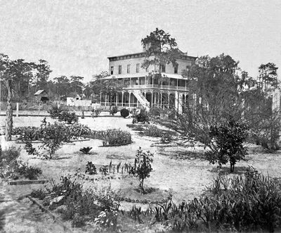
A large three-story frame hotel with double wrap-around verandas, an external stair and a rooftop belvedere, standing behind a young ornamental garden of flower beds and sandy walks, with pine woods behind — the earliest photograph of an Avon Park building this project holds.
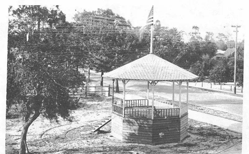
The bandstand after it was moved in 1912. Plate on page 190 of The First Hundred Years of Avon Park, Florida (1976).
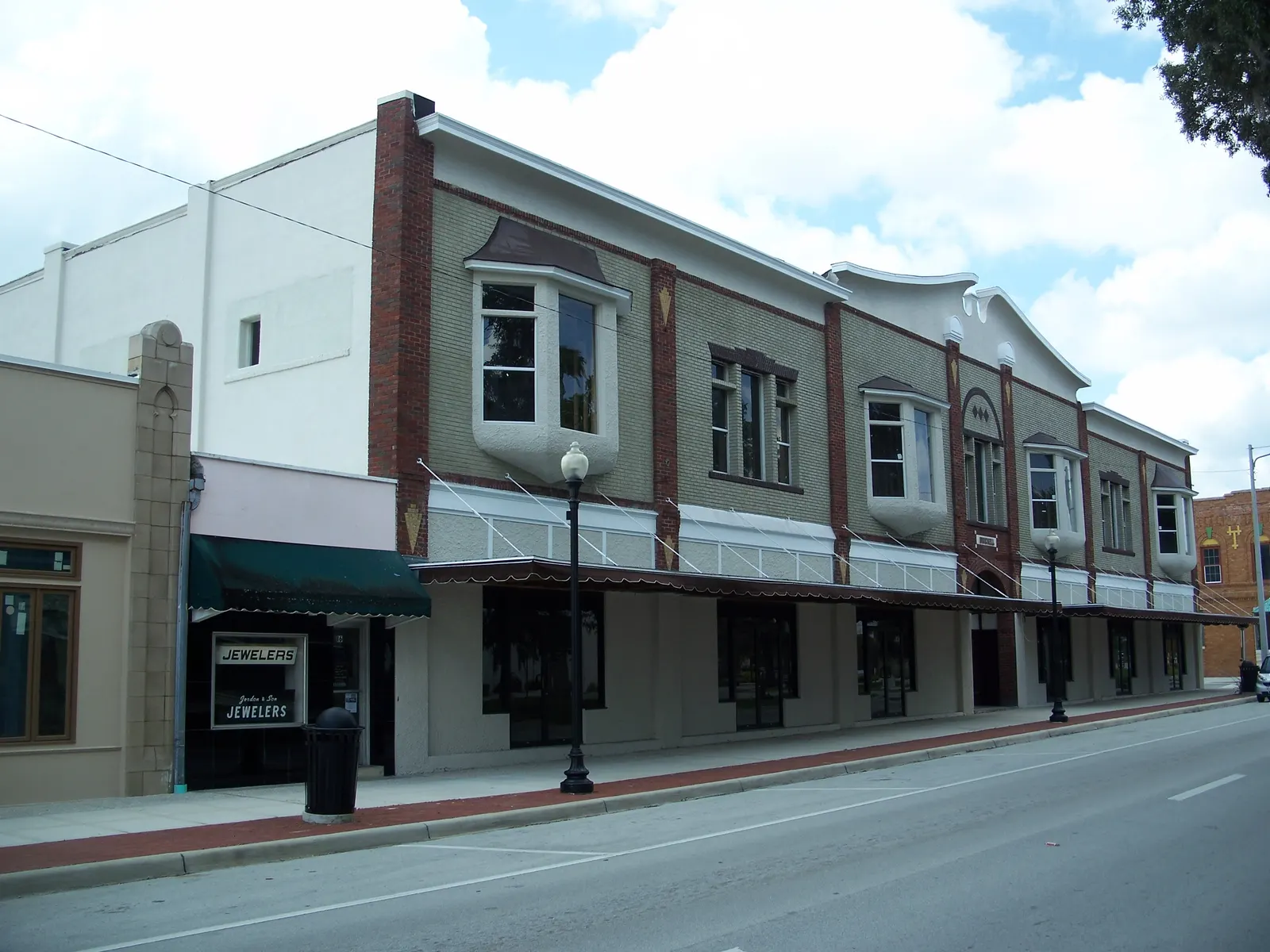
The seven-bay Brickell Building of 1919 at 2-12 East Main Street, with its polychrome brick, oriel windows and broken swan's-neck pediment, photographed from the Mall in September 2010.
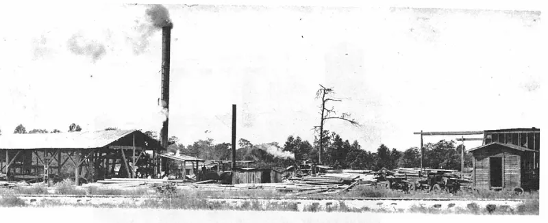
The C. R. Ginn Lumber Company was located south of LaGrande Street between the Atlantic Coast Line Railroad and the Seabord Air Line Railroad right-of-way. Ginn furnished much of the lumber for the first buildings on Main Street. Plate on page 74 of The First Hundred Years of Avon Park, Florida (1976).
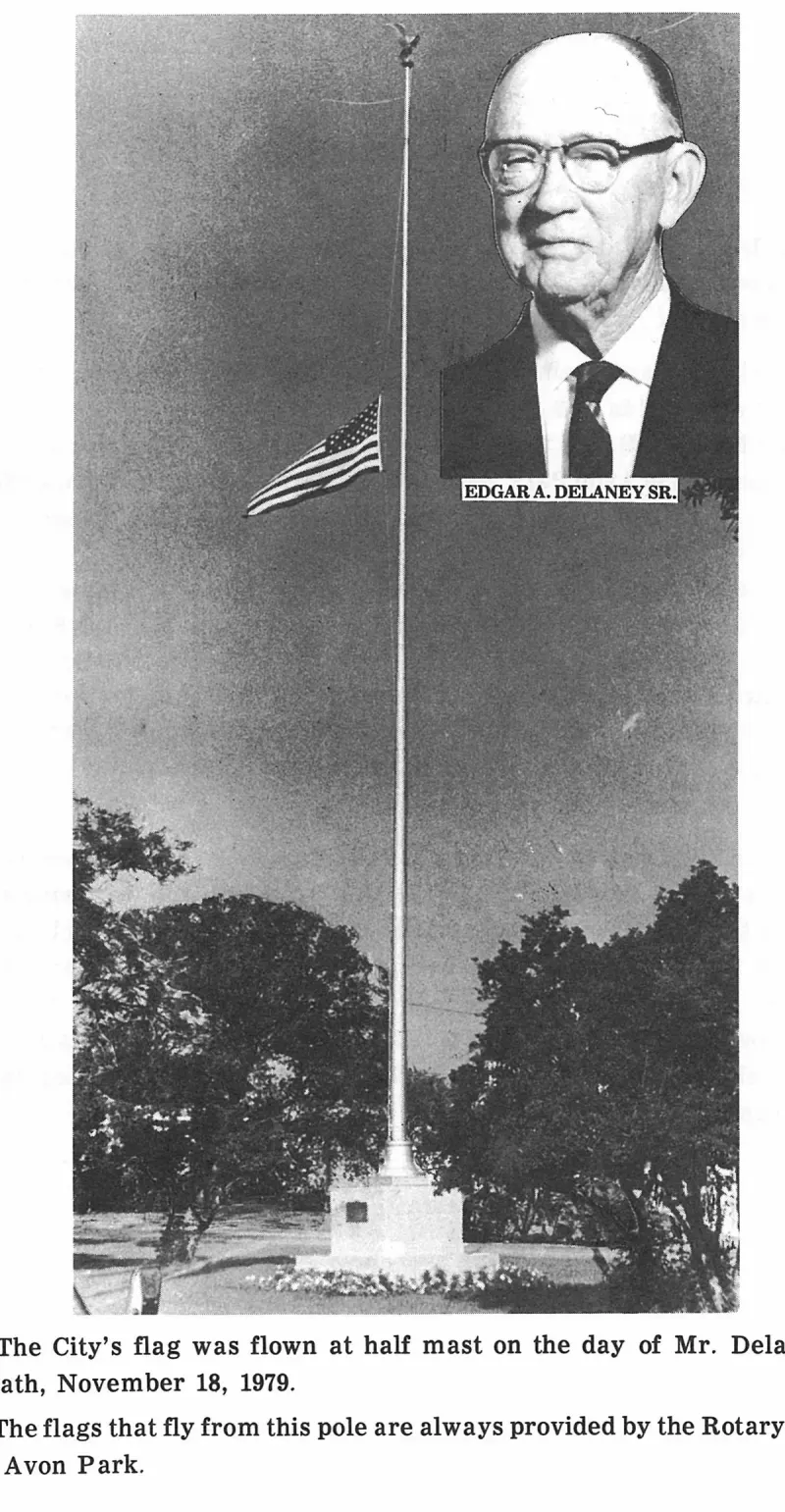
The City's flag was flown at half mast on the day of Mr. Delaney's death, November 18, 1979. Plate on page 199 of The First Hundred Years of Avon Park, Florida (1976).
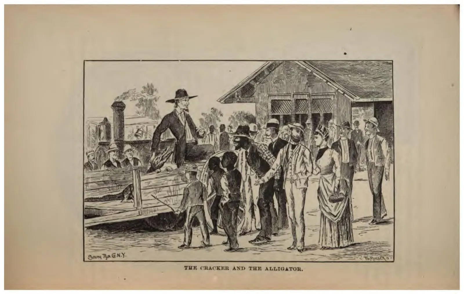
A crowd of tourists on a landing watching a Florida countryman with a captured alligator.
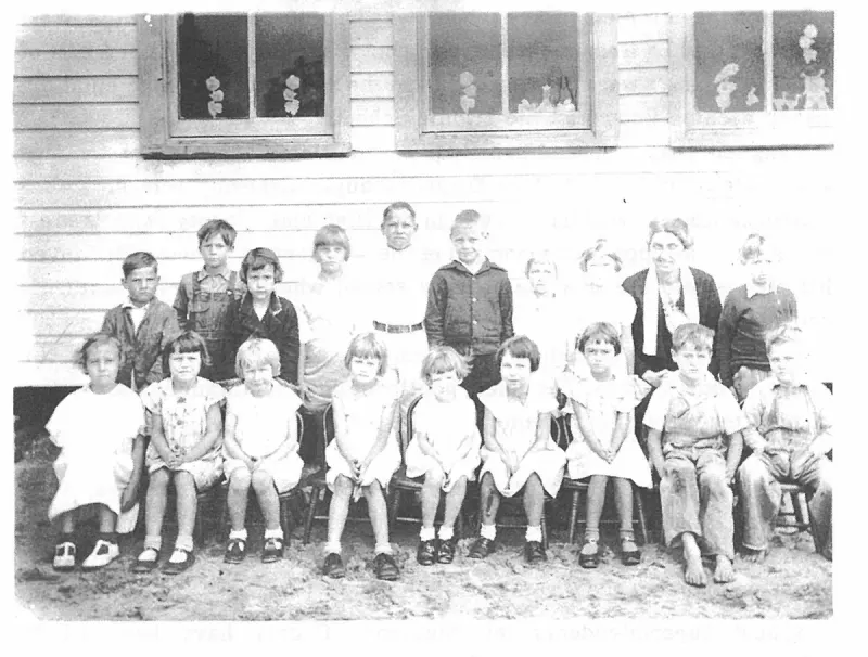
THE CRATE MILL SCHOOL was opened in 1920 for children whose families lived and worked at the crate mills. Mrs. Charles Shepherd was principal of this school. She taught all elementary grades in the small school with one other assistant teacher. Plate on page 121 of The First Hundred Years of Avon Park, Florida (1976).
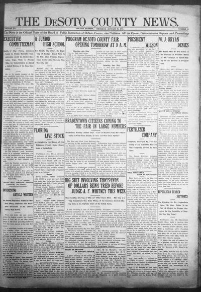
Newspaper page from Arcadia covering regional news, including the Hicoria area.
An uncaptioned plate on page 1 of The First Hundred Years of Avon Park, Florida (1976).
An uncaptioned plate on page 1 of The First Hundred Years of Avon Park, Florida (1976).
An uncaptioned plate on page 100 of The First Hundred Years of Avon Park, Florida (1976).
An uncaptioned plate on page 101 of The First Hundred Years of Avon Park, Florida (1976).
An uncaptioned plate on page 104 of The First Hundred Years of Avon Park, Florida (1976).
An uncaptioned plate on page 111 of The First Hundred Years of Avon Park, Florida (1976).
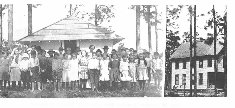
An uncaptioned plate on page 114 of The First Hundred Years of Avon Park, Florida (1976).
An uncaptioned plate on page 125 of The First Hundred Years of Avon Park, Florida (1976).
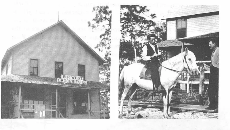
An uncaptioned plate on page 130 of The First Hundred Years of Avon Park, Florida (1976).
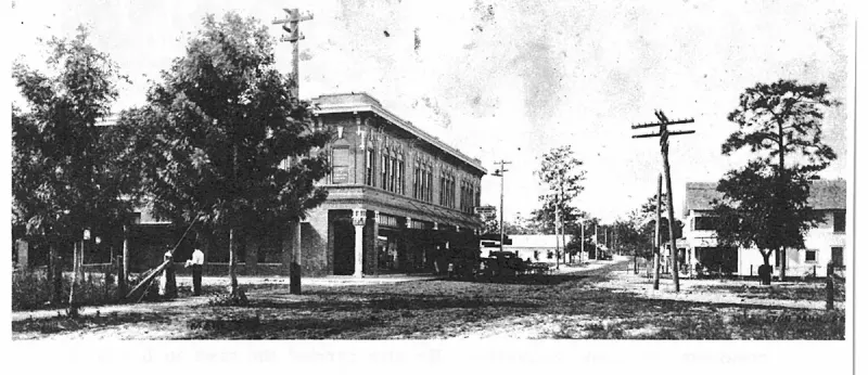
An uncaptioned plate on page 131 of The First Hundred Years of Avon Park, Florida (1976).
An uncaptioned plate on page 132 of The First Hundred Years of Avon Park, Florida (1976).
An uncaptioned plate on page 136 of The First Hundred Years of Avon Park, Florida (1976).
An uncaptioned plate on page 142 of The First Hundred Years of Avon Park, Florida (1976).
An uncaptioned plate on page 143 of The First Hundred Years of Avon Park, Florida (1976).
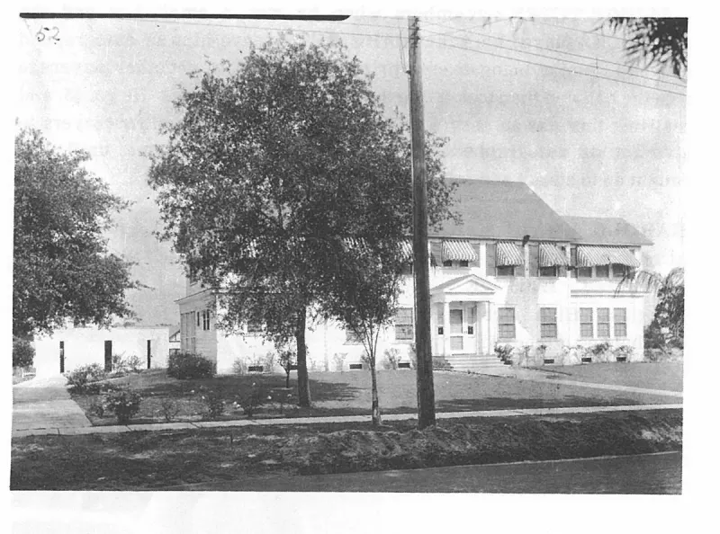
An uncaptioned plate on page 150 of The First Hundred Years of Avon Park, Florida (1976).
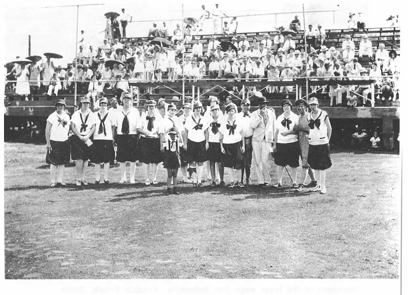
An uncaptioned plate on page 154 of The First Hundred Years of Avon Park, Florida (1976).
An uncaptioned plate on page 157 of The First Hundred Years of Avon Park, Florida (1976).
An uncaptioned plate on page 158 of The First Hundred Years of Avon Park, Florida (1976).
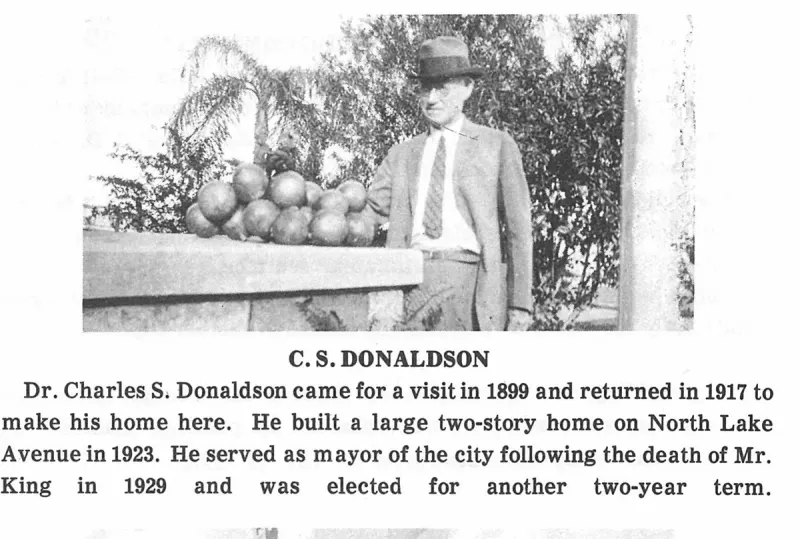
An uncaptioned plate on page 159 of The First Hundred Years of Avon Park, Florida (1976).
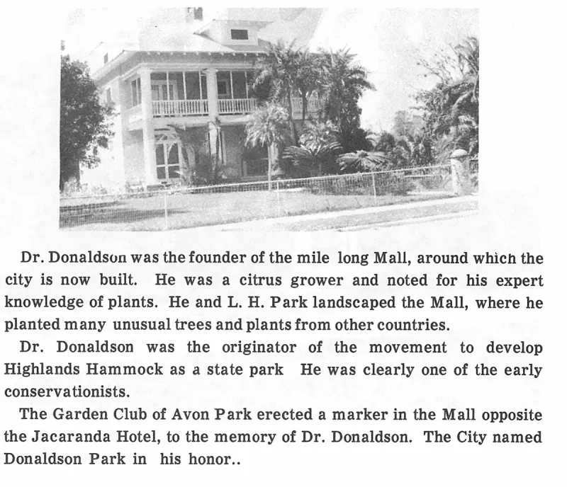
An uncaptioned plate on page 159 of The First Hundred Years of Avon Park, Florida (1976).
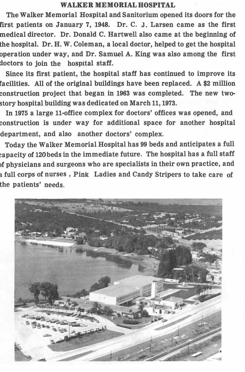
An uncaptioned plate on page 164 of The First Hundred Years of Avon Park, Florida (1976).
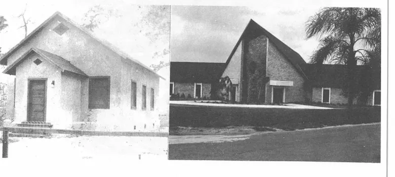
An uncaptioned plate on page 165 of The First Hundred Years of Avon Park, Florida (1976).
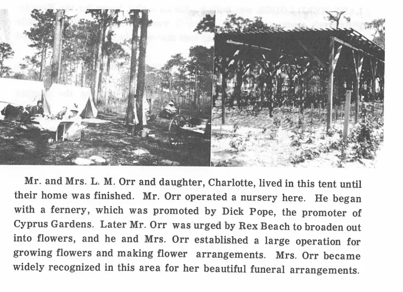
An uncaptioned plate on page 166 of The First Hundred Years of Avon Park, Florida (1976).
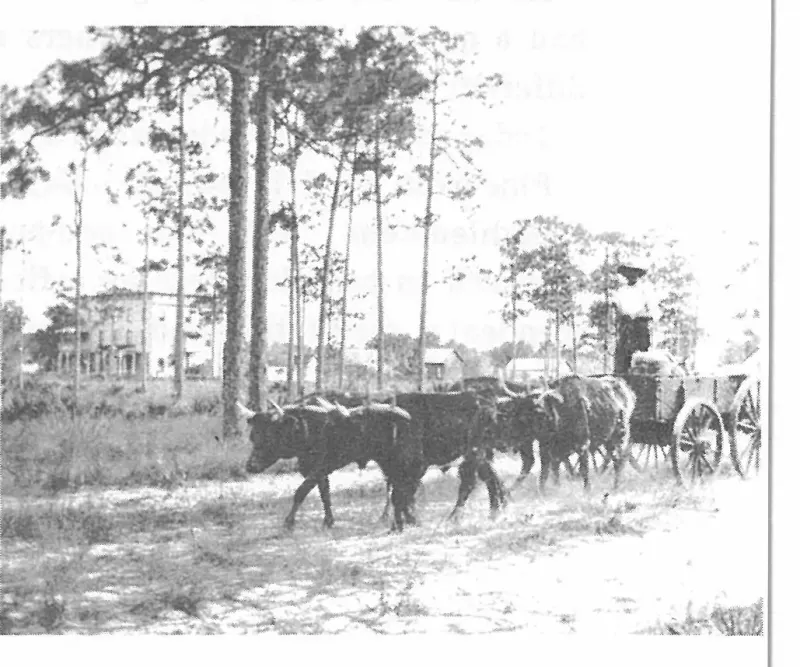
An uncaptioned plate on page 169 of The First Hundred Years of Avon Park, Florida (1976).
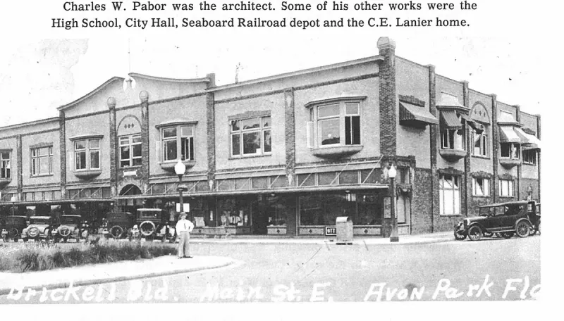
An uncaptioned plate on page 176 of The First Hundred Years of Avon Park, Florida (1976).
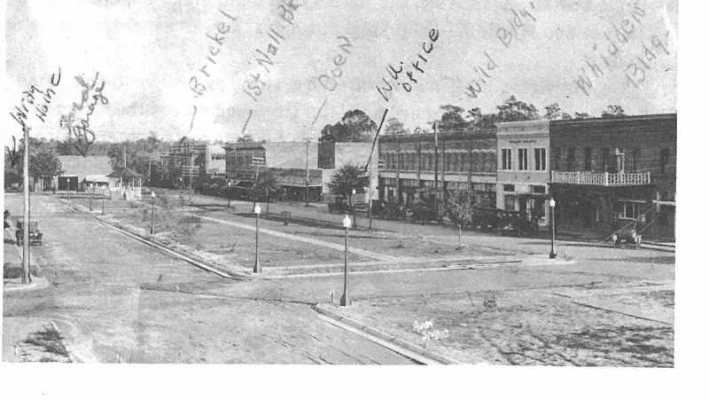
An uncaptioned plate on page 177 of The First Hundred Years of Avon Park, Florida (1976).
An uncaptioned plate on page 181 of The First Hundred Years of Avon Park, Florida (1976).
An uncaptioned plate on page 182 of The First Hundred Years of Avon Park, Florida (1976).
An uncaptioned plate on page 183 of The First Hundred Years of Avon Park, Florida (1976).
An uncaptioned plate on page 186 of The First Hundred Years of Avon Park, Florida (1976).
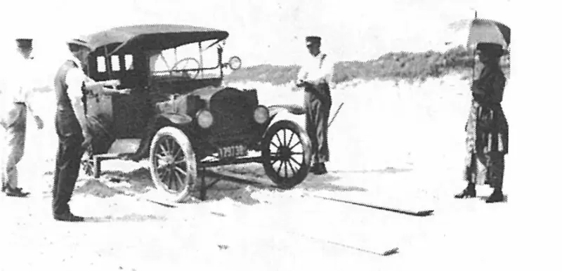
An uncaptioned plate on page 186 of The First Hundred Years of Avon Park, Florida (1976).
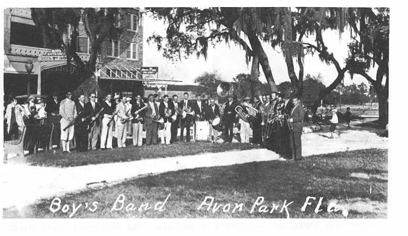
An uncaptioned plate on page 187 of The First Hundred Years of Avon Park, Florida (1976).
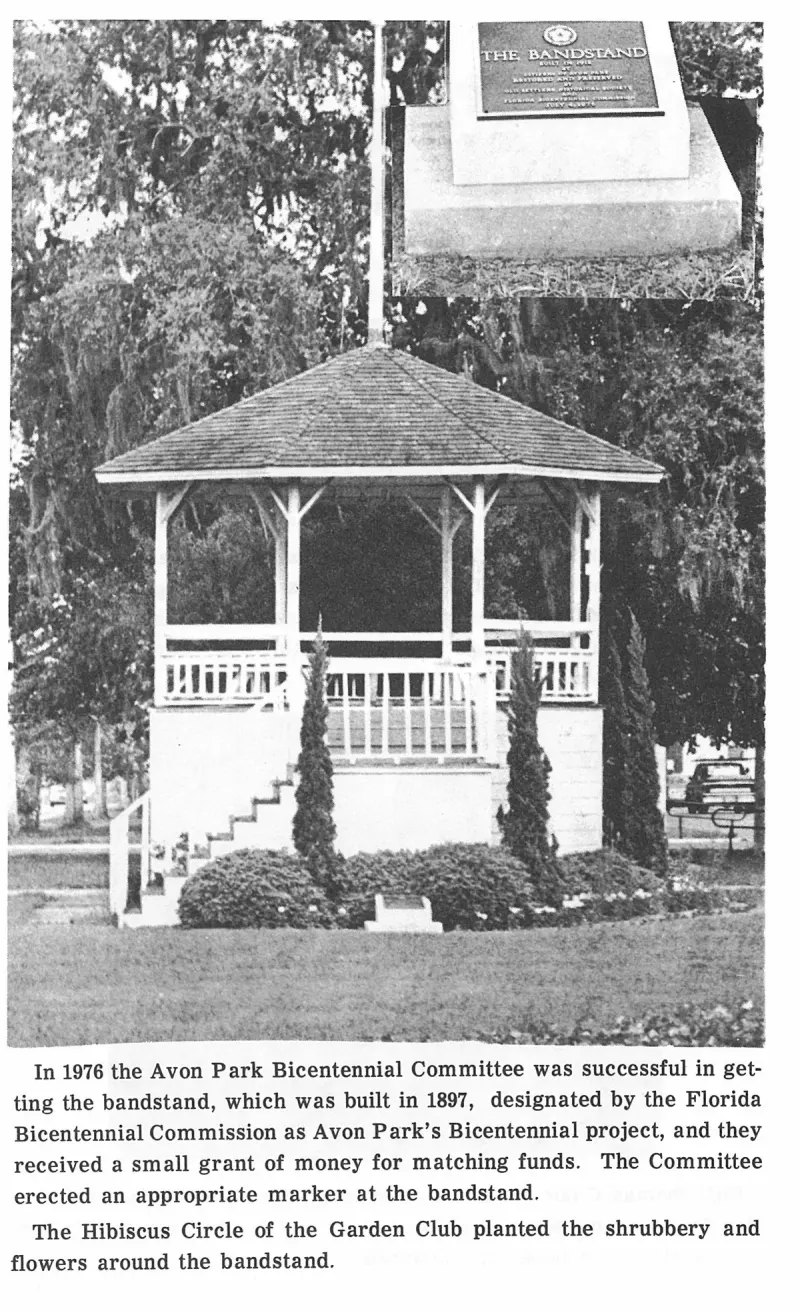
An uncaptioned plate on page 191 of The First Hundred Years of Avon Park, Florida (1976).
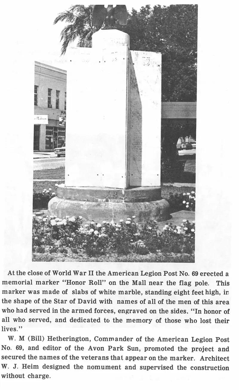
An uncaptioned plate on page 193 of The First Hundred Years of Avon Park, Florida (1976).
An uncaptioned plate on page 195 of The First Hundred Years of Avon Park, Florida (1976).
An uncaptioned plate on page 2 of The First Hundred Years of Avon Park, Florida (1976).
An uncaptioned plate on page 207 of The First Hundred Years of Avon Park, Florida (1976).
An uncaptioned plate on page 217 of The First Hundred Years of Avon Park, Florida (1976).
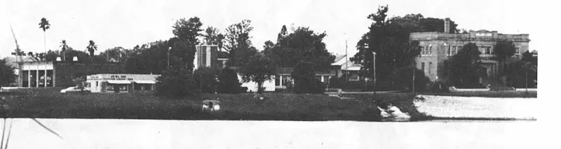
An uncaptioned plate on page 218 of The First Hundred Years of Avon Park, Florida (1976).
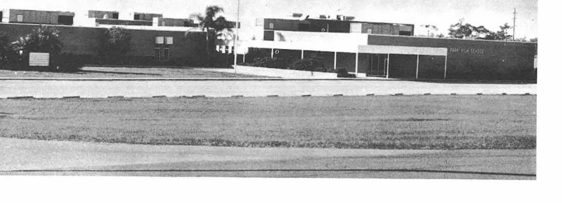
An uncaptioned plate on page 224 of The First Hundred Years of Avon Park, Florida (1976).
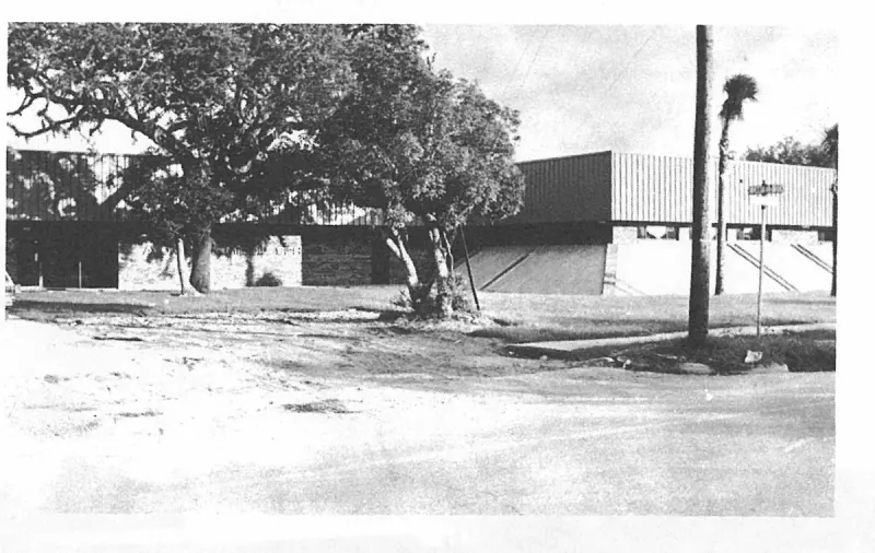
An uncaptioned plate on page 225 of The First Hundred Years of Avon Park, Florida (1976).
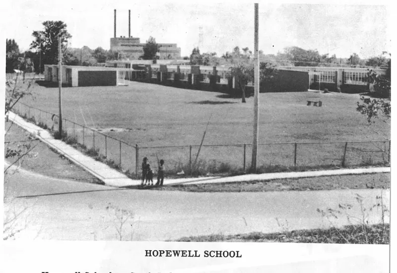
An uncaptioned plate on page 227 of The First Hundred Years of Avon Park, Florida (1976).
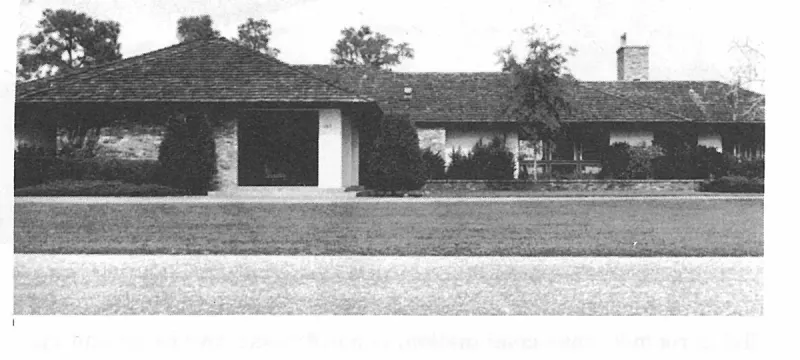
An uncaptioned plate on page 228 of The First Hundred Years of Avon Park, Florida (1976).
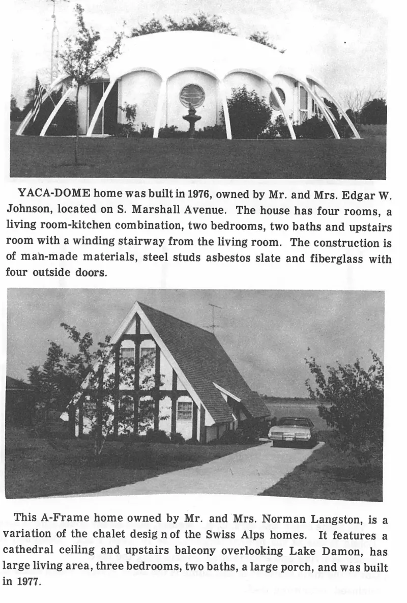
An uncaptioned plate on page 229 of The First Hundred Years of Avon Park, Florida (1976).
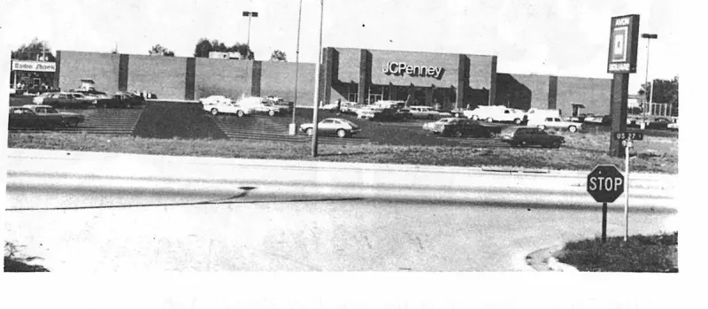
An uncaptioned plate on page 231 of The First Hundred Years of Avon Park, Florida (1976).
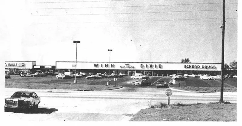
An uncaptioned plate on page 231 of The First Hundred Years of Avon Park, Florida (1976).
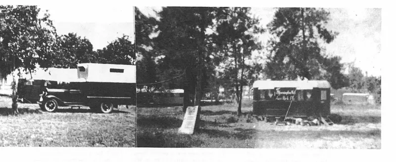
An uncaptioned plate on page 236 of The First Hundred Years of Avon Park, Florida (1976).
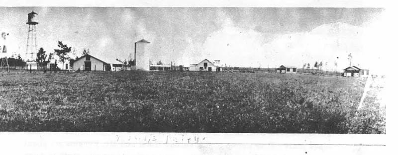
An uncaptioned plate on page 238 of The First Hundred Years of Avon Park, Florida (1976).
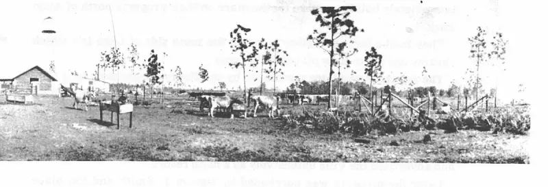
An uncaptioned plate on page 238 of The First Hundred Years of Avon Park, Florida (1976).
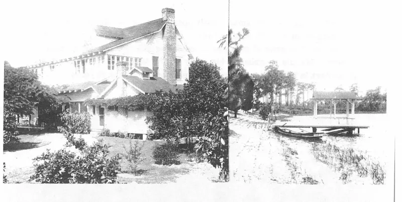
An uncaptioned plate on page 239 of The First Hundred Years of Avon Park, Florida (1976).
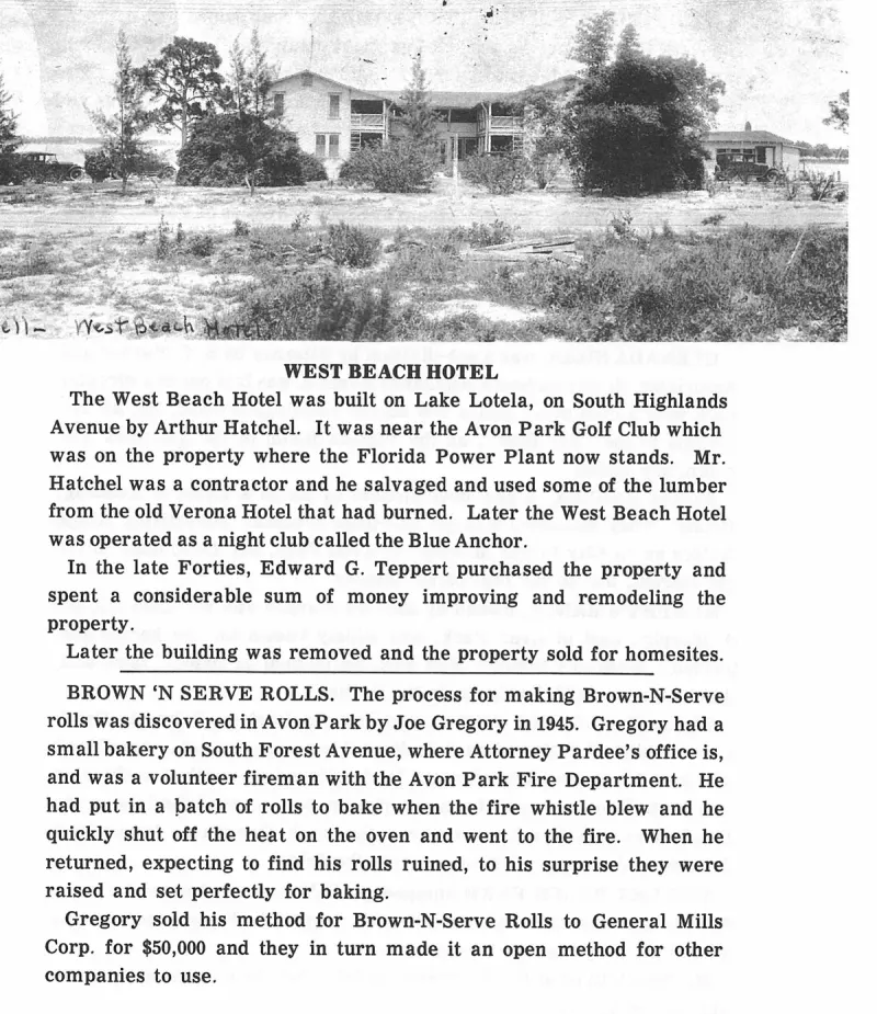
An uncaptioned plate on page 240 of The First Hundred Years of Avon Park, Florida (1976).
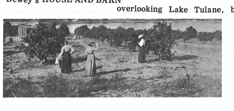
An uncaptioned plate on page 32 of The First Hundred Years of Avon Park, Florida (1976).
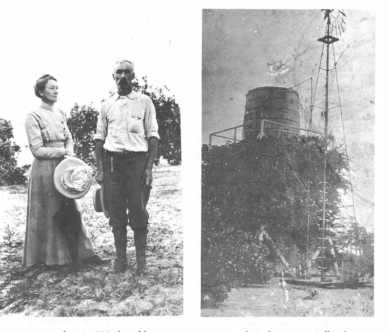
An uncaptioned plate on page 34 of The First Hundred Years of Avon Park, Florida (1976).
An uncaptioned plate on page 39 of The First Hundred Years of Avon Park, Florida (1976).
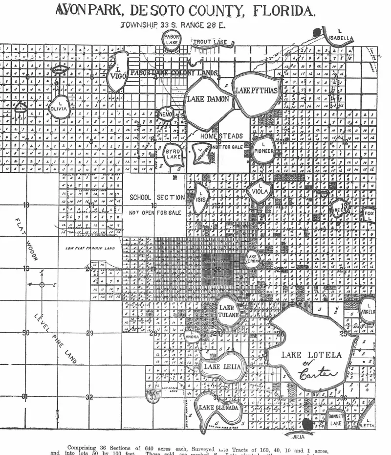
An uncaptioned plate on page 4 of The First Hundred Years of Avon Park, Florida (1976).
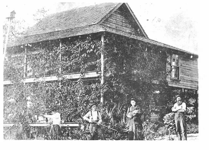
An uncaptioned plate on page 40 of The First Hundred Years of Avon Park, Florida (1976).
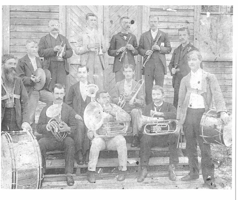
An uncaptioned plate on page 45 of The First Hundred Years of Avon Park, Florida (1976).
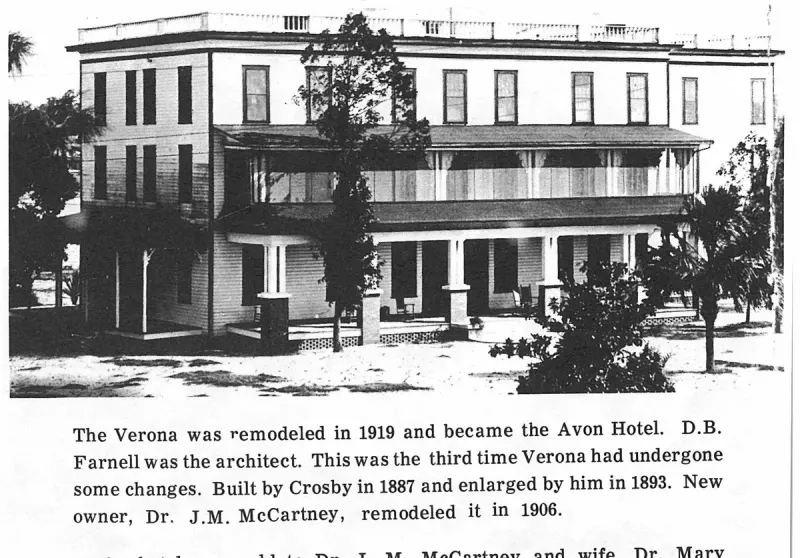
An uncaptioned plate on page 47 of The First Hundred Years of Avon Park, Florida (1976).
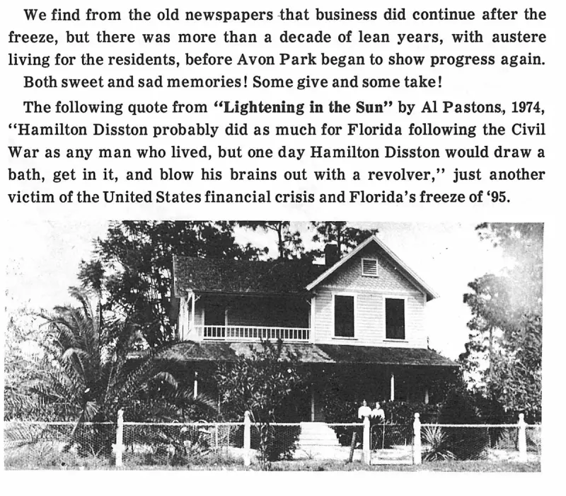
An uncaptioned plate on page 56 of The First Hundred Years of Avon Park, Florida (1976).
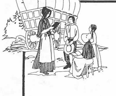
An uncaptioned plate on page 6 of The First Hundred Years of Avon Park, Florida (1976).
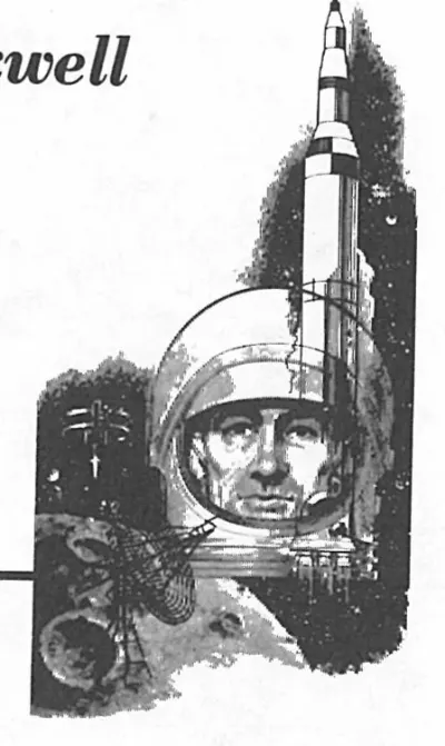
An uncaptioned plate on page 6 of The First Hundred Years of Avon Park, Florida (1976).
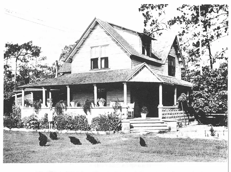
An uncaptioned plate on page 63 of The First Hundred Years of Avon Park, Florida (1976).
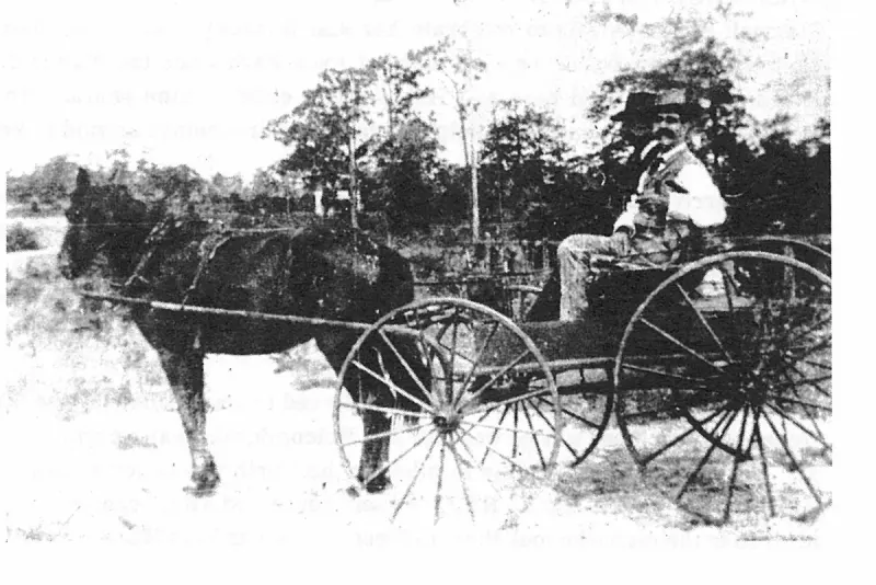
An uncaptioned plate on page 64 of The First Hundred Years of Avon Park, Florida (1976).
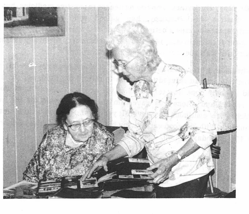
An uncaptioned plate on page 65 of The First Hundred Years of Avon Park, Florida (1976).
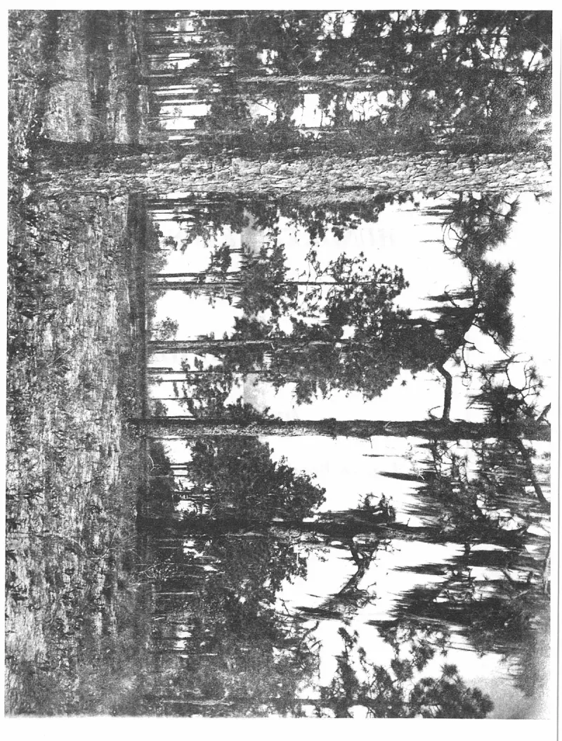
An uncaptioned plate on page 7 of The First Hundred Years of Avon Park, Florida (1976).
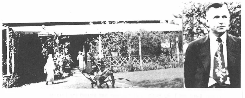
An uncaptioned plate on page 79 of The First Hundred Years of Avon Park, Florida (1976).
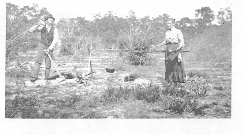
An uncaptioned plate on page 80 of The First Hundred Years of Avon Park, Florida (1976).
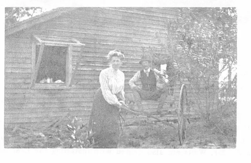
An uncaptioned plate on page 80 of The First Hundred Years of Avon Park, Florida (1976).
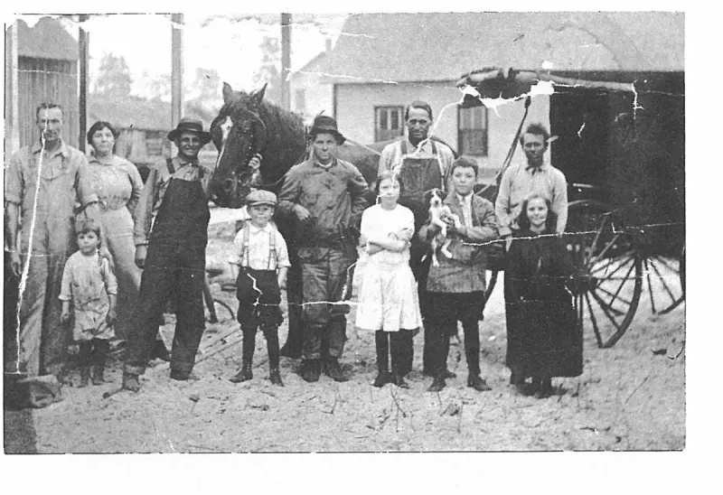
An uncaptioned plate on page 81 of The First Hundred Years of Avon Park, Florida (1976).
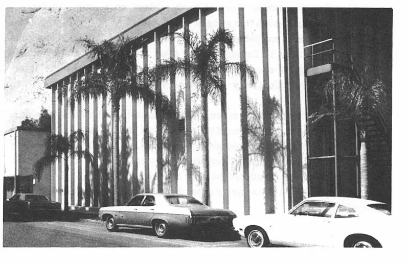
An uncaptioned plate on page 83 of The First Hundred Years of Avon Park, Florida (1976).
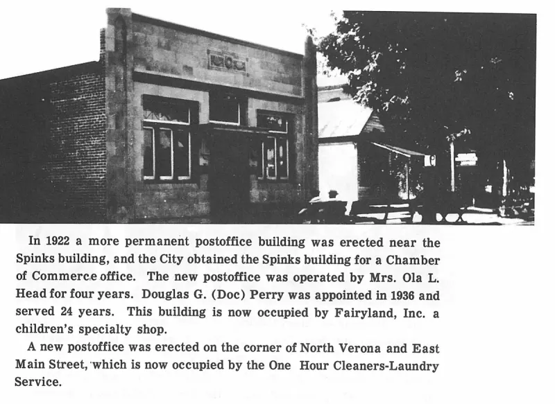
An uncaptioned plate on page 86 of The First Hundred Years of Avon Park, Florida (1976).
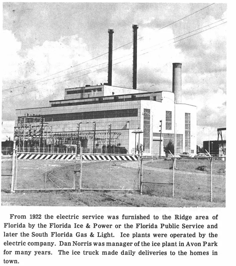
An uncaptioned plate on page 88 of The First Hundred Years of Avon Park, Florida (1976).
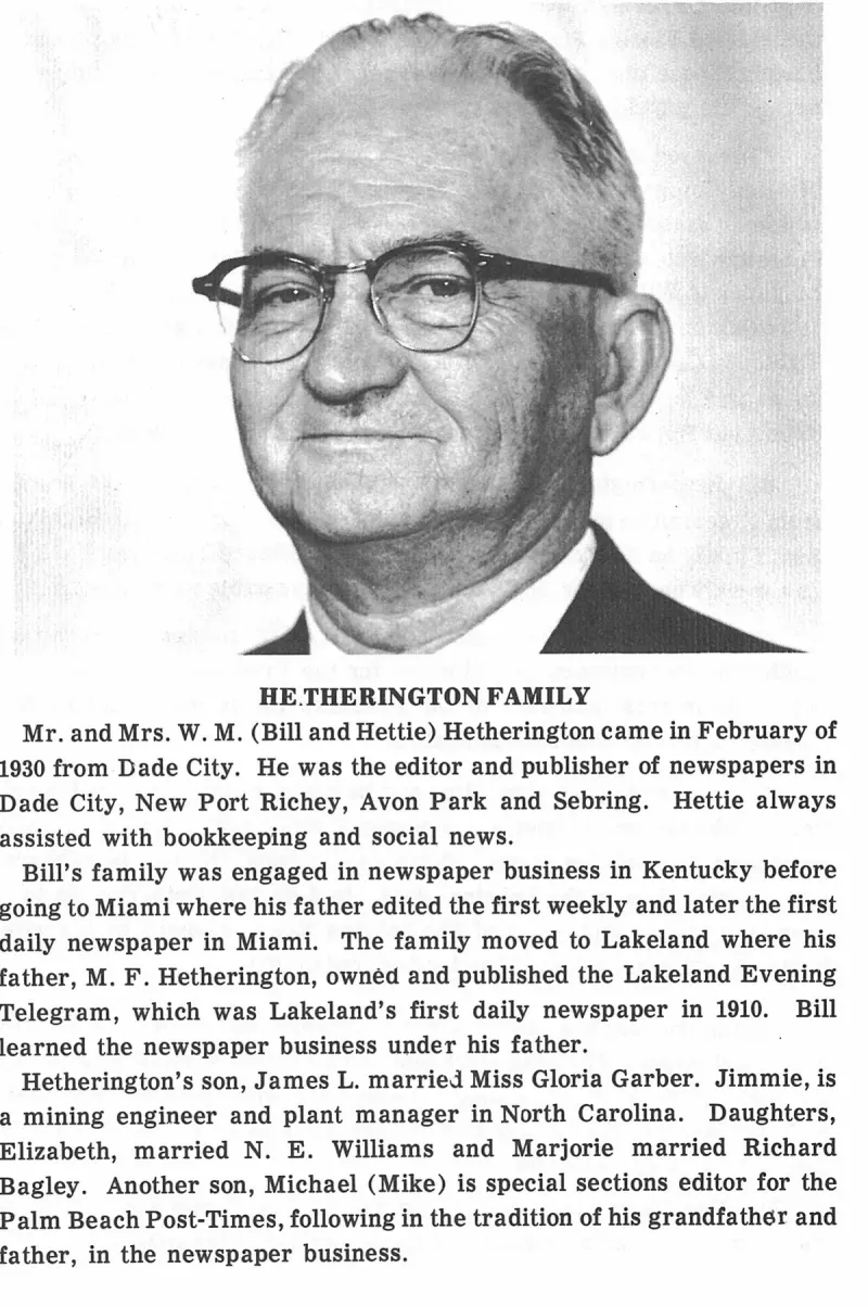
An uncaptioned plate on page 93 of The First Hundred Years of Avon Park, Florida (1976).
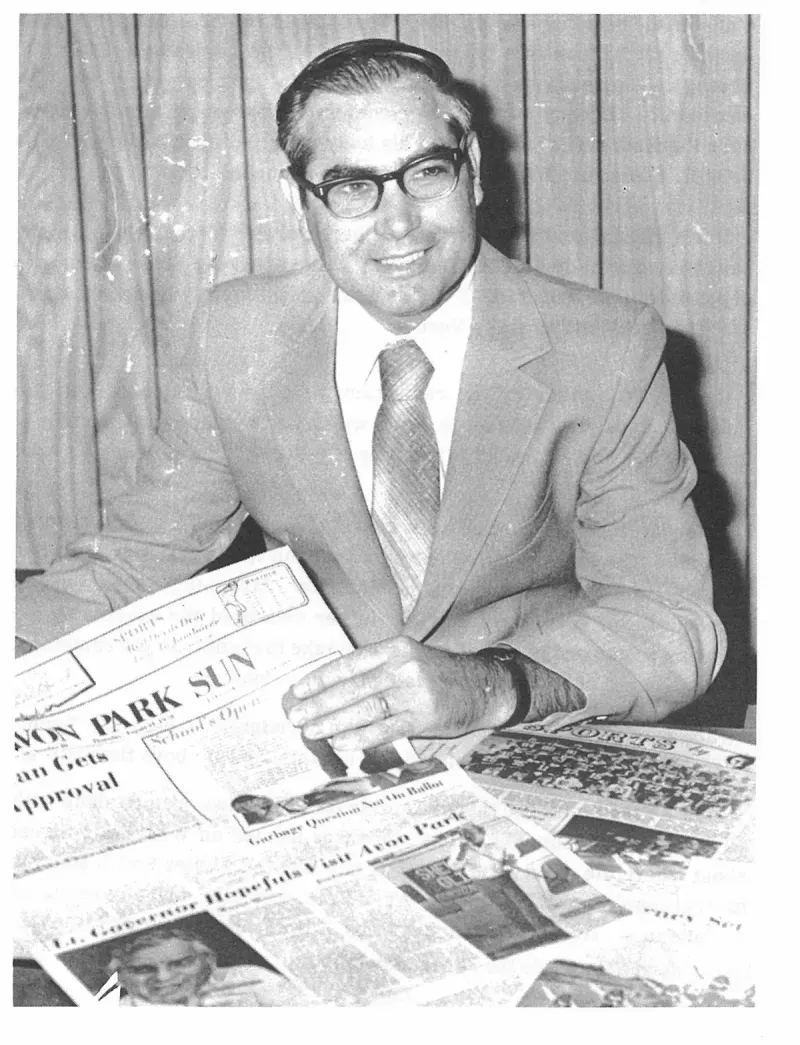
An uncaptioned plate on page 94 of The First Hundred Years of Avon Park, Florida (1976).
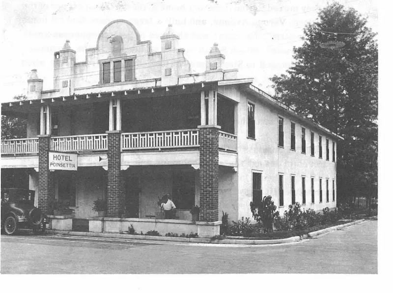
An uncaptioned plate on page 97 of The First Hundred Years of Avon Park, Florida (1976).
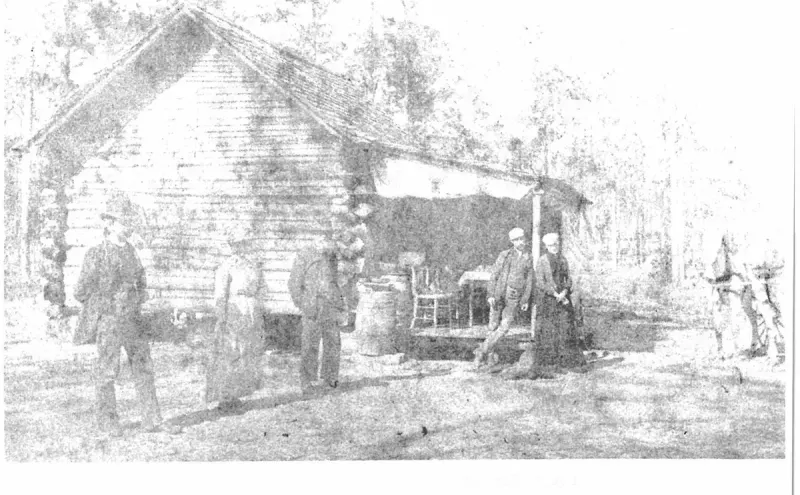
The first log cabin built on Lake Tulane by William A. King 1886. Plate on page 31 of The First Hundred Years of Avon Park, Florida (1976).
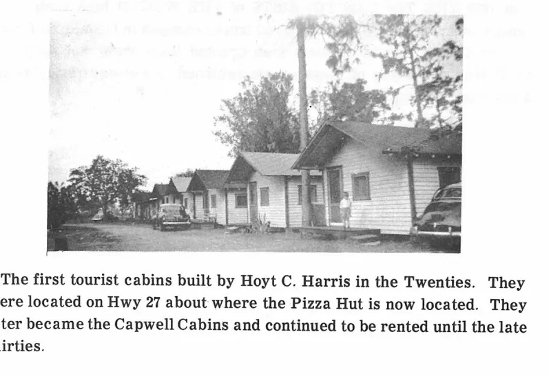
The first tourist cabins built by Hoyt C. Harris in the Twenties. They were located on Hwy 27 about where the Pizza Hut is now located. They later became the Capwell Cabins and continued to be rented until the late thirties. Plate on page 236 of The First Hundred Years of Avon Park, Florida (1976).
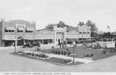
A printed postcard captioned FIRST TRUST AND SAVINGS COMPANY BUILDING, AVON PARK, FLA., showing a long two-story brick block with awnings and a central arched entrance facing the planted Mall, with the bandstand and a flagpole to the right.
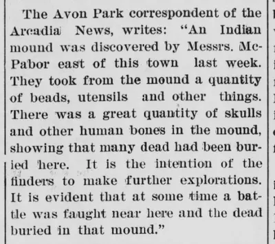
Avon Park correspondent report in The Florida Agriculturist detailing the opening of an ancient burial mound east of town by Messrs. Mc- Pabor.
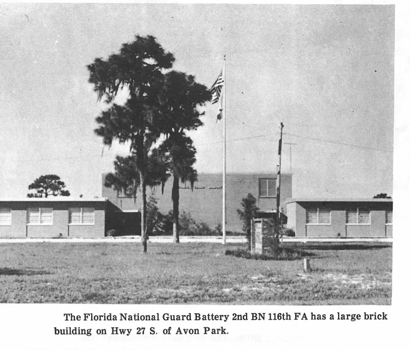
The Florida National Guard Battery 2nd BN 116th FA has a large brick building on Hwy 27 S. of Avon Park. Plate on page 232 of The First Hundred Years of Avon Park, Florida (1976).
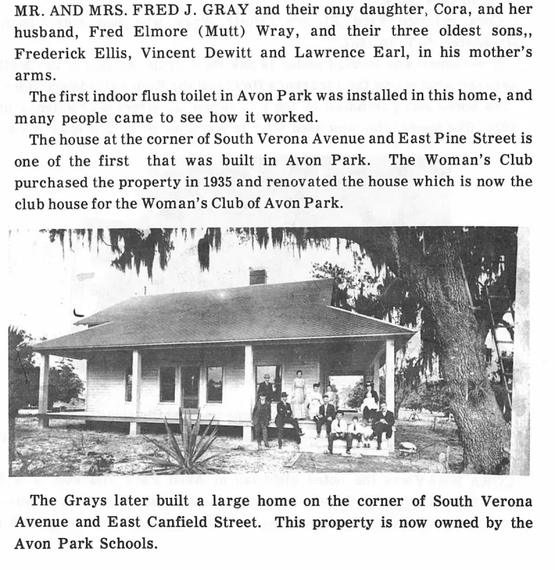
The Grays later built a large home on the corner of South Verona Avenue and East Canfield Street. This property is now owned by the Avon Park Schools. Plate on page 69 of The First Hundred Years of Avon Park, Florida (1976).
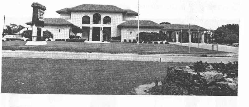
THE HEARTLAND SAVINGS AND LOAN ASSOCIATION bank is located in the Avon Square Shopping Plaza on Highway 27 South of Avon Park. Plate on page 133 of The First Hundred Years of Avon Park, Florida (1976).
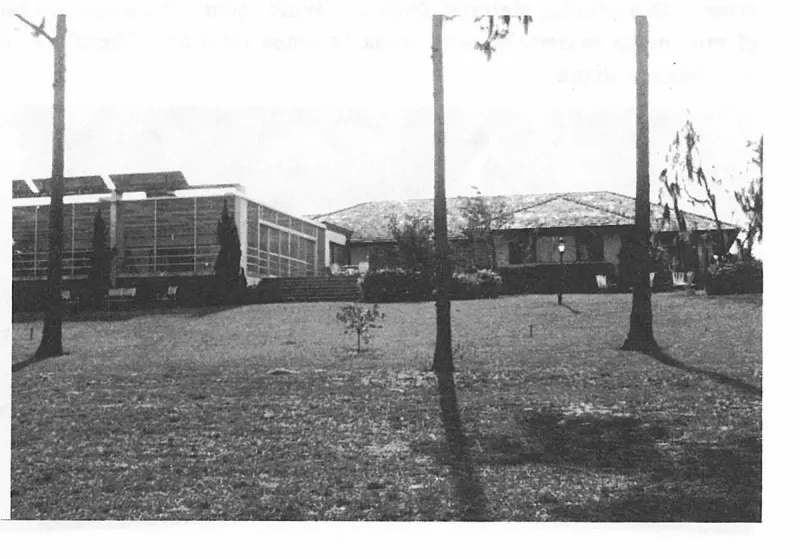
The home of Mr. and Mrs. C. R. Melear, built on the south side of Lake Lotela is one of the newest large homes in Avon Park. Designed for gracious living and entertaining, overlooking the lake. Plate on page 228 of The First Hundred Years of Avon Park, Florida (1976).
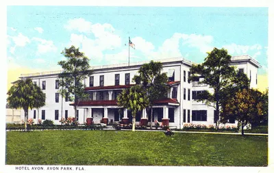
A color-tinted postcard of a three-story white masonry hotel with red-tiled awnings, young palms and a flagpole, captioned HOTEL AVON, AVON PARK, FLA.
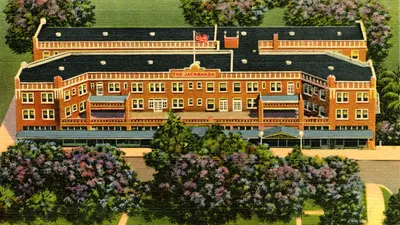
A linen-finish color postcard giving a bird's-eye view of the whole Hotel Jacaranda, its rooftop sign reading THE JACARANDA, with jacaranda trees in flower around the grounds.
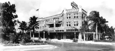
A wide black-and-white photoprint of the Hotel Jacaranda with its rooftop sign, the awnings along its shopfronts, palms and a flagpole, and the street curving away in front; from the Louise Frisbie collection.
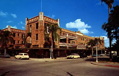
A color postcard of the Hotel Jacaranda published by Colourpicture of Boston, about 1950.
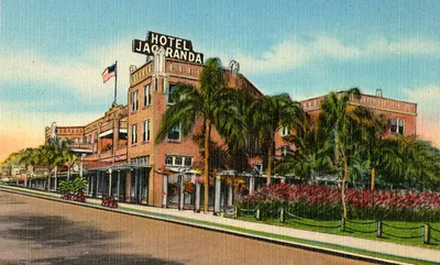
A linen-finish color postcard of the Hotel Jacaranda seen along the street, its rooftop sign lettered HOTEL JACARANDA, with palms, flower borders and a flag; the linen finish points to the nineteen-thirties or forties rather than to the archive's circa 1926.
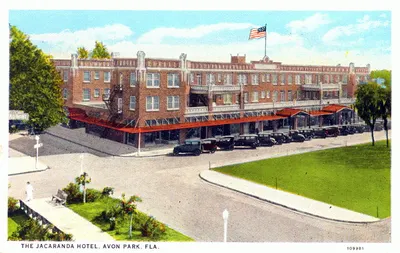
A white-border color postcard captioned THE JACARANDA HOTEL, AVON PARK, FLA., showing the hotel behind its red awnings with about a dozen cars angle-parked at the curb and the planted Mall in the foreground; the cars are of the middle nineteen-thirties, so the archive's circa 1926 is too early.
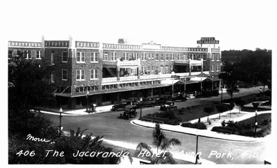
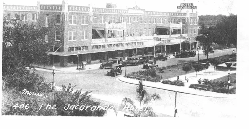
A real-photo postcard captioned in the negative 406 The Jacaranda Hotel, Avon Park, Fla., with a photographer's signature reading Mour, showing the hotel's roof sign, cars of the late nineteen-twenties at the curb, and the Mall's benches and lamp standards; the State Archives dates it circa 1900, which is impossible, as the hotel opened in 1926.
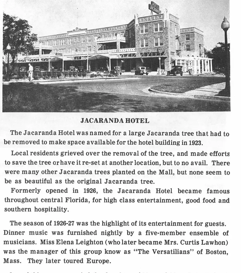
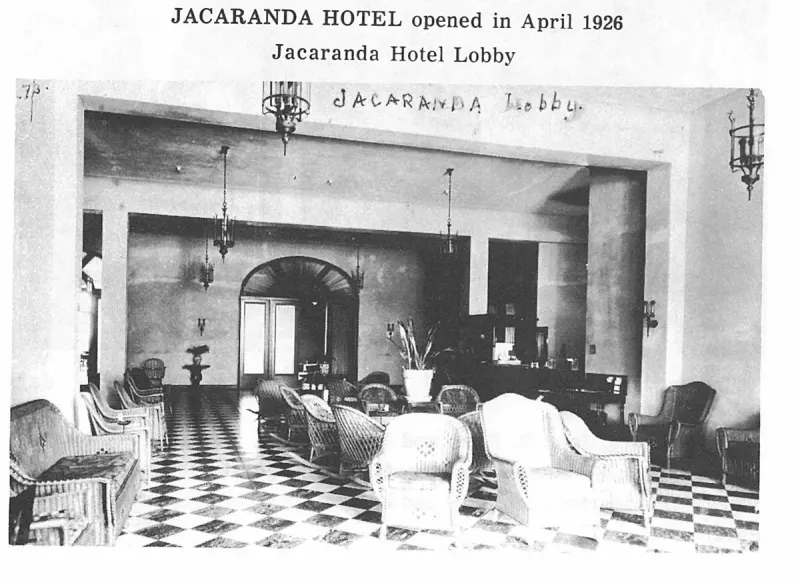
The Jacaranda Hotel, opened in April 1926 during the height of the 1920s building boom. Plate on page 149 of The First Hundred Years of Avon Park, Florida (1976).
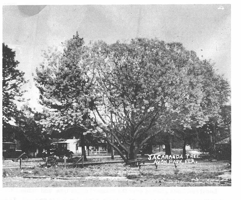
The Jacaranda tree that had to be cut down to make room for building the Jacaranda Hotel. The tree stood between East Main and Waycross Street. Plate on page 148 of The First Hundred Years of Avon Park, Florida (1976).
Newspaper page containing regional news and land records for the general Hicoria area.
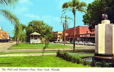
A color postcard captioned The Mall and Business Area, Avon Park, Florida, looking along the planted median with the white bandstand at its center, palms, a war memorial obelisk topped by an eagle in the right foreground, and the shopfronts of the business block behind, among them a Ben Franklin store.
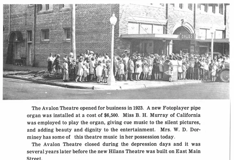
The Mall in the 1920s with central parkway plantings, facing the First National Bank building. Plate on page 173 of The First Hundred Years of Avon Park, Florida (1976).
Newspaper clipping from The Montgomery Advertiser discussing the Florida Western and Northern Railroad.
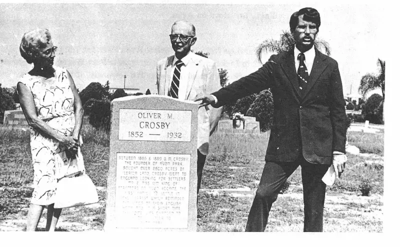
The monument erected on Oliver M. Crosby's grave in Bougainvillea Cemetery on July 4, 1976. Plate on page 58 of The First Hundred Years of Avon Park, Florida (1976).
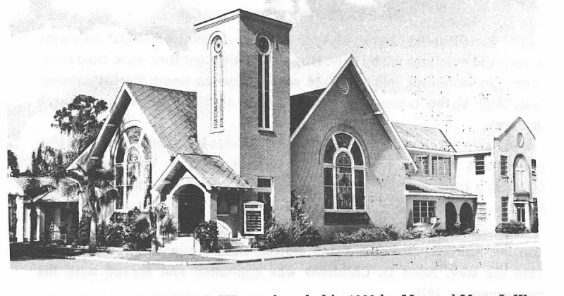
THE NAZARENE CHURCH was founded in 1929 by Mr. and Mrs. J. W. Meredith, T. R. Johnson, C. Syfrett, M. H. Gribble, Rev. N. B. Shade and Mrs. M. M. Bussey. The first pastor was the Rev. John Tompkins. Plate on page 105 of The First Hundred Years of Avon Park, Florida (1976).
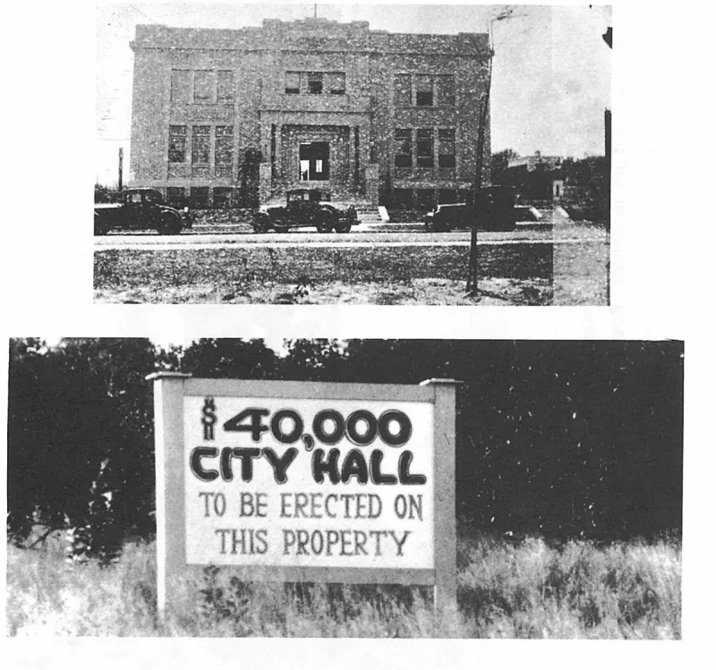
THE NEW CITY HALL as it looked April 6, 1929. Plate on page 38 of The First Hundred Years of Avon Park, Florida (1976).
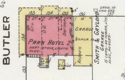
Detail of sheet 2 of the Sanborn Map Company's November 1920 fire-insurance map of Avon Park, showing the Park Hotel, a two-story brick building on the south side of Main Street at Butler Avenue, with a grocery, a dry-goods store and a barber's shop on its ground floor and the Smith and Gaylord garage next door.
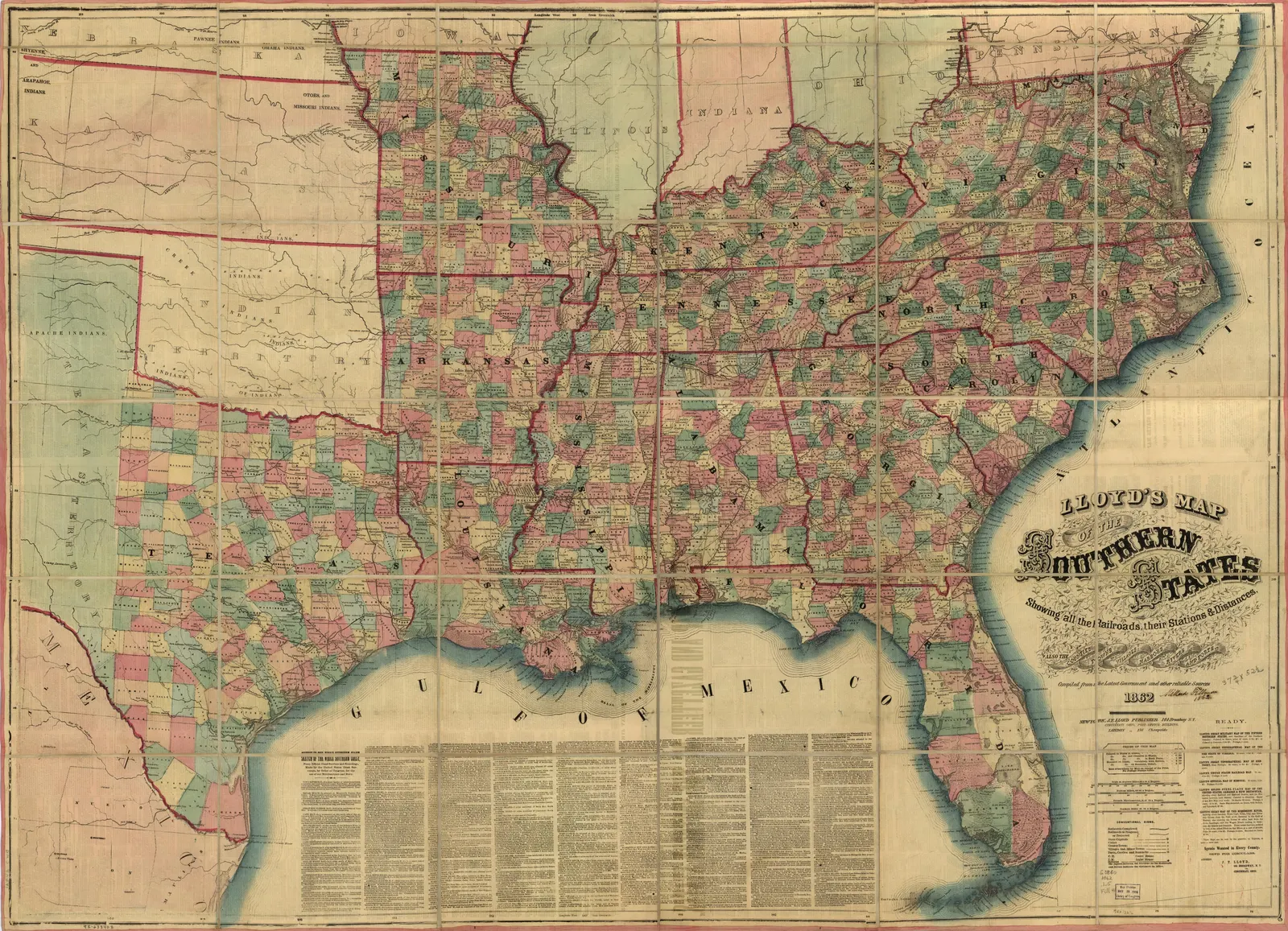
Shows all railroads, cities, towns, villages.
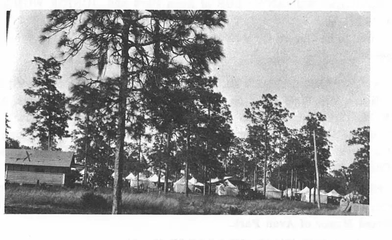
THE TOWNSEND SASH DOOR AND LUMBER COMPANY operated a business in Avon Park for more than 20 years. Plate on page 235 of The First Hundred Years of Avon Park, Florida (1976).
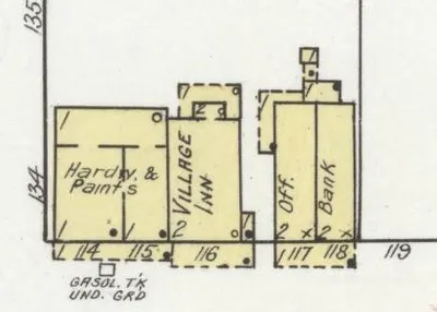
Detail of sheet 2 of the Sanborn Map Company's November 1920 fire-insurance map of Avon Park, showing the Village Inn, a two-story frame building at 116 Main Street on the north side of the street, between a hardware and paint store and the bank.
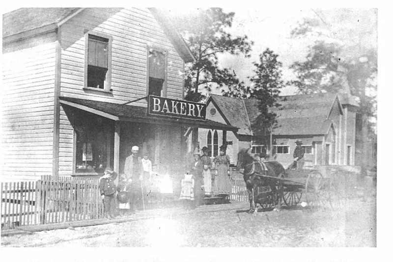
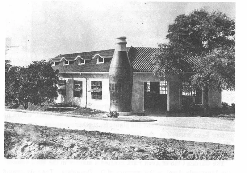
The Visel Bakery was located near the Congregational Church and the also the C. D. Noland Bottling Company was in this area. Some recall today how they went there to buy their bottled soda drinks. Plate on page 180 of The First Hundred Years of Avon Park, Florida (1976).
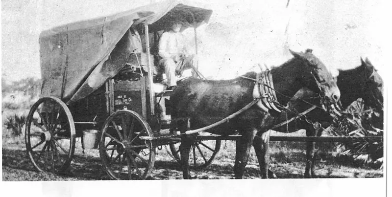
The way we came in 1903. Plate on page 71 of The First Hundred Years of Avon Park, Florida (1976).
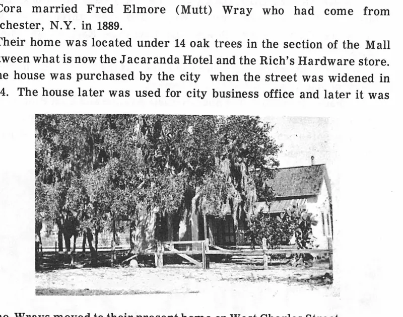
The Wrays moved to their present home on West Charles Street. Plate on page 68 of The First Hundred Years of Avon Park, Florida (1976).
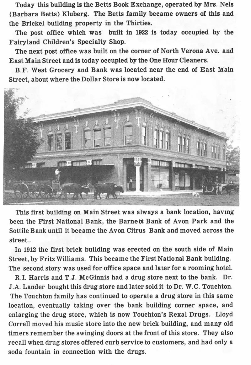
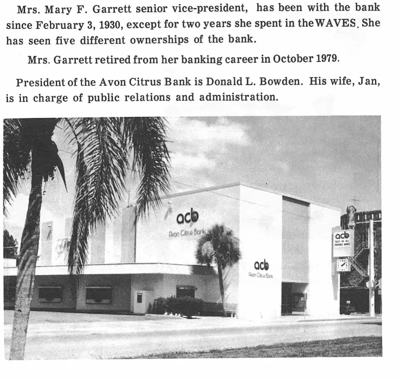
This first building on Main Street was always a bank location, having been the First National Bank, the Barnett Bank of Avon Park and the Sottile Bank until it became the Avon Citrus Bank and moved across the street. Plate on page 172 of The First Hundred Years of Avon Park, Florida (1976).
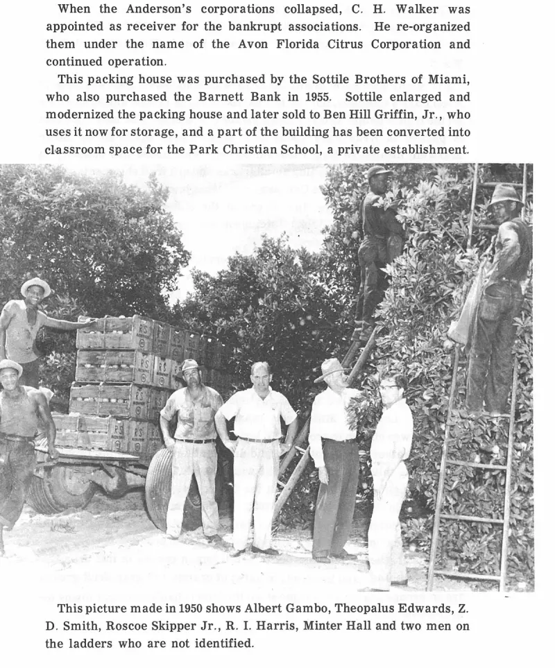
This picture made in 1950 shows Albert Gambo, Theopalus Edwards, Z. D. Smith, Roscoe Skipper Jr., R. I. Harris, Minter Hall and two men on the ladders who are not identified. Plate on page 146 of The First Hundred Years of Avon Park, Florida (1976).
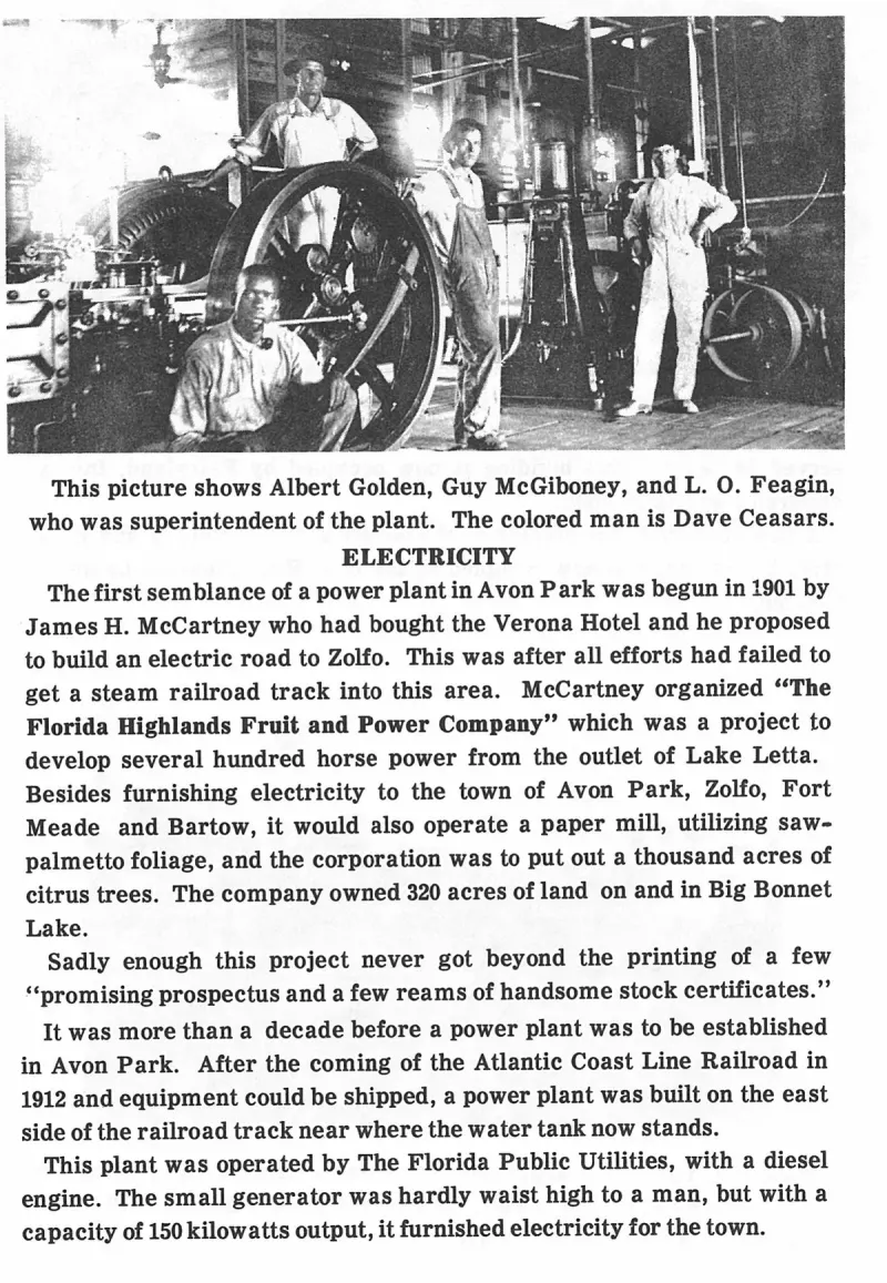
This picture shows Albert Golden, Guy McGiboney, and L. O. Feagin, who was superintendent of the plant. The colored man is Dave Ceasars. Plate on page 87 of The First Hundred Years of Avon Park, Florida (1976).
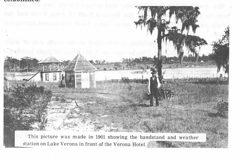
This picture was made in 1901 showing the bandstand and weather station on Lake Verona in front of the Verona Hotel. Plate on page 173 of The First Hundred Years of Avon Park, Florida (1976).
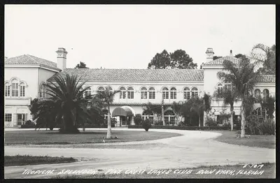
Tropical splendor, Pine Crest Lakes Club, Avon Park, Florida
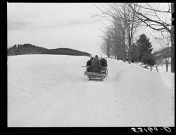
Typical structure and operation of a Florida turpentine still from the late 1930s.
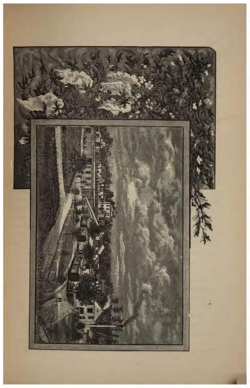
An uncaptioned plate of two overlapping vignettes, a mossy lake shore and a crowded harbor.
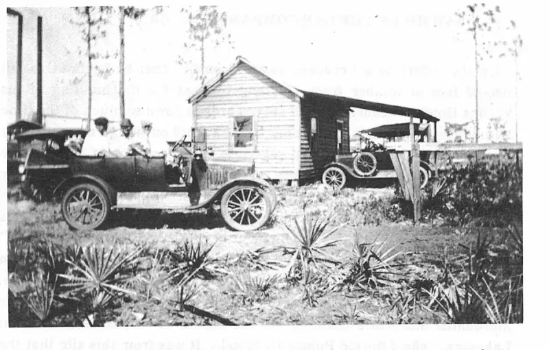
Typical Florida home 1909, notice the sawmill smoke stacks at left. Plate on page 73 of The First Hundred Years of Avon Park, Florida (1976).
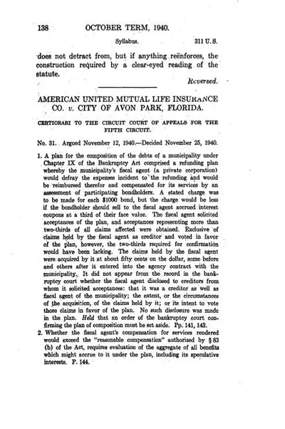
U.S. Reports: American Ins Co. v. Avon Park, 311 U.S. 138 (1940).
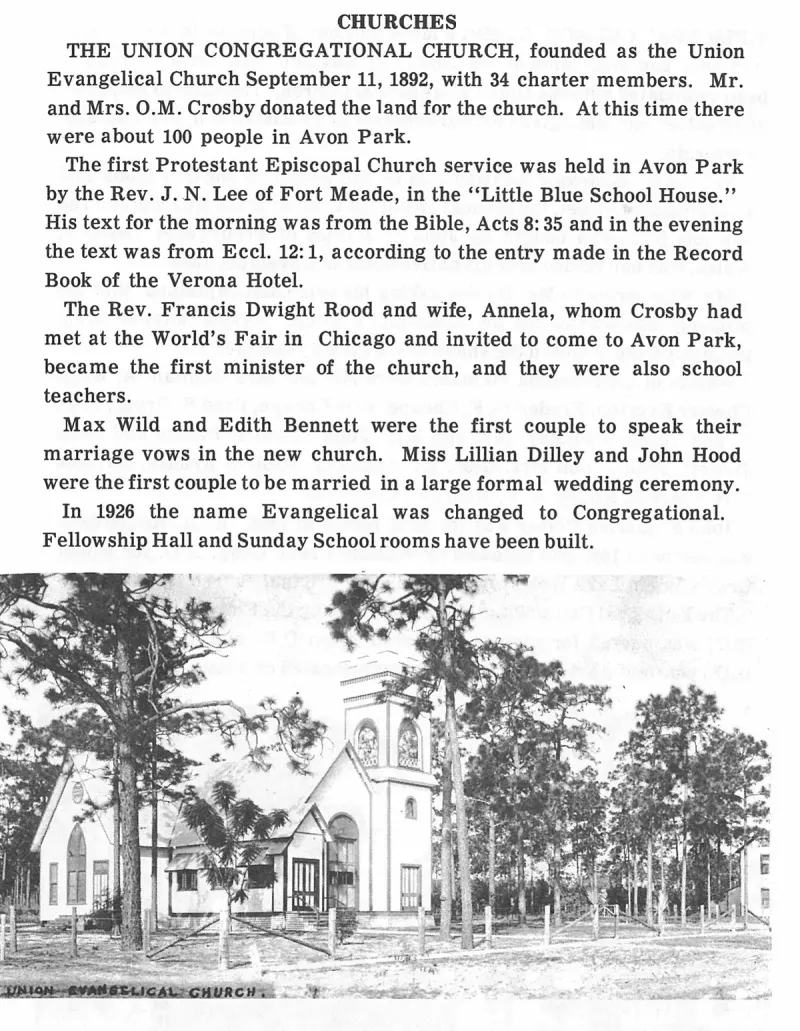
Union Evangelical Church. Plate on page 102 of The First Hundred Years of Avon Park, Florida (1976).
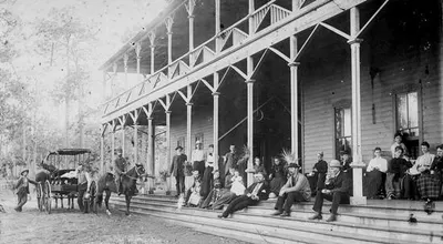
An additional historical view of the Verona Hotel on Lake Verona in Avon Park, built between 1887 and 1889.
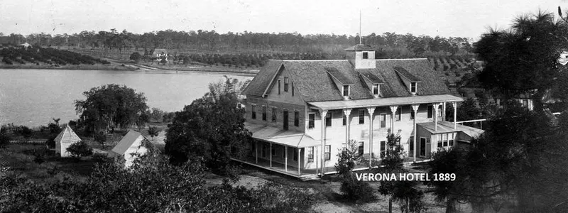
Historical photo of the Verona Hotel on Lake Verona, Avon Park, completed in 1889 and destroyed by fire in 1926.
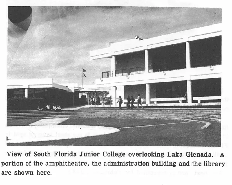
View of South Florida Junior College overlooking Laka Glenada. A portion of the amphitheater, the administration building and the library are shown here. Plate on page 221 of The First Hundred Years of Avon Park, Florida (1976).
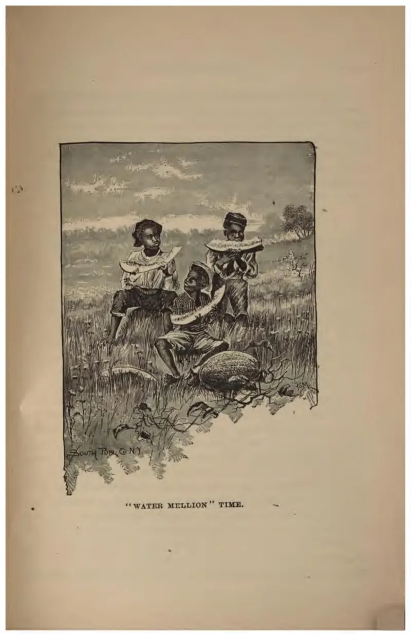
A caricature of two Black children eating watermelon, drawn in the racial idiom of 1887 promotional publishing.
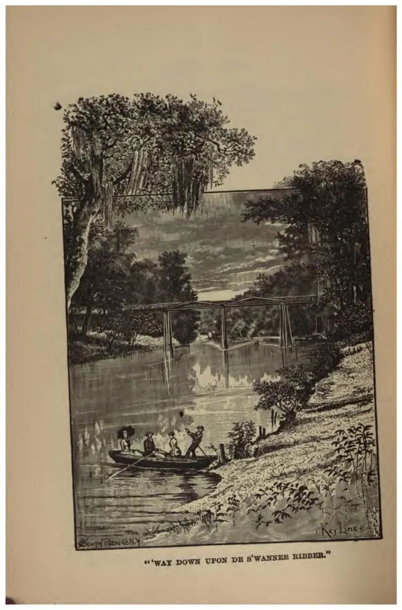
A river scene with figures in a boat, titled from the minstrel song, in the dialect spelling the book uses.
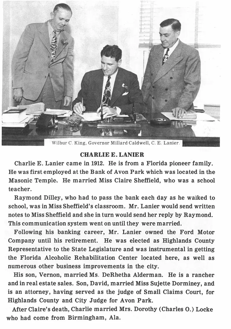
Wilbur C. King, Governor Millard Caldwell, C. E. Lanier. Plate on page 99 of The First Hundred Years of Avon Park, Florida (1976).
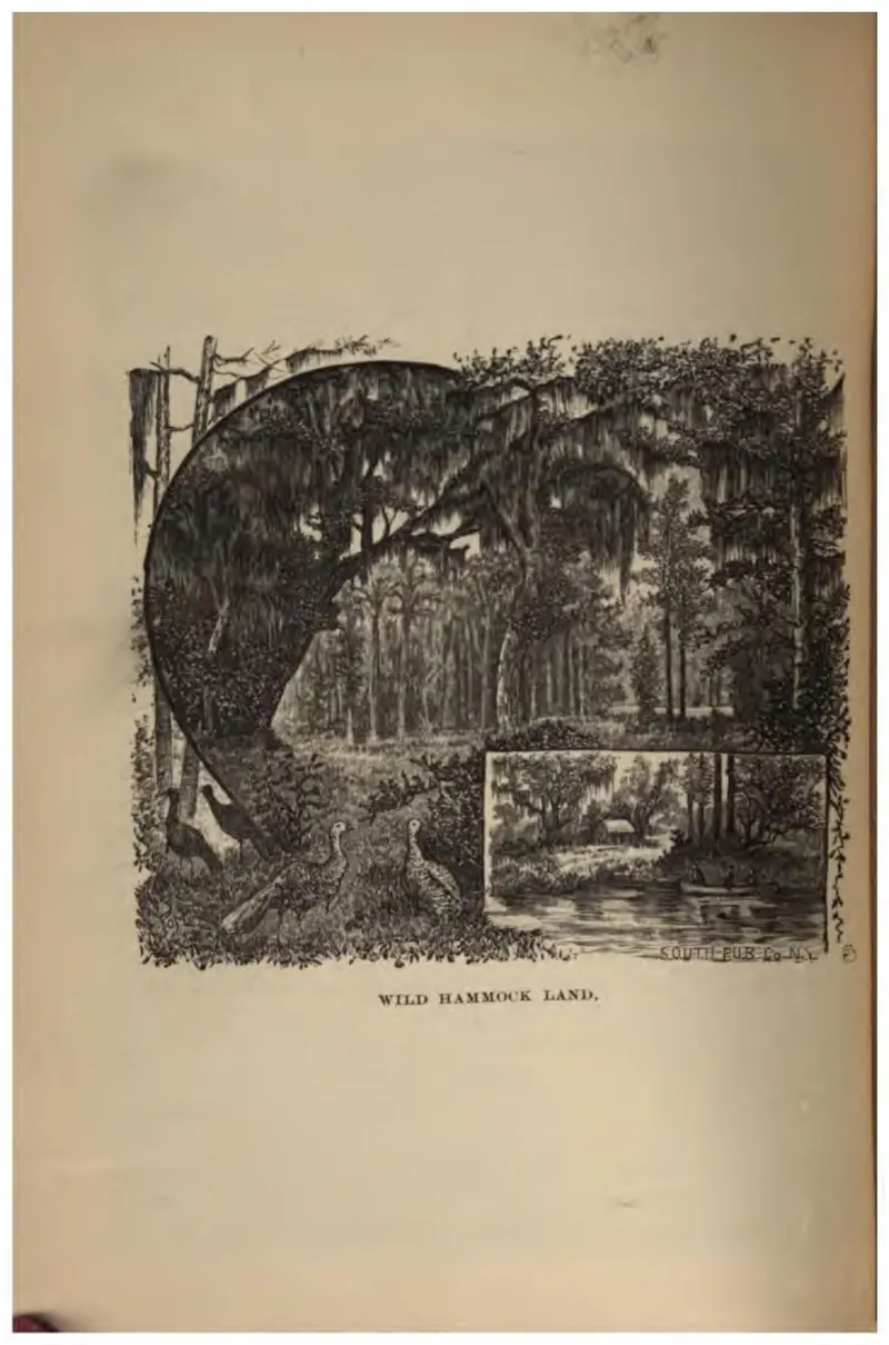
Dense hardwood hammock, the land type Crosby's text rates most fertile and hardest to clear.
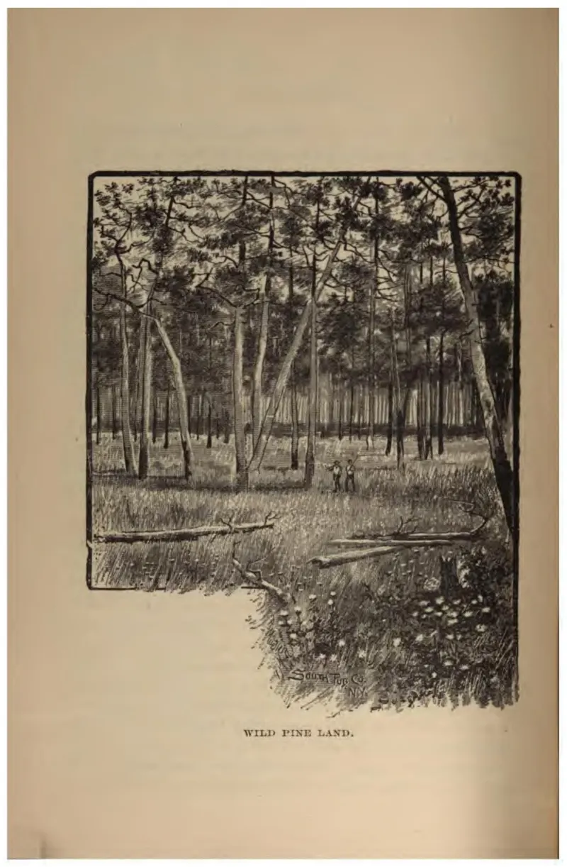
Open longleaf pine flatwoods with wire grass, the commonest land a settler was offered.
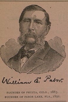
An engraved bust portrait of William E. Pabor printed in his own newspaper, with his facsimile signature beneath it and the line FOUNDER OF FRUITA, COLO., 1883. FOUNDER OF PABOR LAKE, FLA., 1892. Cropped from page 173 of the issue of 15 November 1895; the first likeness of Pabor this project has found.
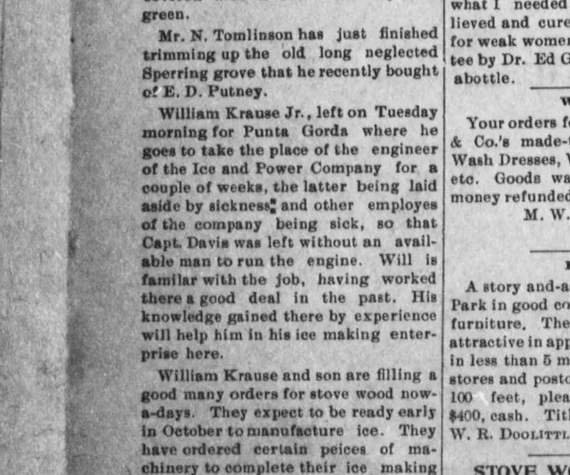
Items from the Avon Park department of The De Soto County News (Arcadia), 8 September 1905: William Krause Jr. relieving the engineer of the Ice and Power Company at Punta Gorda, and William Krause and son ordering machinery to complete their ice-making plant at Avon Park, expected to make ice early in October.
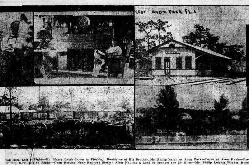
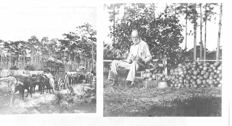
Six photographs of Avon Park published together in May 1913: the depot, two ox teams hauling oranges to the packing house, Philip Leigh's winter home, and palms and camphor trees.
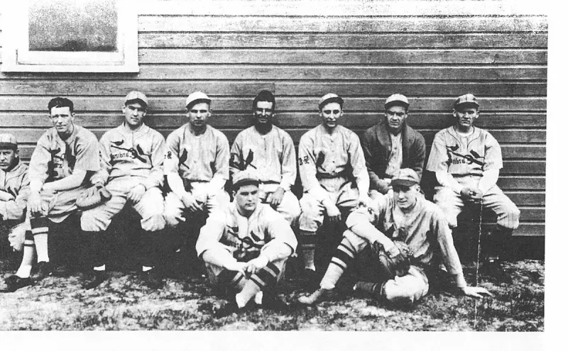
World Champion St. Louis Cardinals. Plate on page 156 of The First Hundred Years of Avon Park, Florida (1976).